PLANTAE / PHANEROGAMAE / ANTHOPHYTA / CARYOPHYLLALES / AIZOACEAE / RUSCHIOIDEAE / RUSCHIEAE / RUSCHIA / MULTIFLORA

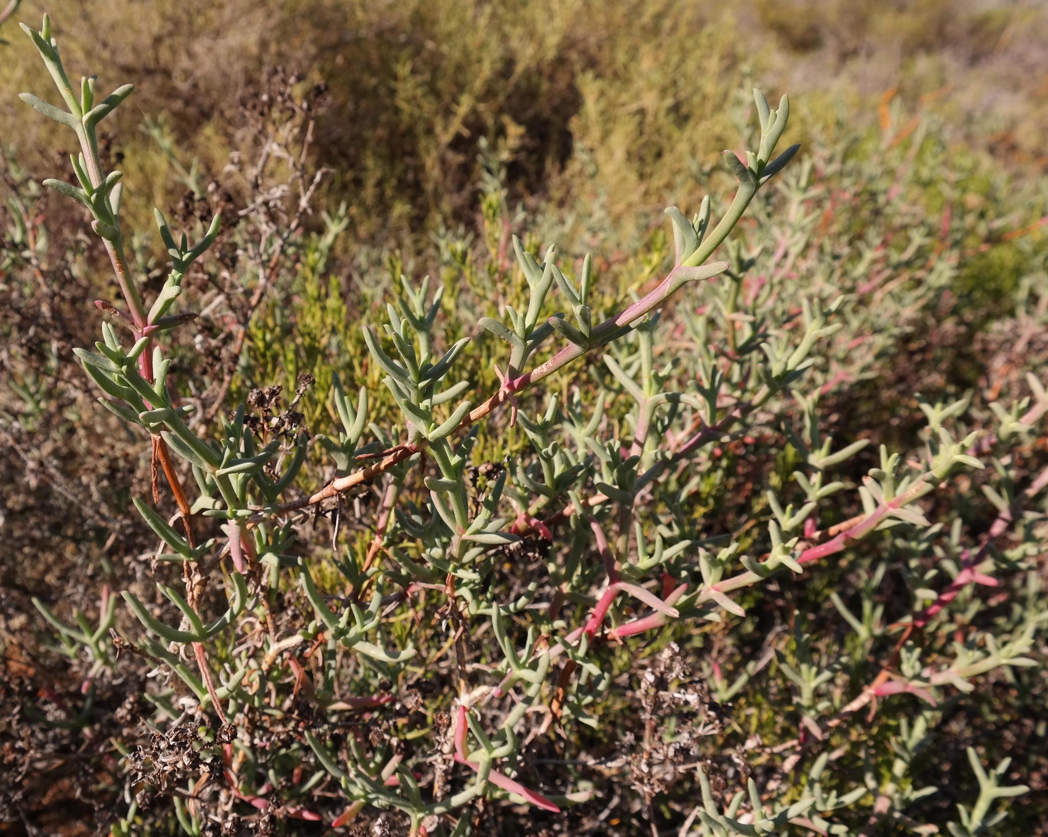
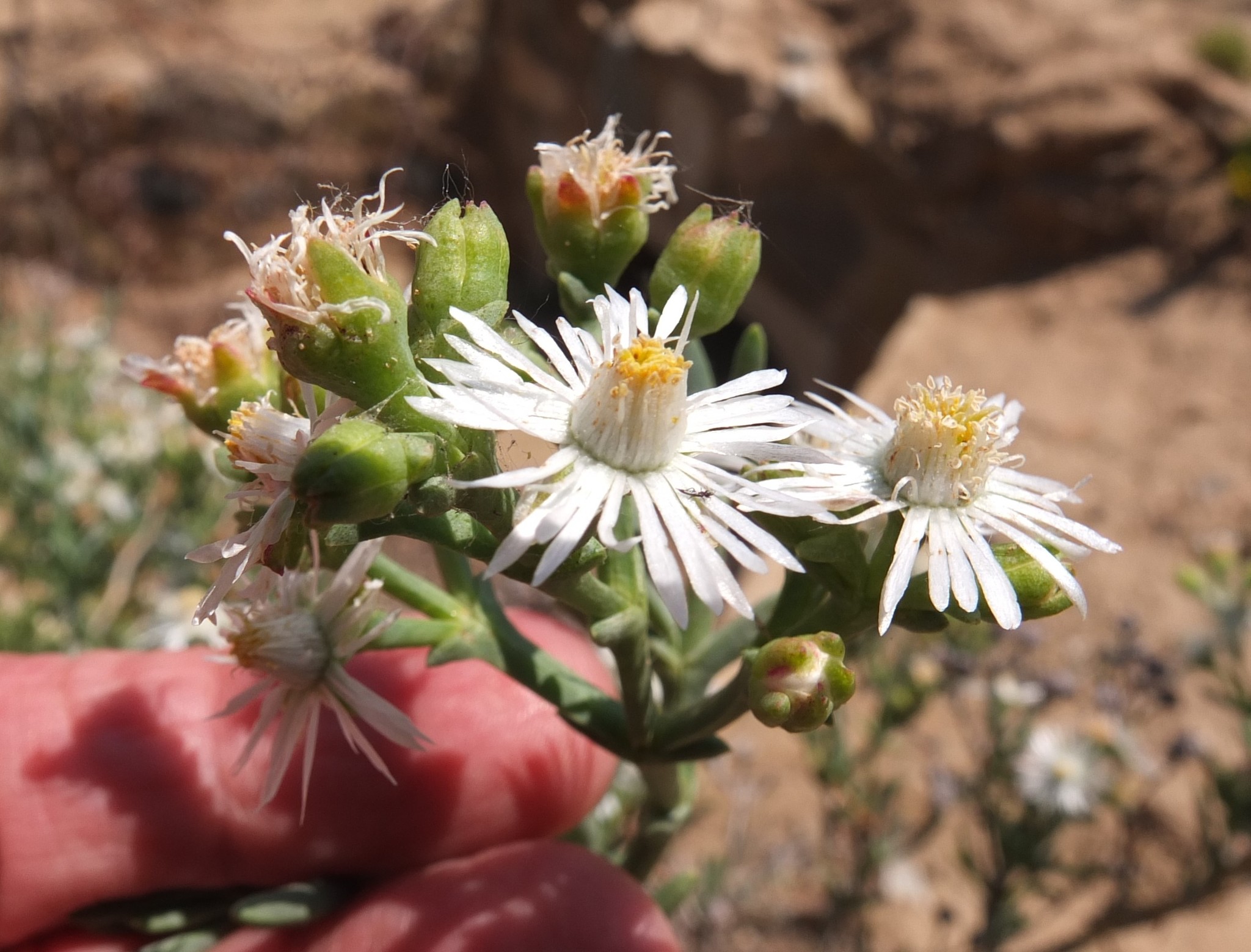
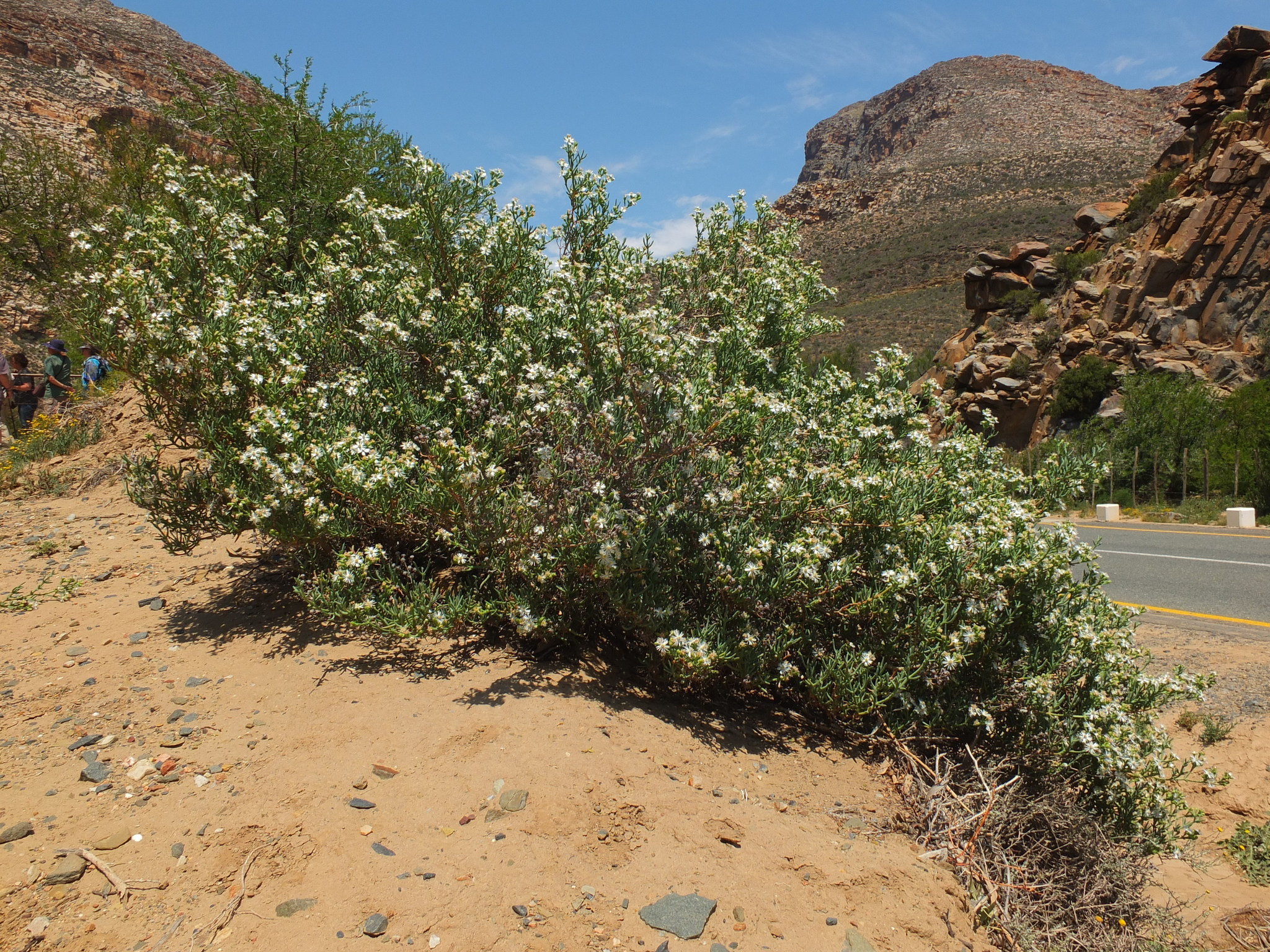
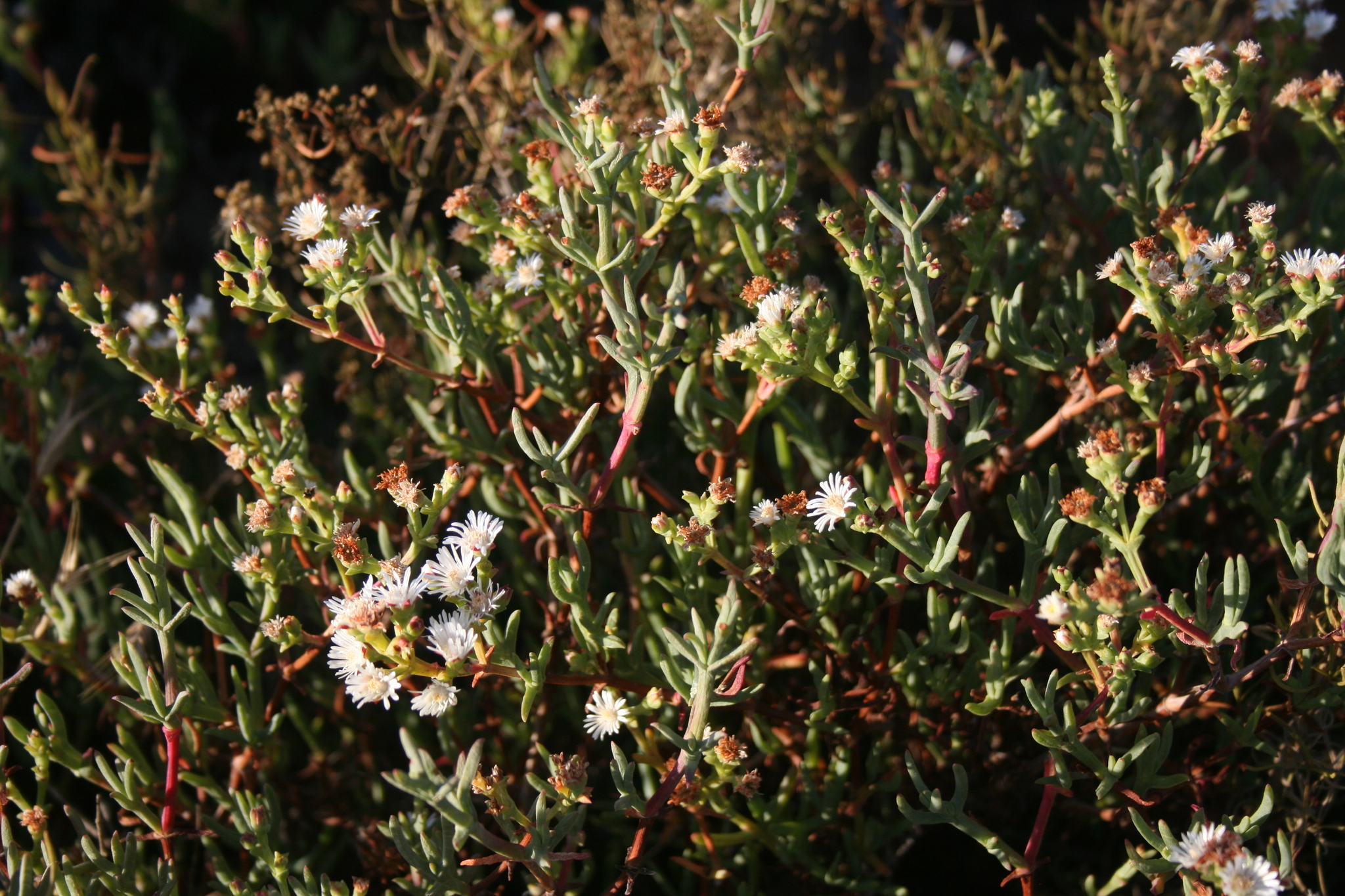
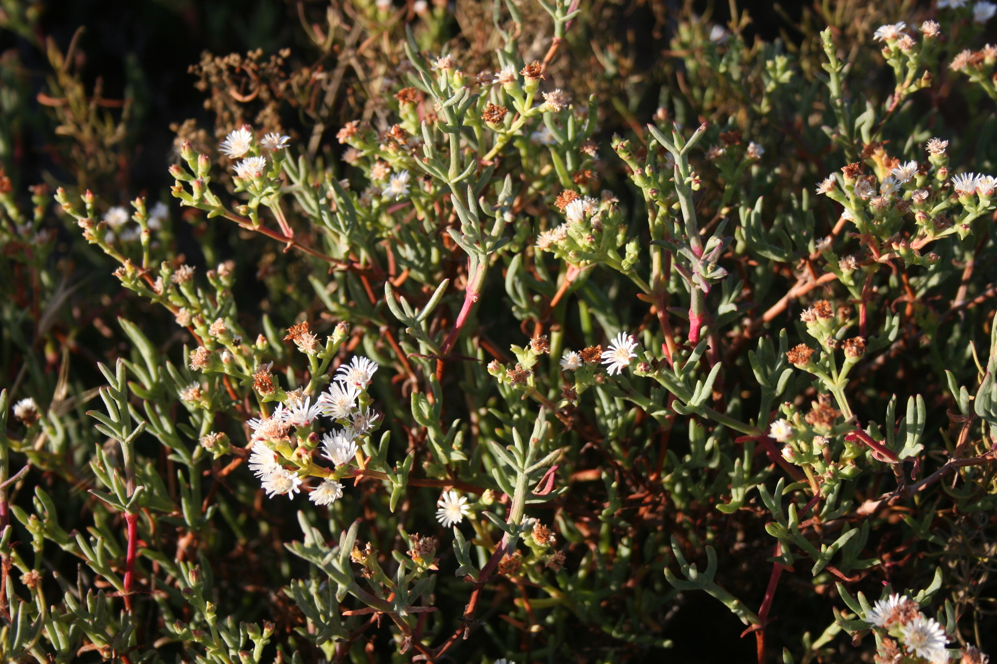
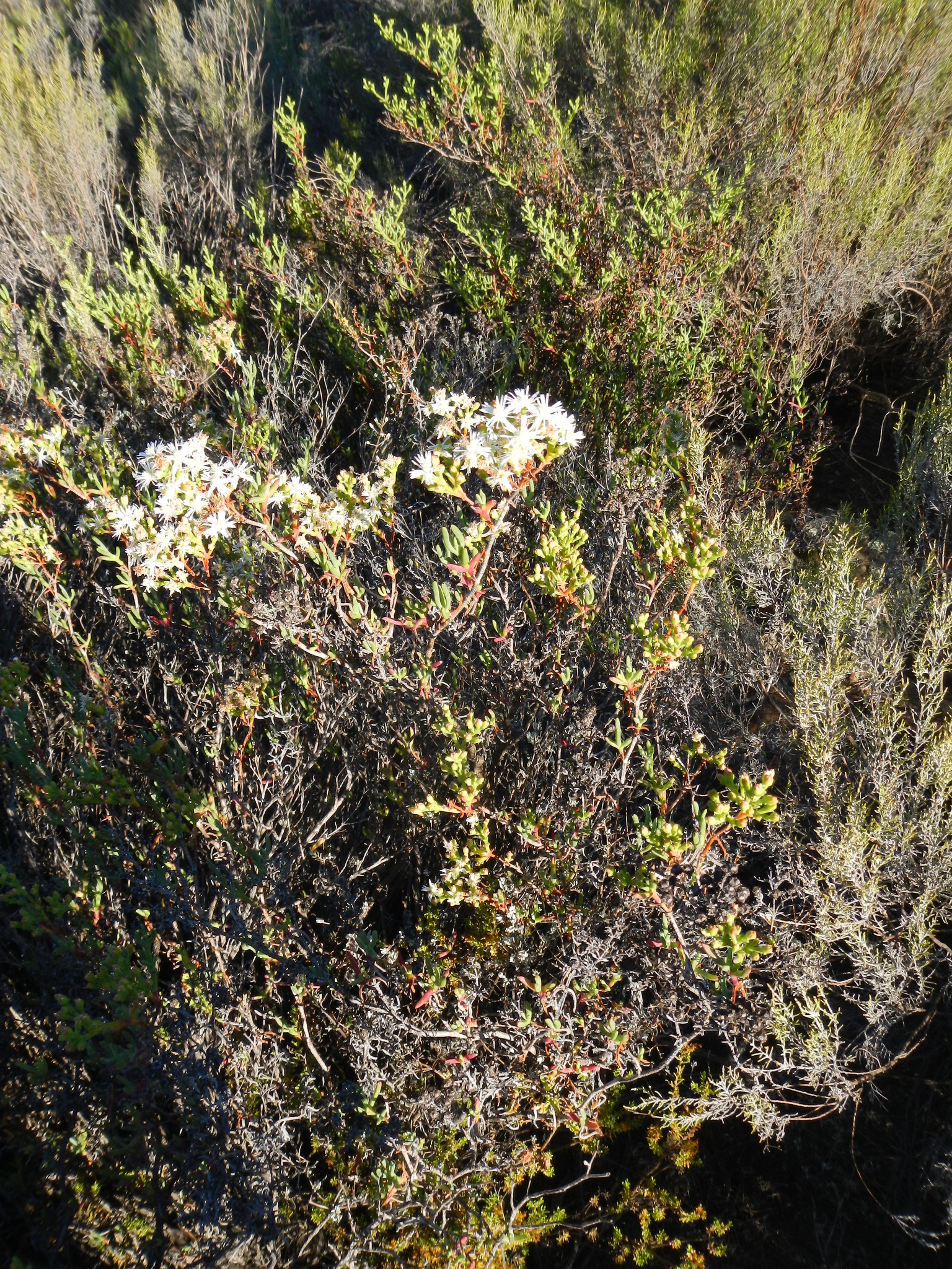
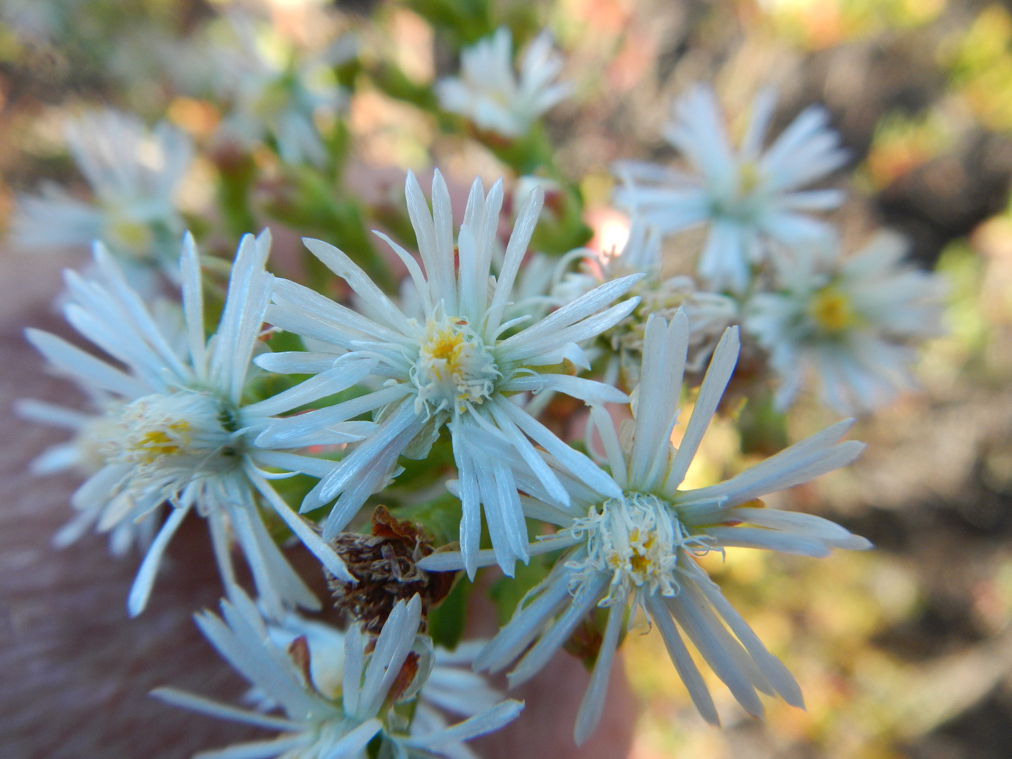
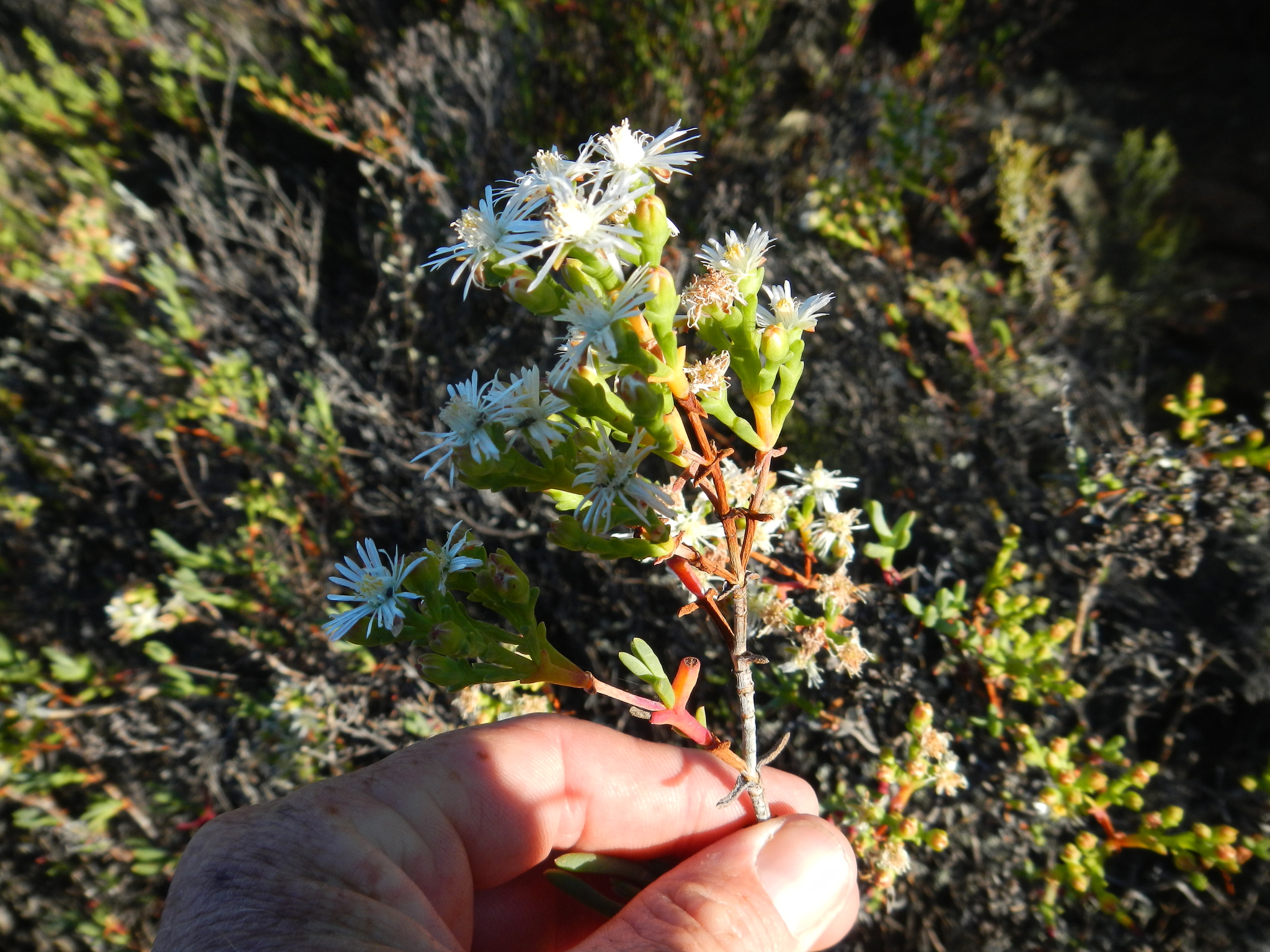
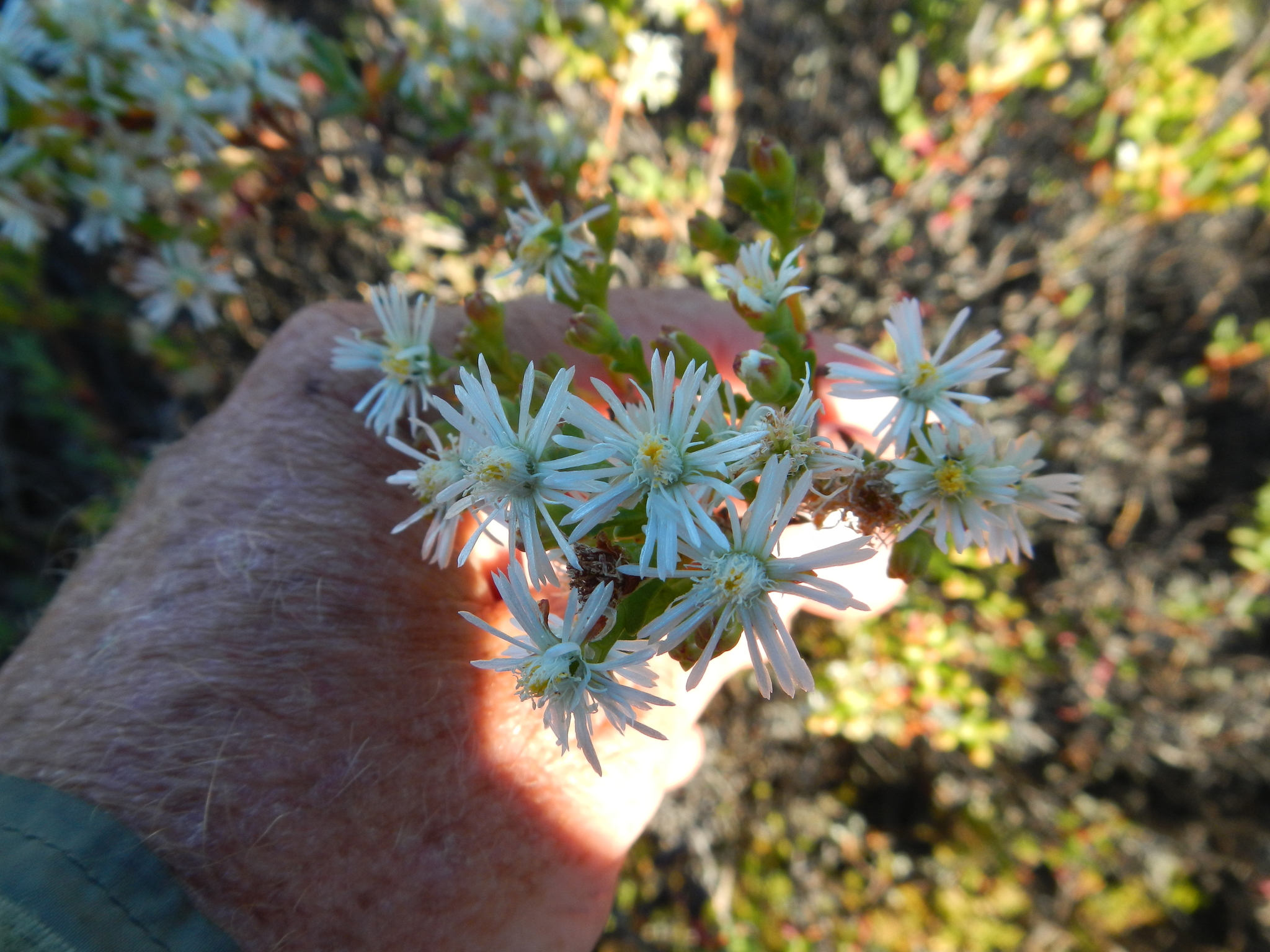
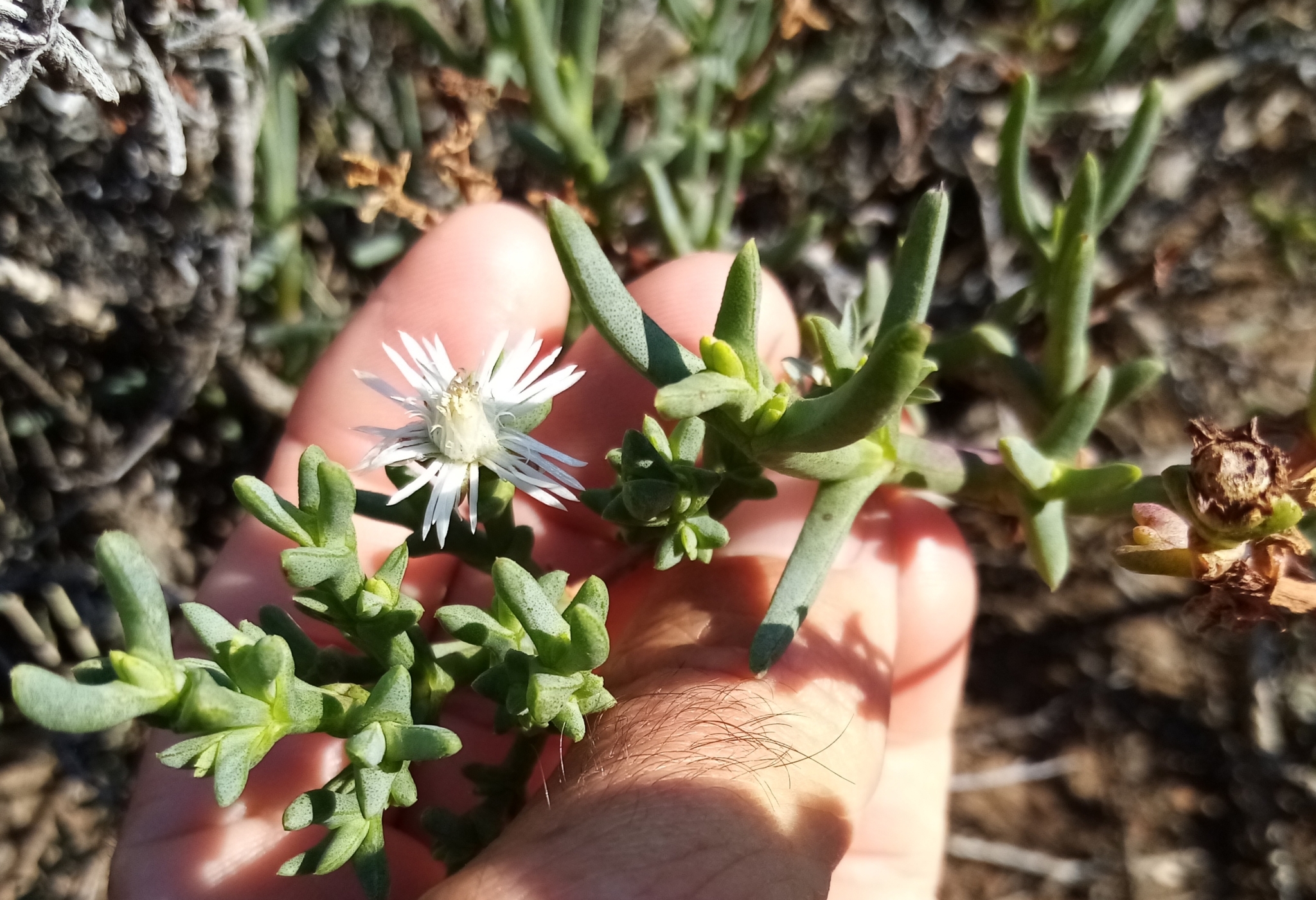
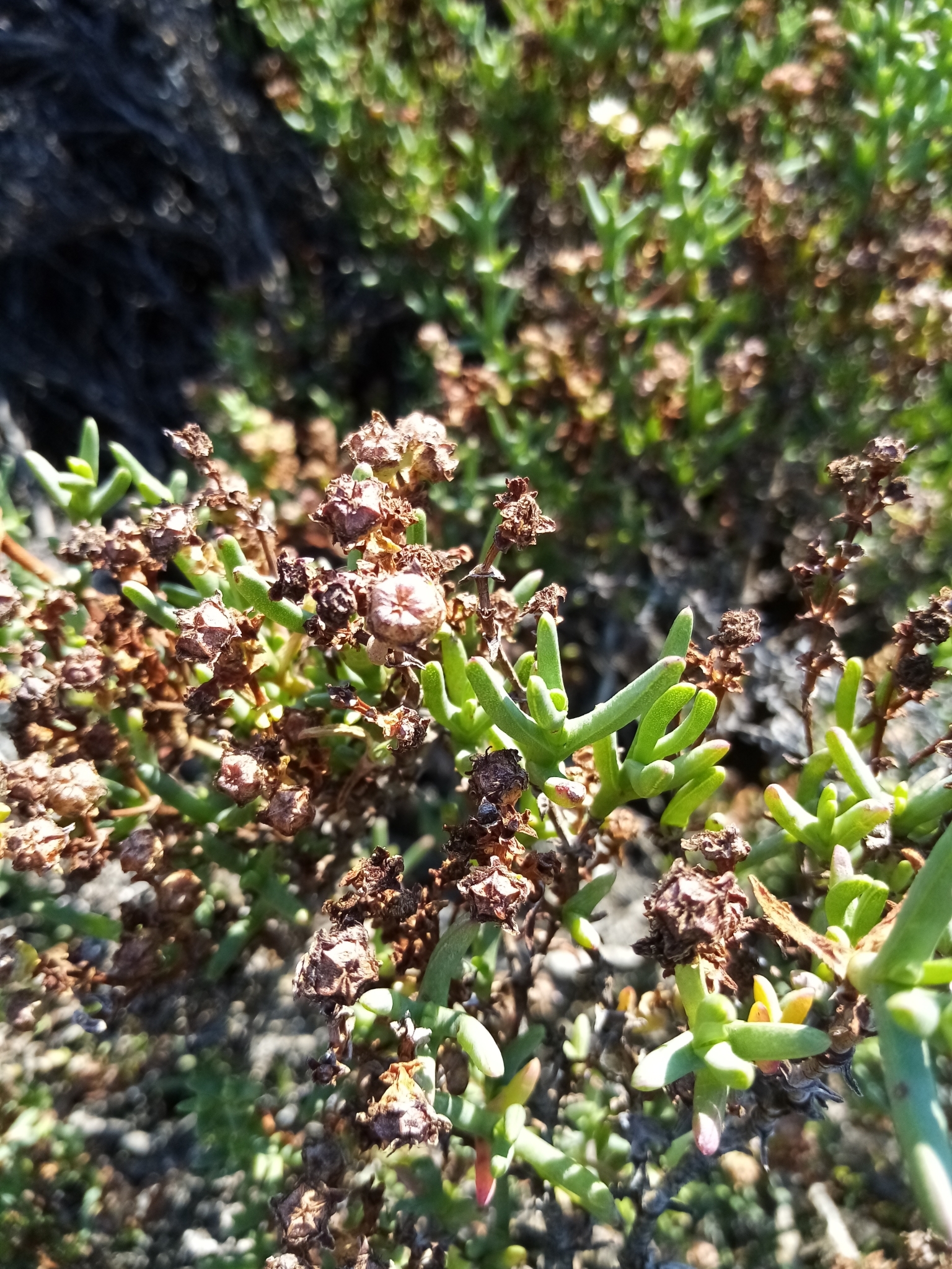
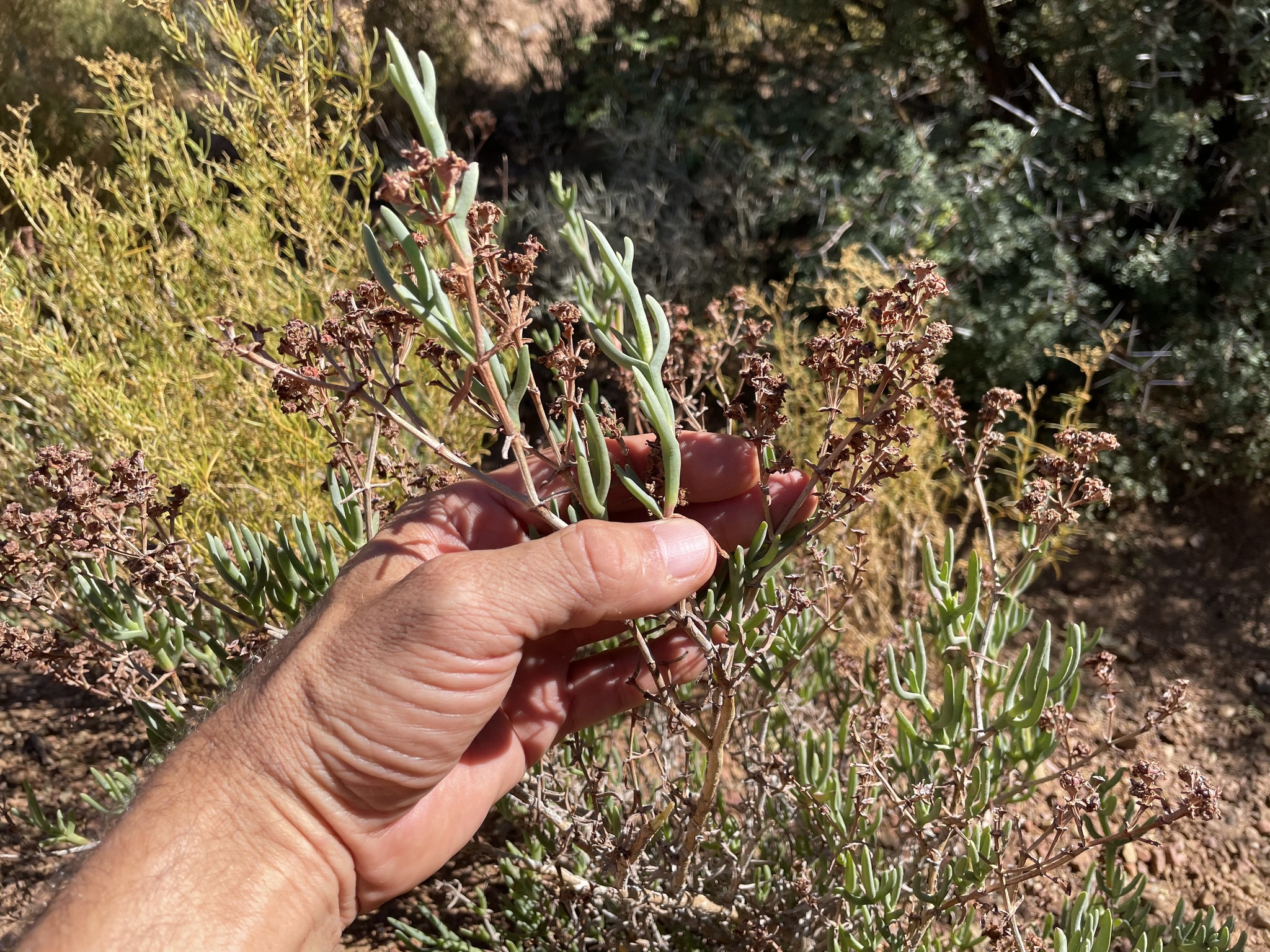
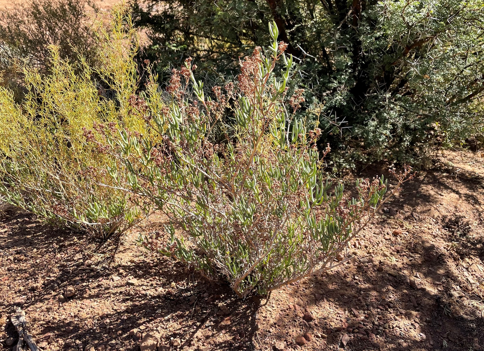
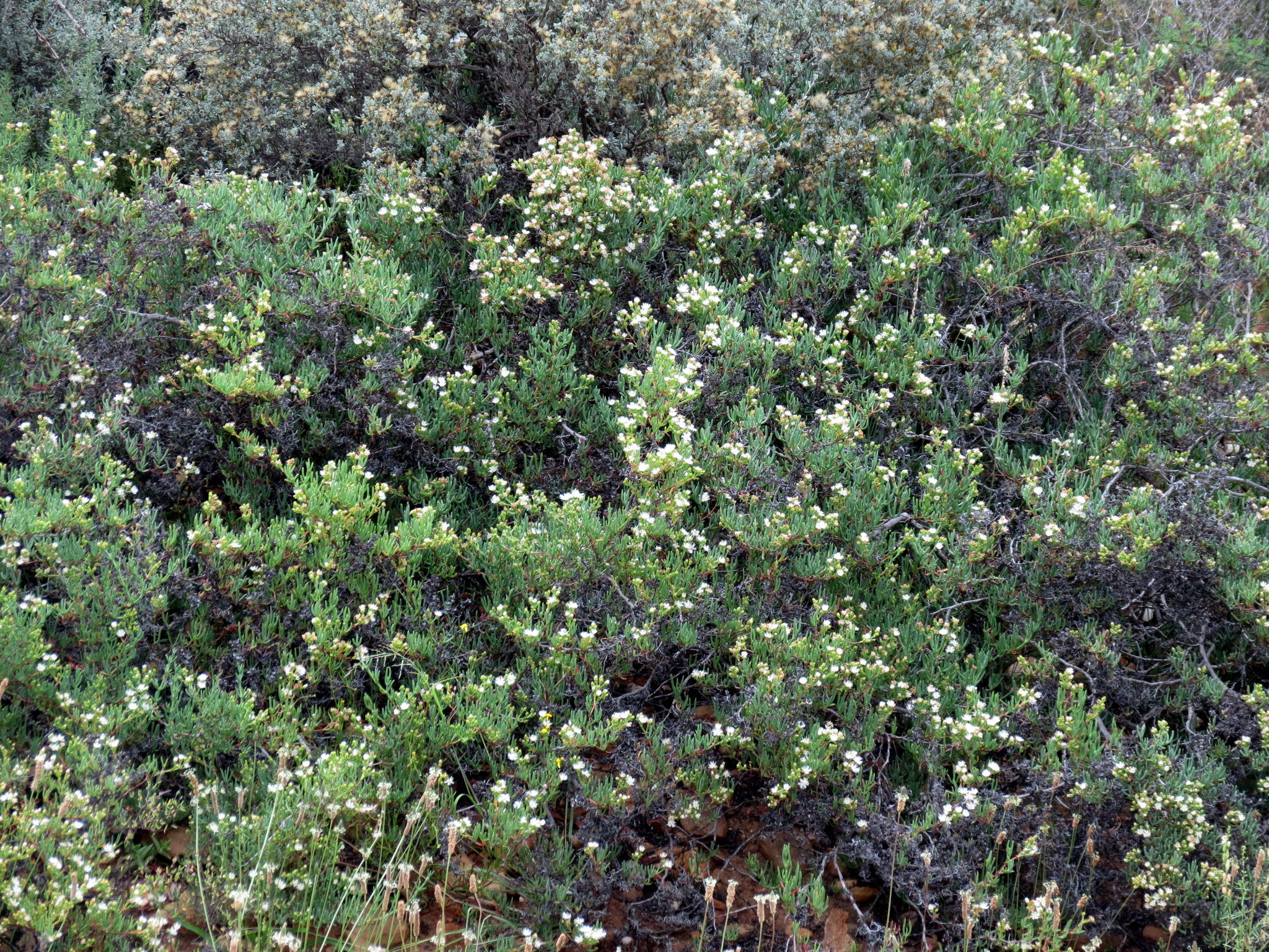
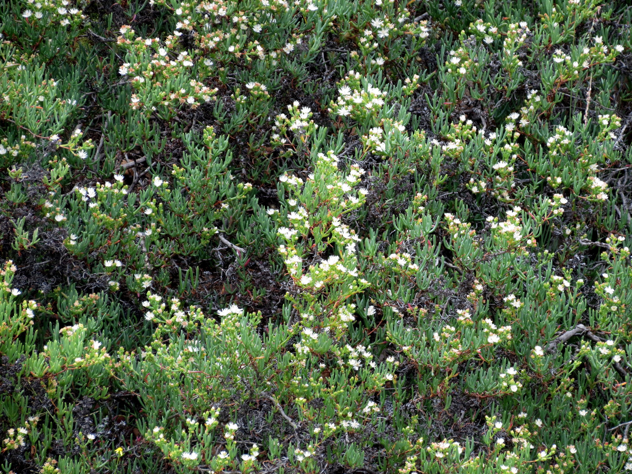
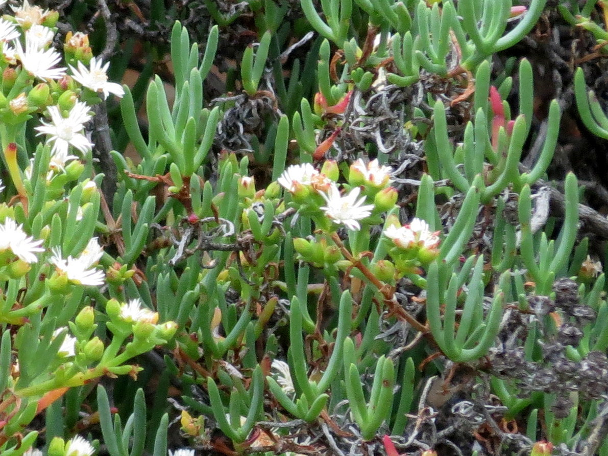
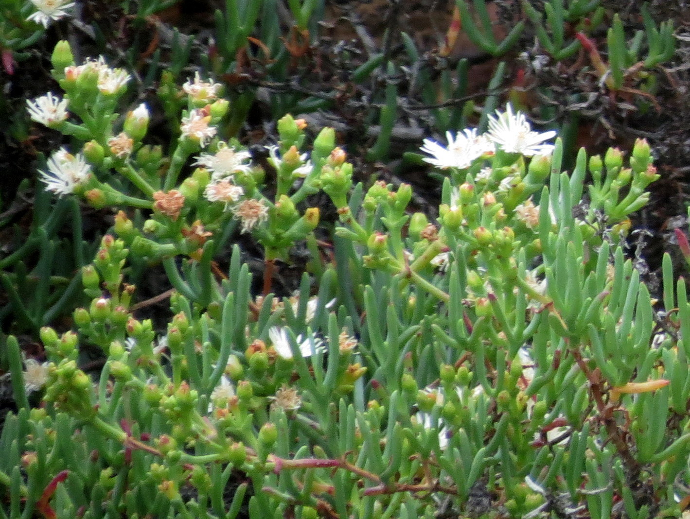
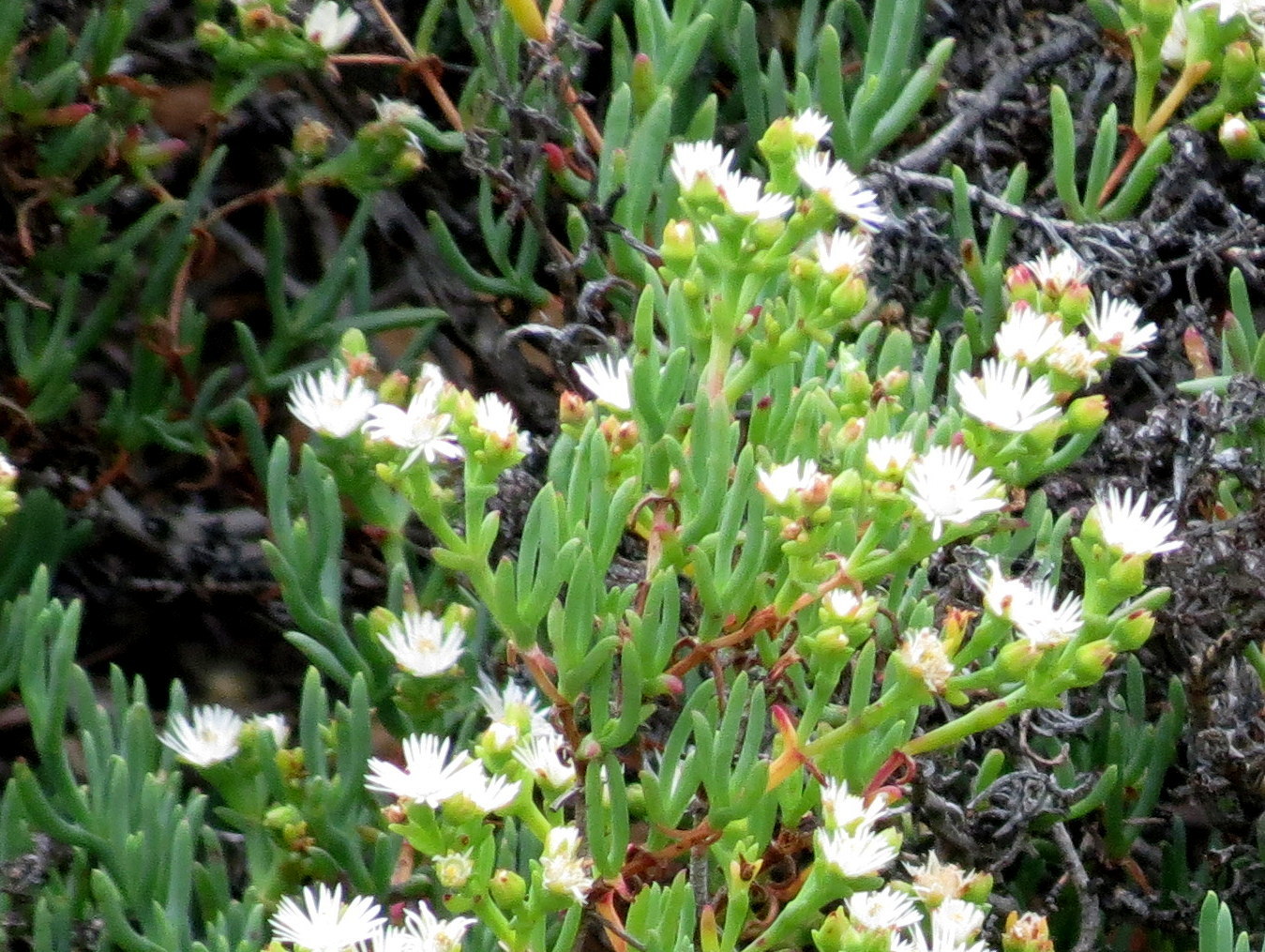
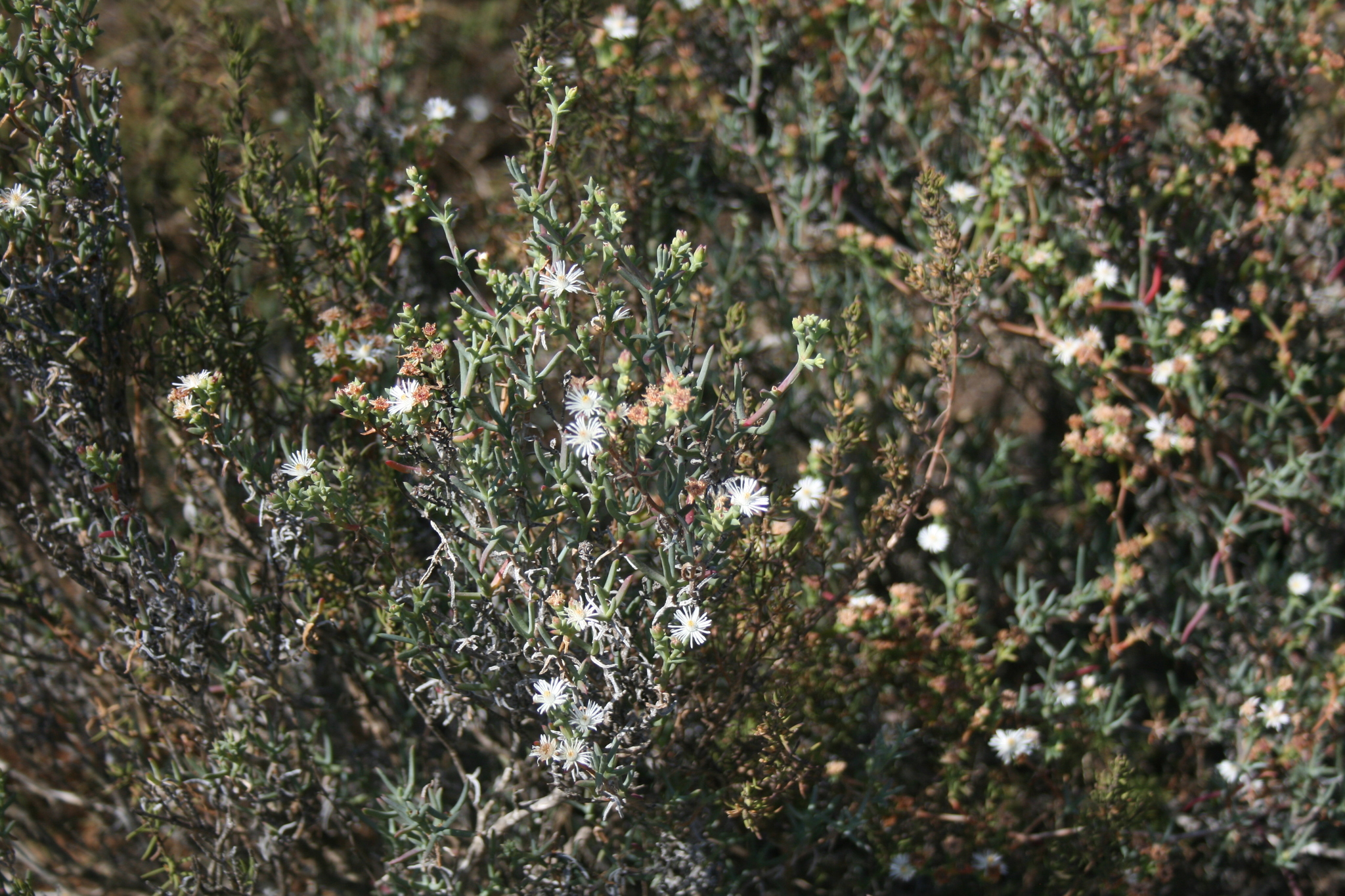
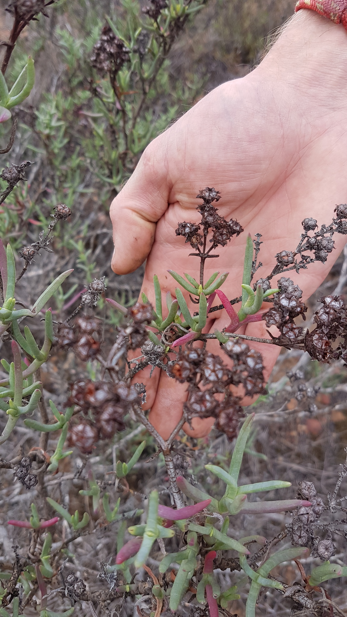
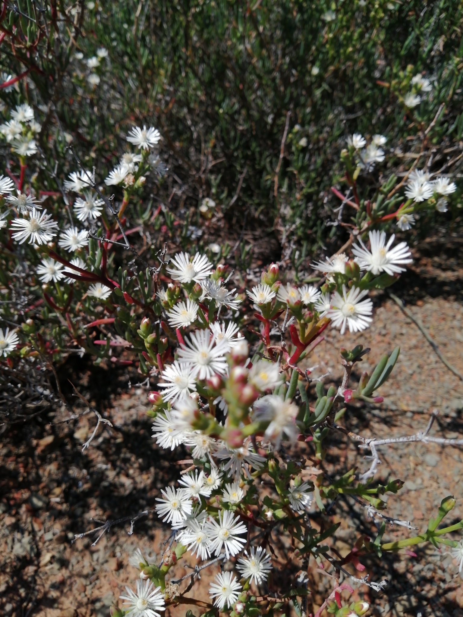
Plants decumbent to erect. Shrub to 1 x 2 m, with erect branches. Leaves fused below into a sheath, trigonous, shortly mucronate. Flowers in many-flowered cymes, subsessile, white, to 30 mm diam. Fruits unknown. From: Klak, C. 2012. Aizoaceae: Ruschia Schwantes. In: J Manning & P Goldblatt (eds), Plants of the Greater Cape Floristic Region 1: The Core Cape flora. Strelitzia 29: 299-304. South African National Biodiversity Institute, Pretoria. [CC BY]
Uncertain. From: Klak, C. 2012. Aizoaceae: Ruschia Schwantes. In: J Manning & P Goldblatt (eds), Plants of the Greater Cape Floristic Region 1: The Core Cape flora. Strelitzia 29: 299-304. South African National Biodiversity Institute, Pretoria. [CC BY]
W Karoo to Swellendam. From: Klak, C. 2012. Aizoaceae: Ruschia Schwantes. In: J Manning & P Goldblatt (eds), Plants of the Greater Cape Floristic Region 1: The Core Cape flora. Strelitzia 29: 299-304. South African National Biodiversity Institute, Pretoria. [CC BY]
October to December
250 to 850 m
This map contains point-based occurrences at different locations
Occurrence in the Flora of Southern Africa (FSA) countries and South African provinces. Residence status indicates if a taxon is indigenous, endemic, naturalised or invasive in a specific region. This data is based on specimen records and literature
FSA
SA
BOT
NAM
ESW
LES
WC
EC
NC
FS
GA
KZN
LP
MP
NW
Absent
Indigenous
Endemic
Naturalised
Invasive
Names and Sources
Mesembryanthemum multiflorum Haw.
Published in: Observ. Mesembryanthemum 2: 318 (1795)
Classification
KINGDOM Plantae
SUBKINGDOM Phanerogamae
PHYLUM Anthophyta
ORDER Caryophyllales
FAMILY Aizoaceae
SUBFAMILY Ruschioideae
TRIBE Ruschieae
GENUS Ruschia
SPECIES multiflora
29 results for Ruschia multiflora (Haw.) Schwantes
Barcode: PRE0853220-0 Collector(s) & number: Van Jaarsveld, EJ, 3647 | 1978-11-8
South Africa, Western Cape, Protem, oos van Stormsvlei.
Data Resource: BODATSA View record
Barcode: NBG0022000-0 Collector(s) & number: Compton, RH, 18966 | 1946-12-20
South Africa, Western Cape, Cape Province, Worcester District, Karoo Garden Worcester
Data Resource: BODATSA View record
Barcode: NBG0272331-0 Collector(s) & number: Le Roux, A, 411 | 2007-11-14
South Africa, Western Cape, Range of hills between the Breede river and the Brandvlei dam - S of Worcester next to the R101 road to Rawsonville. 33°40'36.4" S; 19°23'25.5" E.
Data Resource: BODATSA View record
Barcode: NBG0021999-0 Collector(s) & number: Wurts, TM, 1208 | 1953-10-28
South Africa, Western Cape, Cape Province, Ladismith District, Toverkop Kloof [Toorkloof]
Data Resource: BODATSA View record
Barcode: NBG0802046-0 Collector(s) & number: Kotze, JC, 7 | 1970-1-19
South Africa, Western Cape, (Wuppertal). Cers, farm "Bokrivier". 3219C/D
Data Resource: BODATSA View record
Barcode: NBG0197950-0 Collector(s) & number: Burgoyne, PM, 6291 | 1997-6-25
South Africa, Western Cape, Worcester area: ± 8 km from Worcester on road to Robertson.
Data Resource: BODATSA View record
Barcode: NBG0022001-0 Collector(s) & number: Thorns, F, s.n. | 1939-12-9
South Africa, Western Cape, Cape Province, Ladismith District, Seven Weeks Poort
Data Resource: BODATSA View record
Barcode: NBG0202937-0 Collector(s) & number: Steyn, HM, 394 | 2003-3-2
South Africa, Western Cape, Uniondale District: Fort (Uniondale) above town of Uniondale.
General notes: Gentle slope.
Data Resource: BODATSA View record
Barcode: NBG0071882-0 Collector(s) & number: Middlemost, AJ, 2273 | 1963-11-11
South Africa, Western Cape, Cape Province, Ceres District, Bokkerivier Farms - Verkeerde Vlei
Data Resource: BODATSA View record
Barcode: SAM0005217-0 Collector(s) & number: Pearson, HHW, 4829 | 1908-11-29
South Africa, Western Cape, Cape Region, roadside between Hottentots Kloof and Karoopoort
Data Resource: BODATSA View record
Barcode: NBG0248328-0 Collector(s) & number: Low, AB, 13677 / S24/3 | 2007-8-31
South Africa, Northern Cape, Namaqualand Coast. Schulpfontein Farm, NW of old farm house. -30.06317°S, 17.27842°E. [3017 AA & AB].
Data Resource: BODATSA View record
Barcode: NBG0802043-0 Collector(s) & number: Olivier, MC, 193 | 1962-10-3
South Africa, Western Cape, Worcester District, Veldreservaat, bokant kanaal [Veld Reserve, above channel]
Data Resource: BODATSA View record
Barcode: NBG0802044-0 Collector(s) & number: Dahlstrand, KA, 1440 | 1970-10-19
South Africa, Western Cape, (Oudtshoorn) de Rust, The Hon. P.M.K. le Roux' farm, "Doornkraal", Water Reservoir hill.
Data Resource: BODATSA View record
Barcode: NBG0802045-0 Collector(s) & number: Van Rensburg, WLJ, 287 | 1959-11-3
South Africa, Western Cape, Worcester District, Mowershoogte
Data Resource: BODATSA View record
Barcode: NBG0117005-0 Collector(s) & number: Barker, WF, 4089 | 1946-8-14
South Africa, Western Cape, (Cape Town). 20 miles from Cape Town, Mamre Road
Data Resource: BODATSA View record
Barcode: NBG0266826-0 Collector(s) & number: Low, AB, ABL15111 | 2007-10-30
South Africa, Western Cape, Quaggaskloof, (Worcester district). Near old stone cottage (near canal). 33.71068°S; 19.46524°E.
General notes: Fynbos biome. Breede Shale Fynbos vegetation. Mountain bottom. Well-drained, sandy soil. Full sun. No slope. Shrub. Succulent. Flowers white. Fruit absent. Plant height 50 cm.
Data Resource: BODATSA View record
Barcode: NBG0202930-0 Collector(s) & number: Steyn, HM, 383 | 2003-3-2
South Africa, Western Cape, Uniondale District: Uniondale fort (Uniondale) above town. Roadside.
General notes: Slope: none. Disturbed. Fruit present.
Data Resource: BODATSA View record
Barcode: NBG0802042-0 Collector(s) & number: Hugo, L, 1044 | 1978-2-9
South Africa, Western Cape, Klipfonteinkoppe: Pankop, sandy ridge.
Data Resource: BODATSA View record
Barcode: PRE0843293-0 Collector(s) & number: Smith, PP, 1500 | 2005-2-22
South Africa, Eastern Cape, Grahamstown Military Base - golf course.
General notes: Millenium Seed Bank. Coastal/grassland. Modifying factors: fire, alien spp. Brown/red loamy clay soil. Slope: gentle.
Data Resource: BODATSA View record
This map contains point-based occurrences at different locations
2012
SERIES CHAPTER
Aizoaceae: Ruschia Schwantes Klak, CIn: J Manning & P Goldblatt (eds), Plants of the Greater Cape Floristic Region 1: The Core Cape flora. Strelitzia 29: 299-304
South African National Biodiversity Institute, Pretoria
2001
BOOK
Illustrated handbook of succulent plants: Aizoaceae F-Z Hartmann, HEKO1999
PERIODICAL/JOURNAL
An annotated list of the species placed in Ruschia (Aizoaceae) Hartmann, HEKBradleya 17: 38-74
1927
No results found for Ruschia multiflora (Haw.) Schwantes
Status and criteria
LC
Assessor(s)
Plantae Coordinator
JOURNAL ARTICLE
Gaugris JY, Van Rooyen MW 2010. Woody vegetation structure in conserved versus communal land in a biodiversity hotspot: a case study in Maputaland, South Africa. South African Journal of Botany. 76:289-298
JOURNAL ARTICLE
Lawes MJ, Macfarlane DM, Eeley HA 2004. Forest landscape pattern in the KwaZulu-Natal midlands, South Africa: 50 years of change or stasis?. Austral Ecology. 29:613-623
THESIS
Louw SL 2010. The effect of the spatial scale of tree harvesting on woody seedling establishment and tree dynamic at Ongoye Forest Reserve.. University of KwaZulu-Natal
JOURNAL ARTICLE
Mugo, D.N., Lombard, A.T., Bronner, G.N. and Gelderblom, C.M. 1995. Distribution and protection of endemic or threatened rodents, lagomorphs and macrosceledids in South Africa. Journal of Zoology. 30:115-126.
JOURNAL ARTICLE
Linden B., Linden J., Fischer F., Linsenmair K.E. 2015. Seed dispersal by South Africa’s only forest-dwelling guenon, the samango monkey (<i>Cercopithecus mitis</i>). African Journal of Wildlife Research. 45:88–99
JOURNAL ARTICLE
Smith RJ et al. 2008. Designing a transfrontier conservation landscape for the Maputaland centre of endemism using biodiversity, economic and threat data. Biological Conservation. 141:2127–2138
| Part(s) of plant used | Use(s) | Reference |
|---|
Coming soon...
