PLANTAE / PHANEROGAMAE / ANTHOPHYTA / ASTERALES / ASTERACEAE / CICHORIOIDEAE / ARCTOTIDEAE / ARCTOTHECA / FORBESIANA

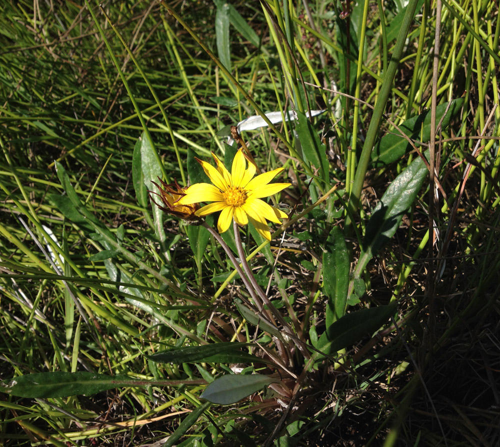
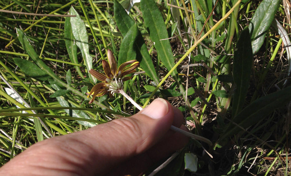
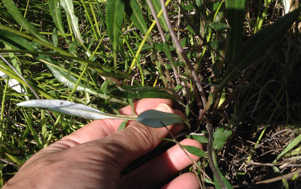
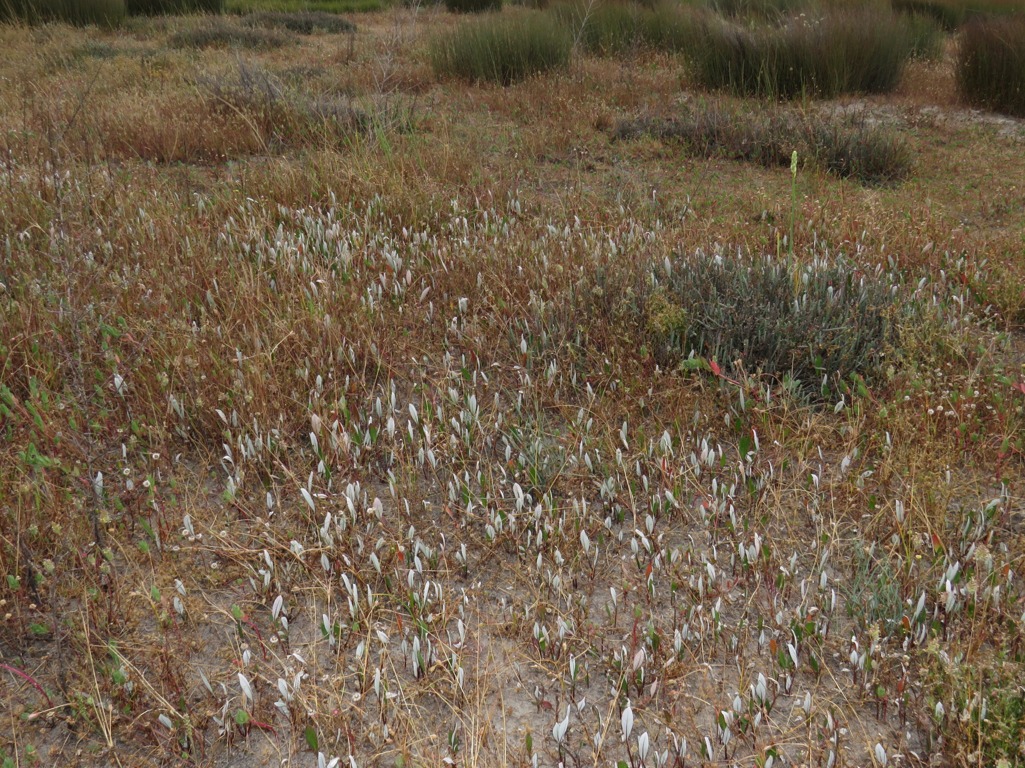
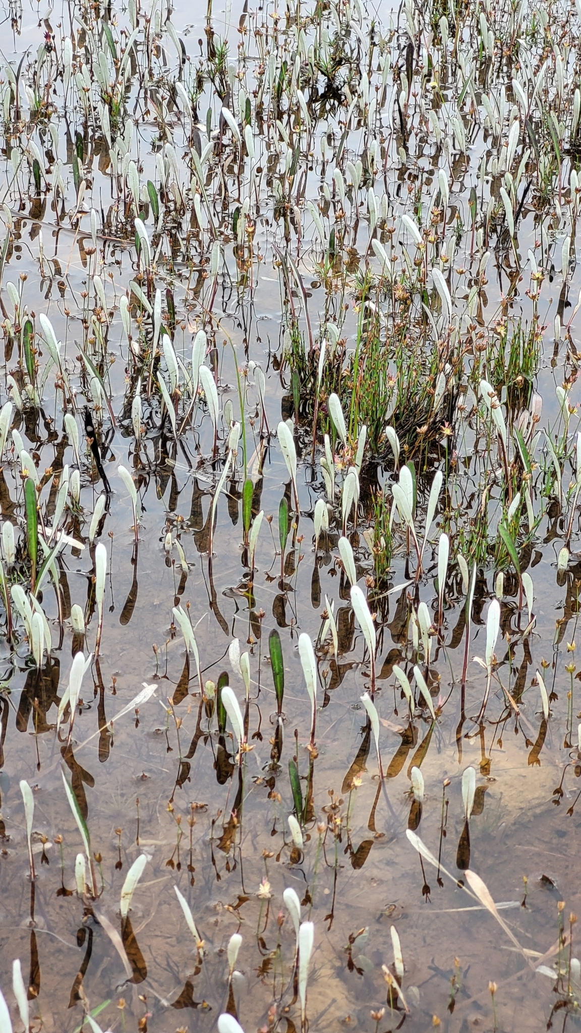
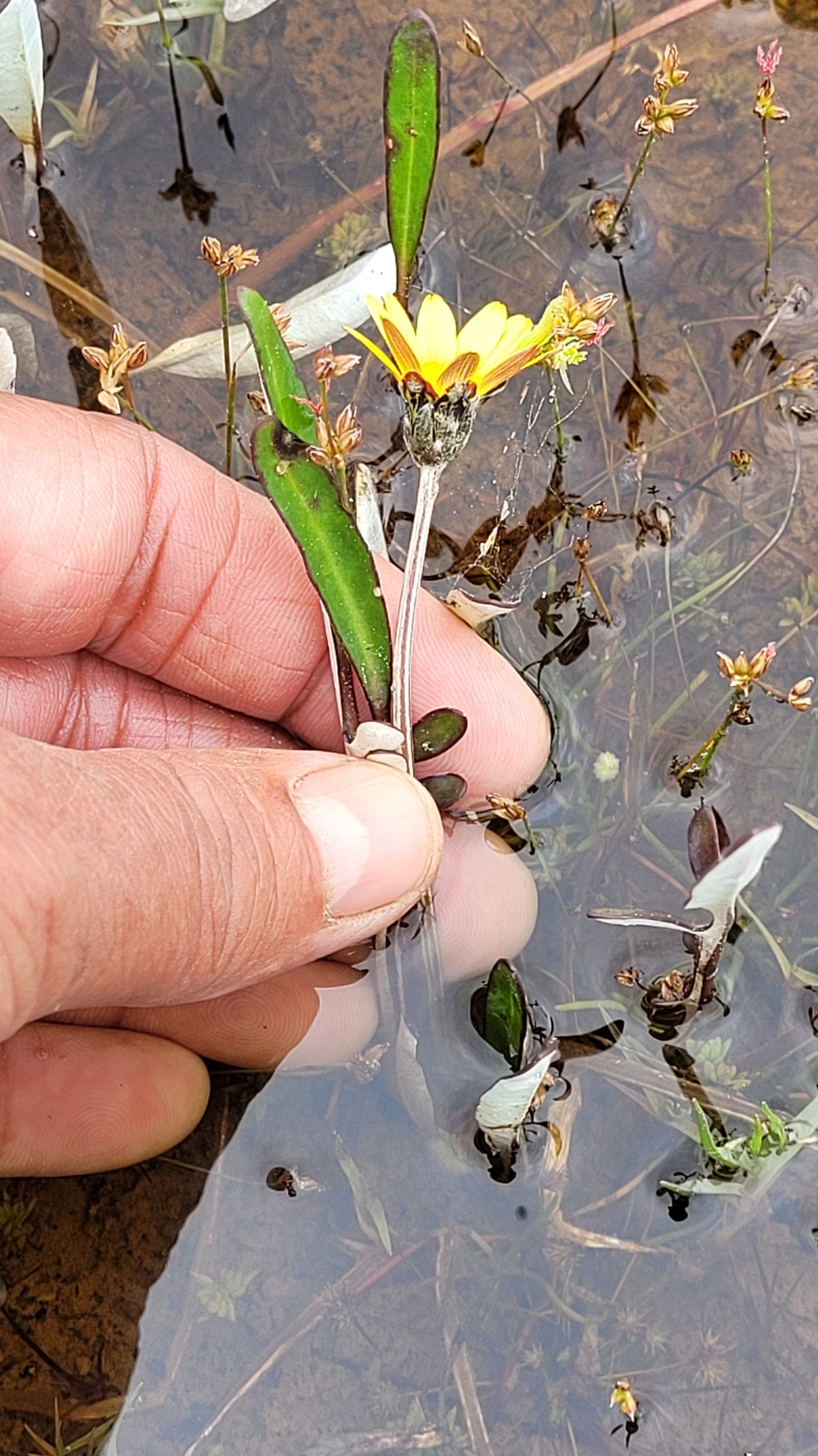
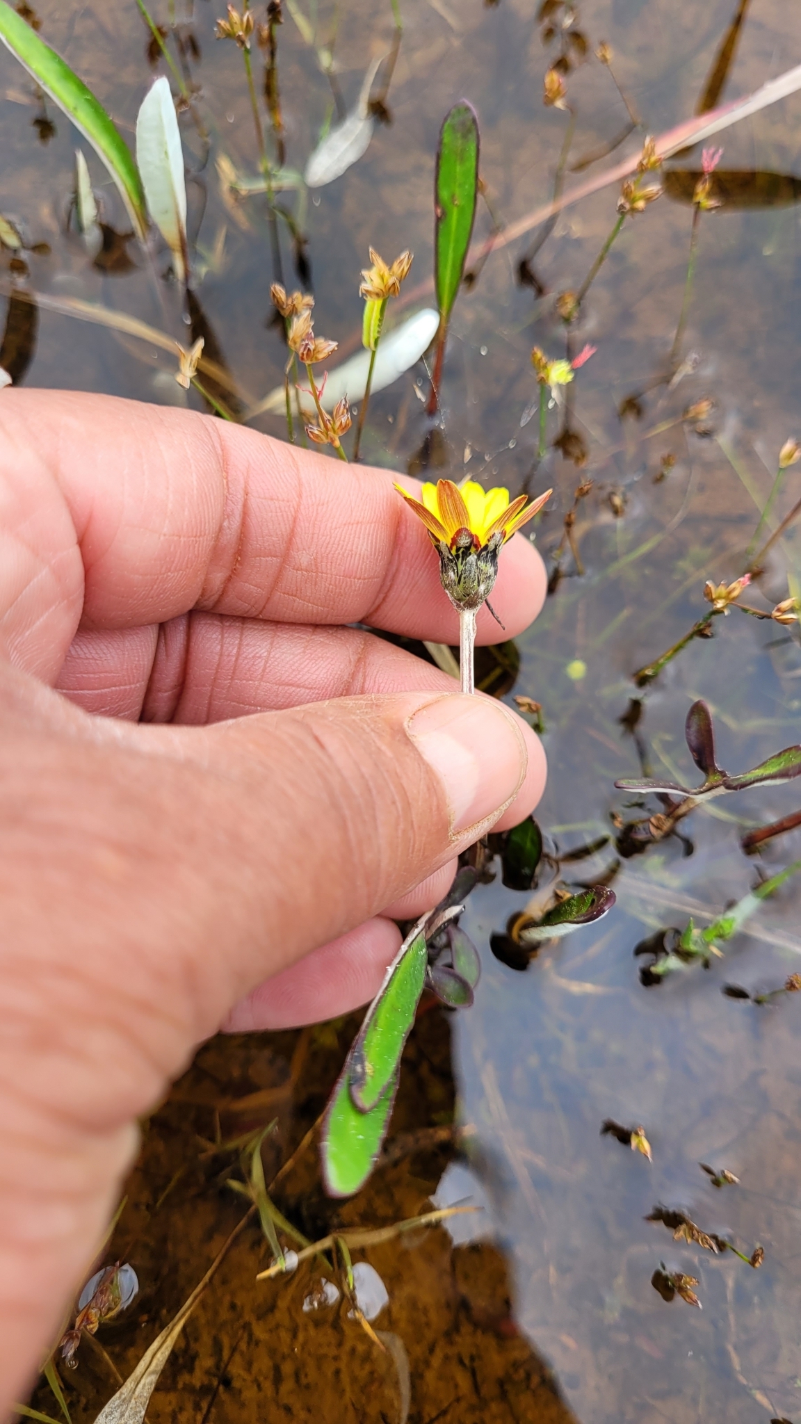
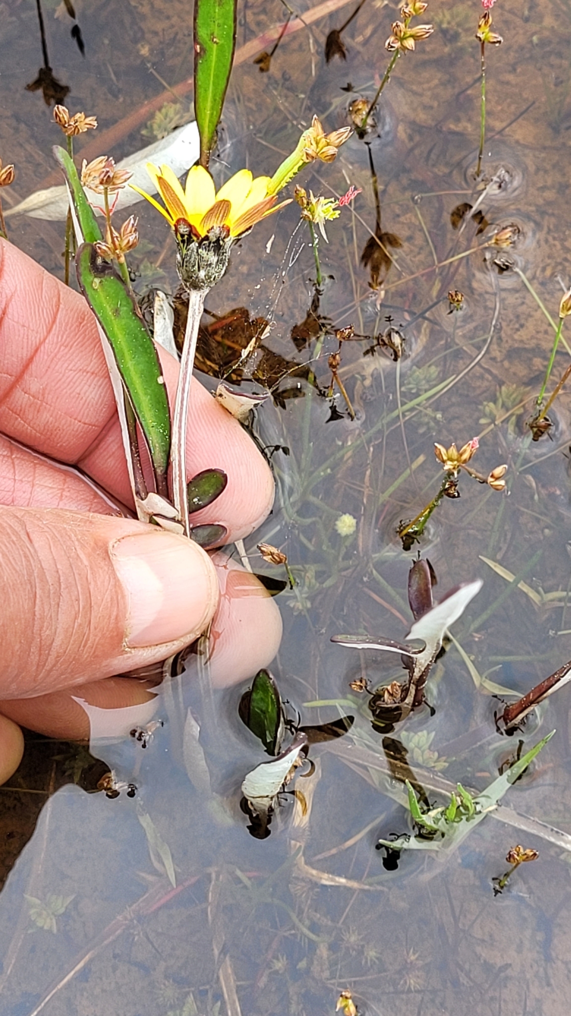
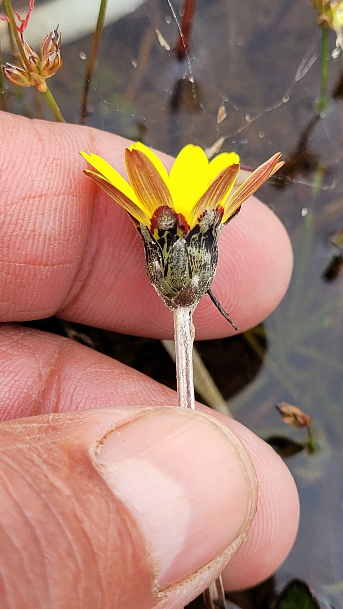
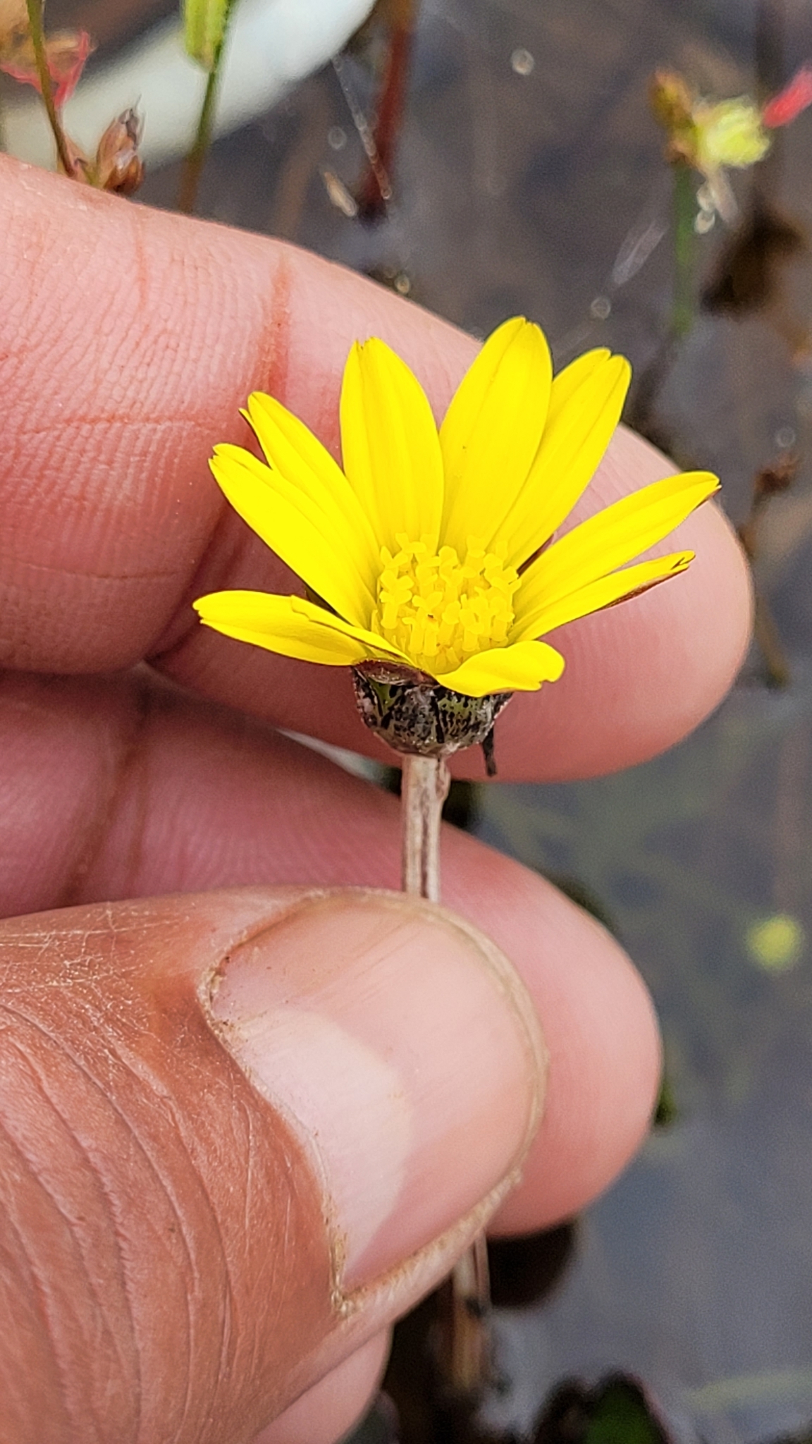
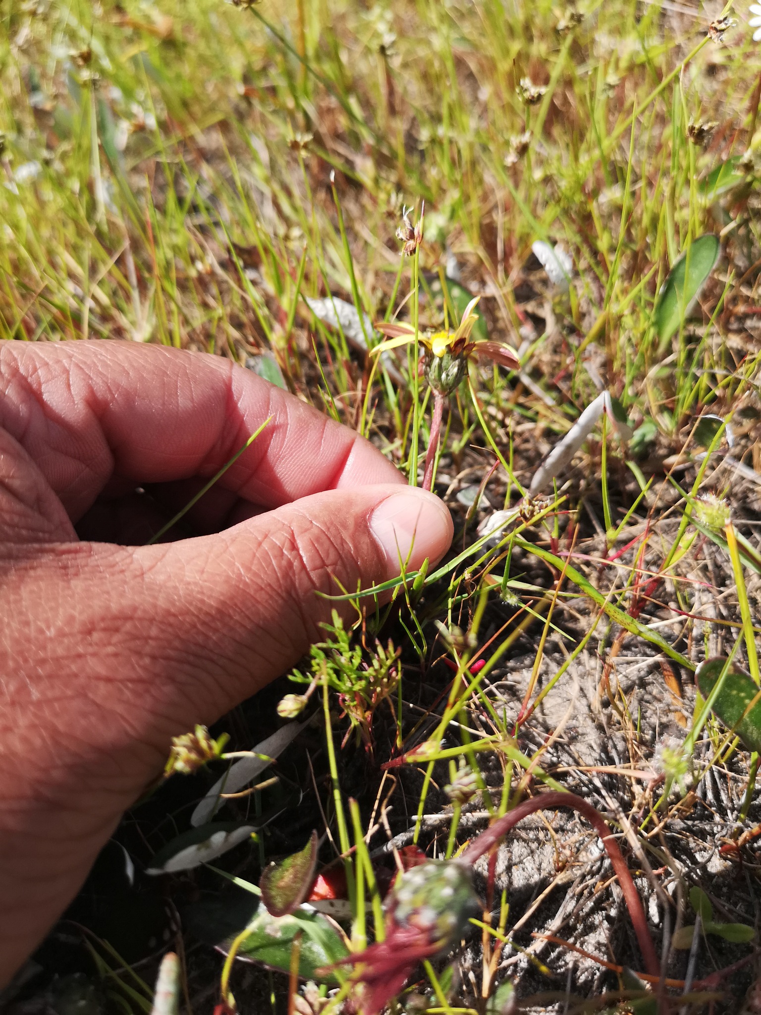
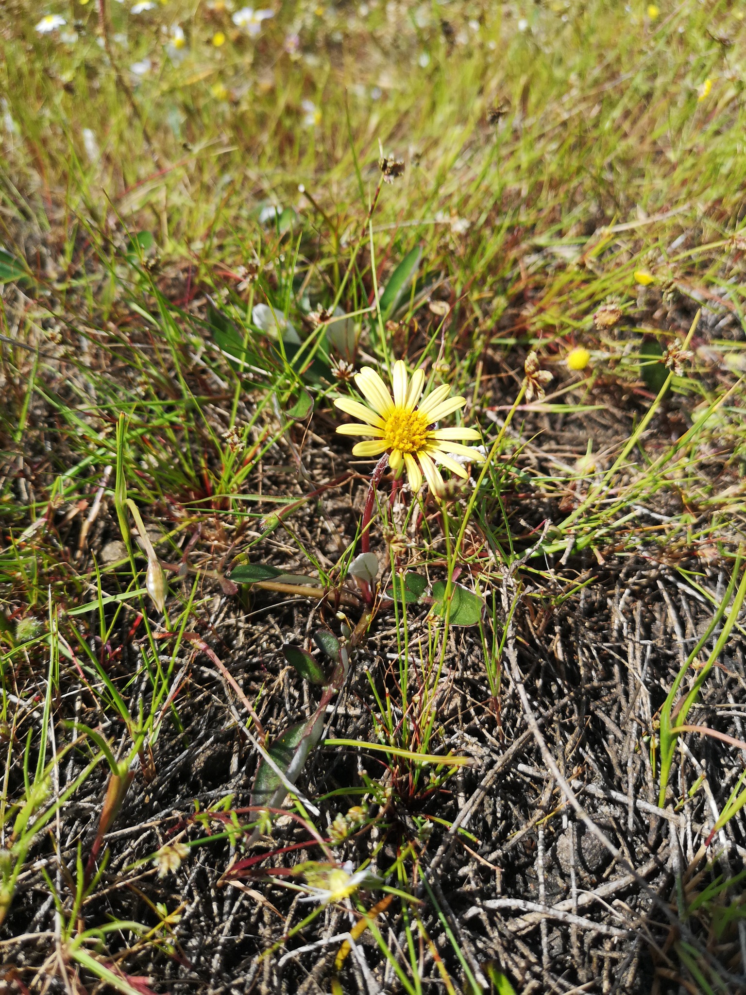
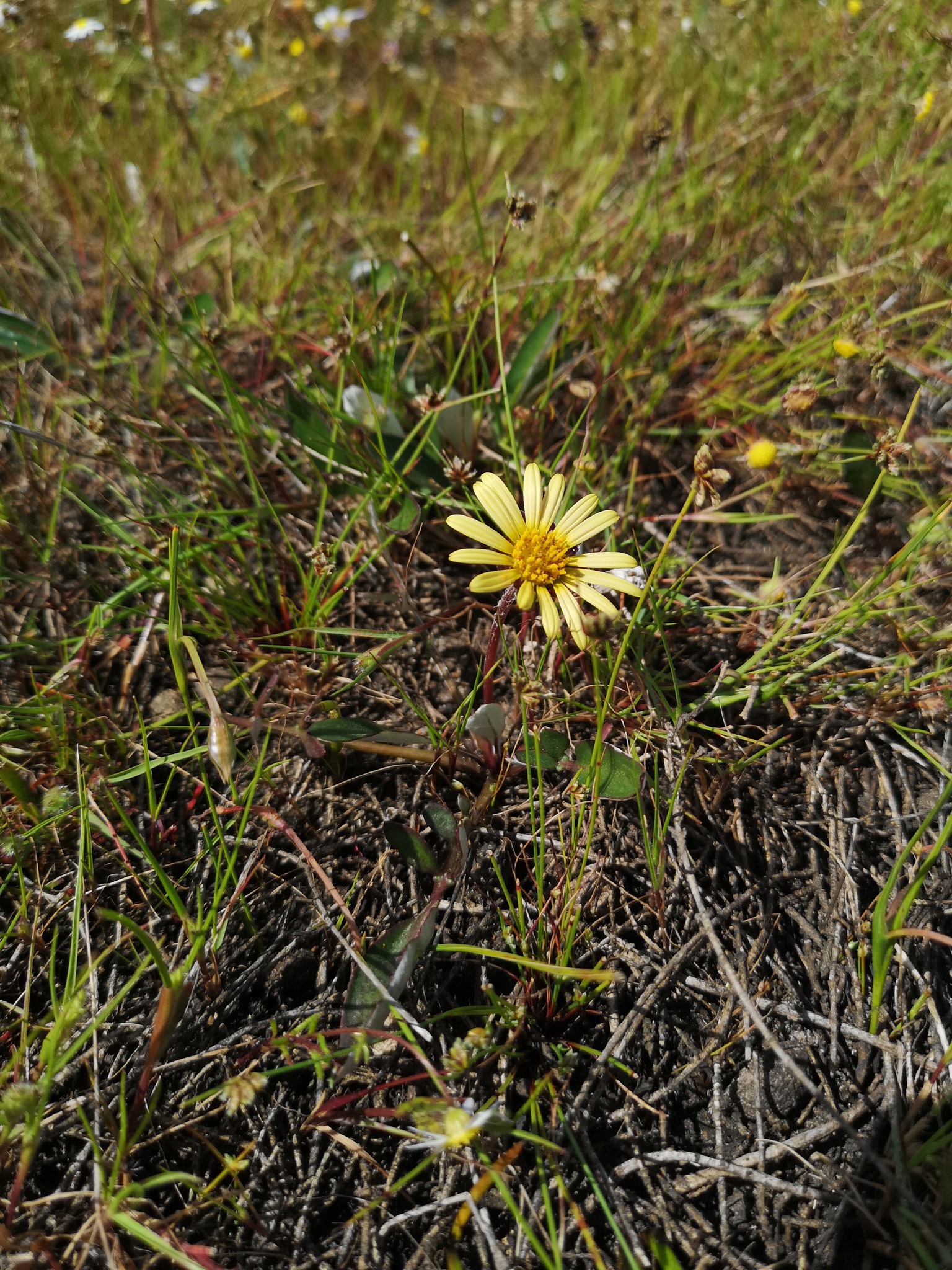
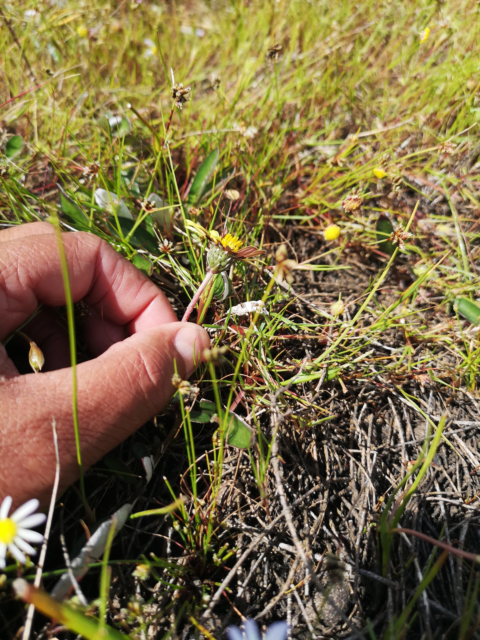
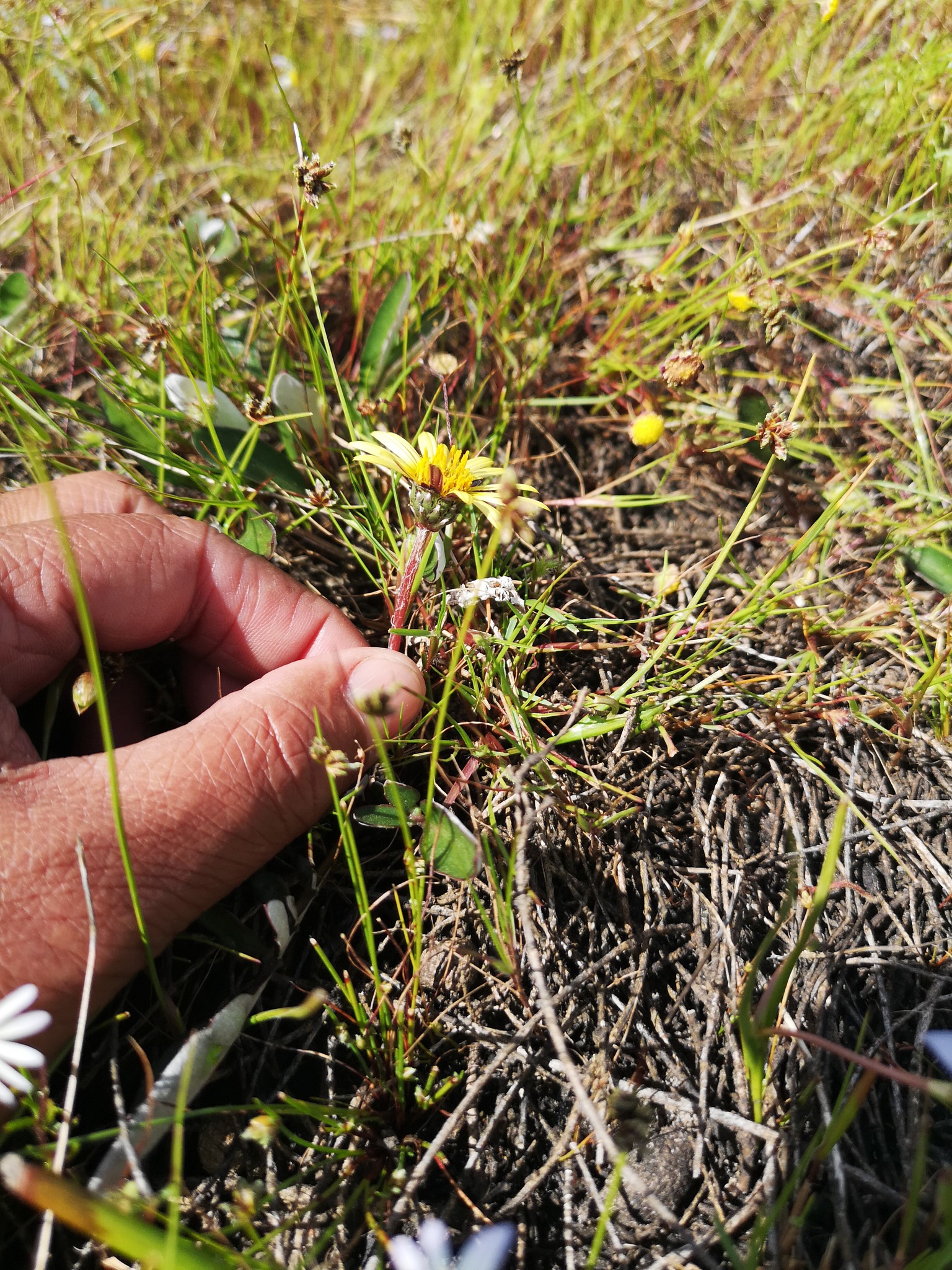
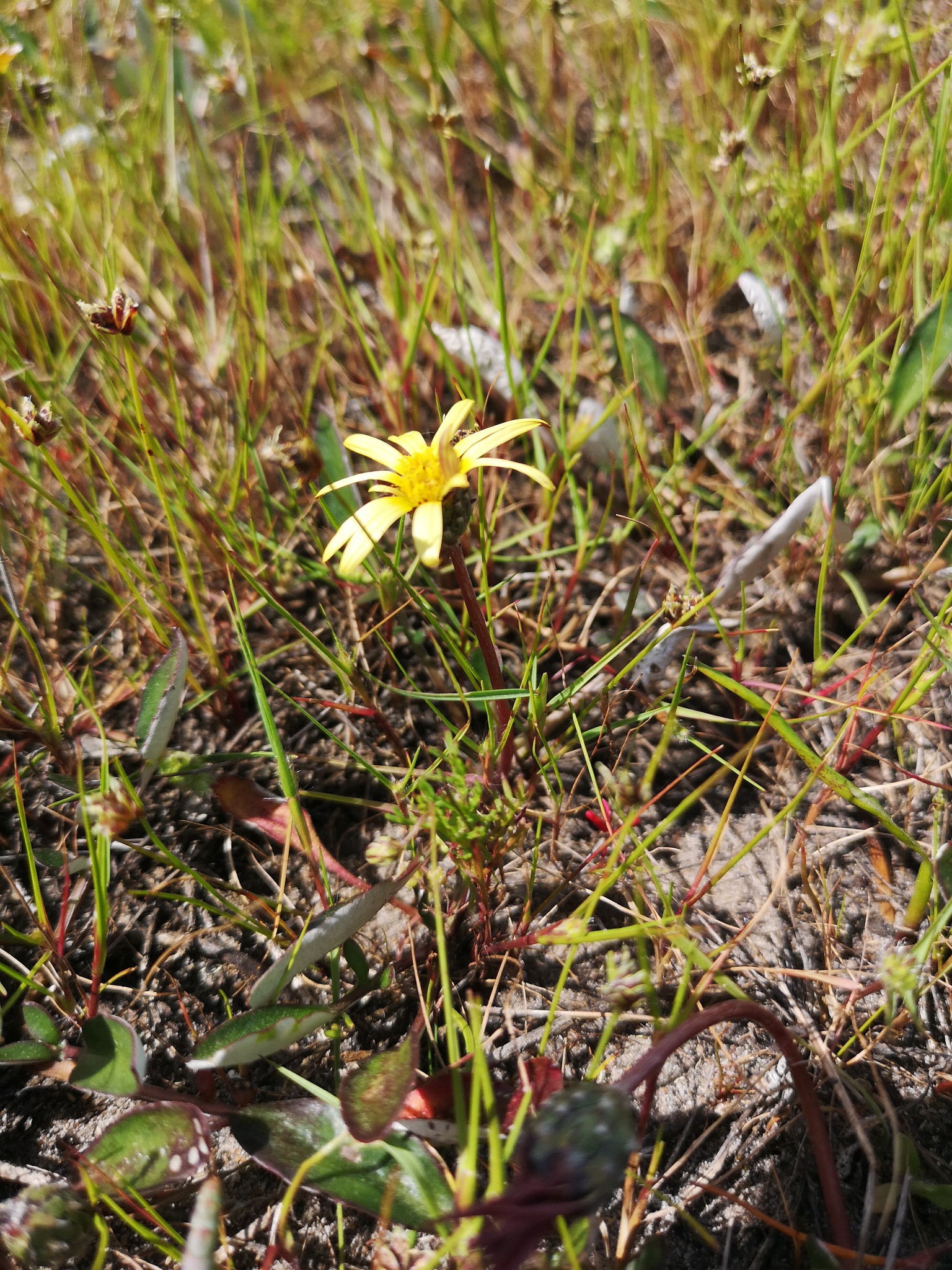
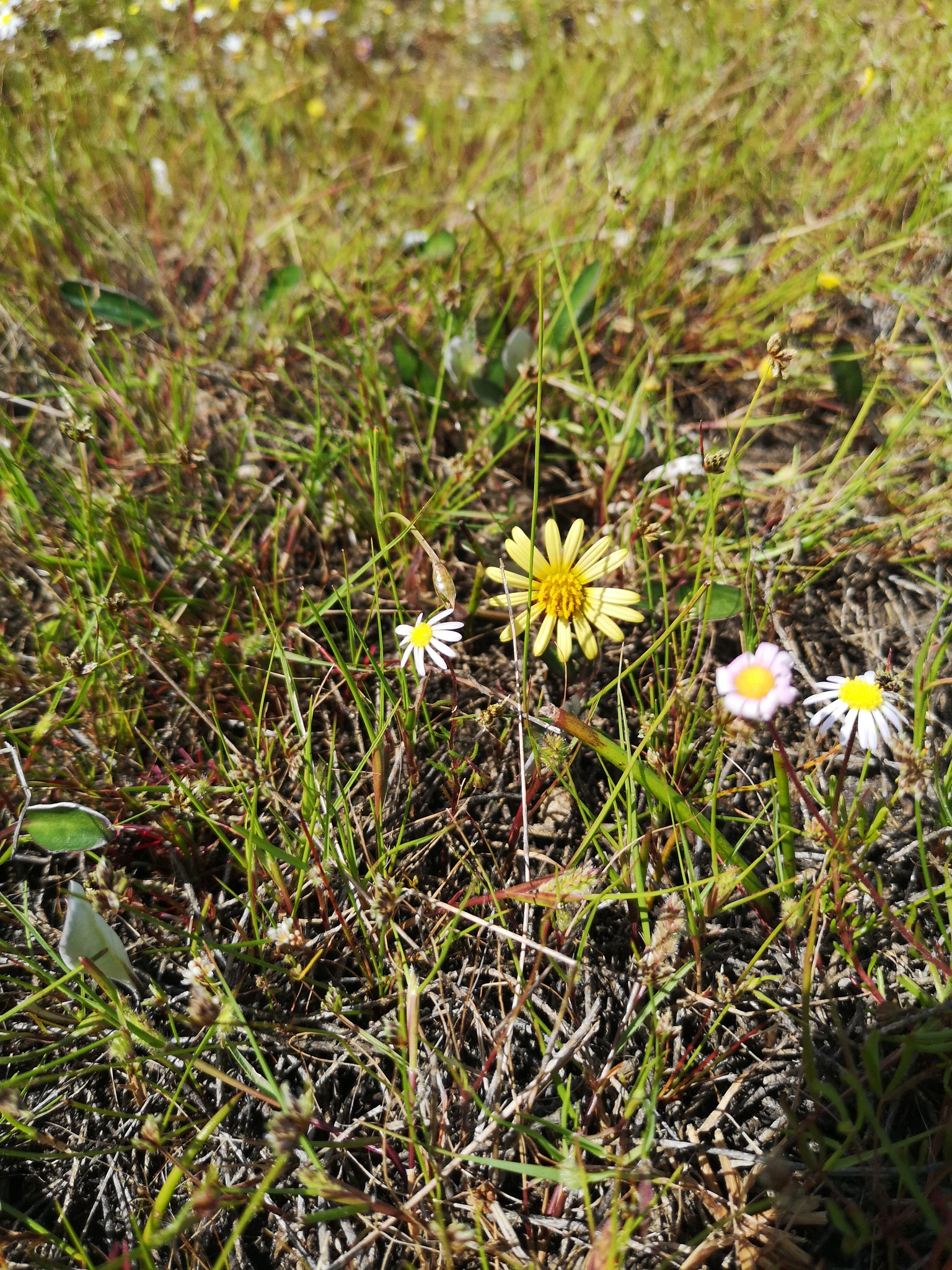
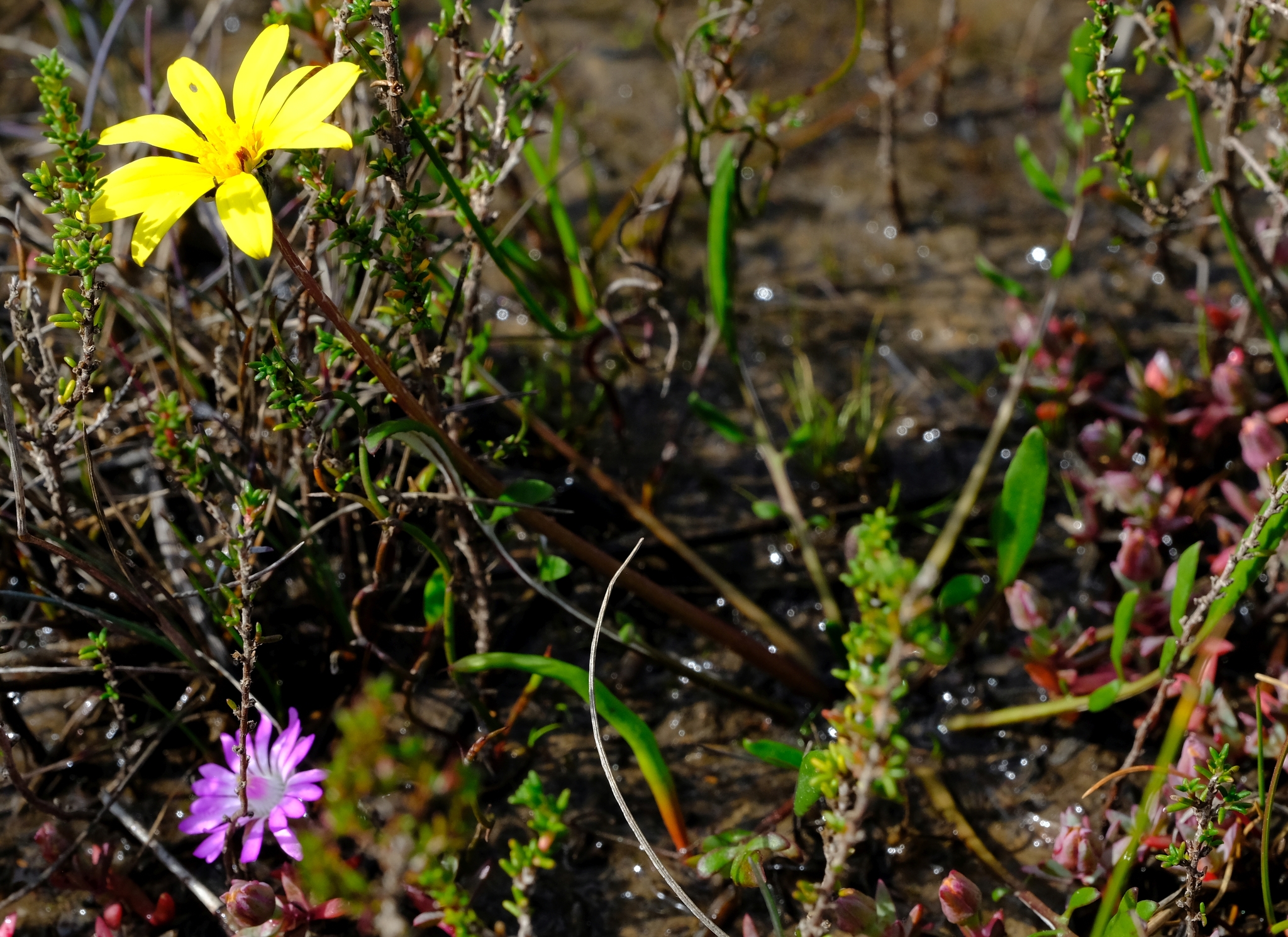
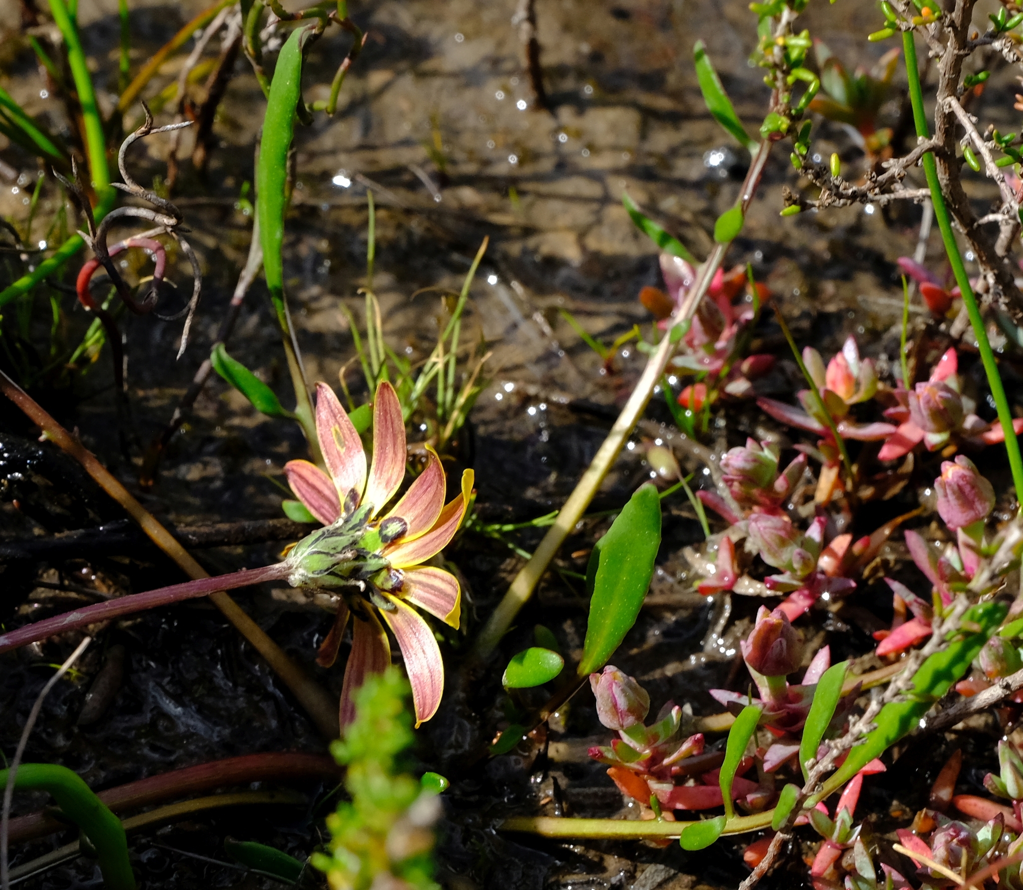
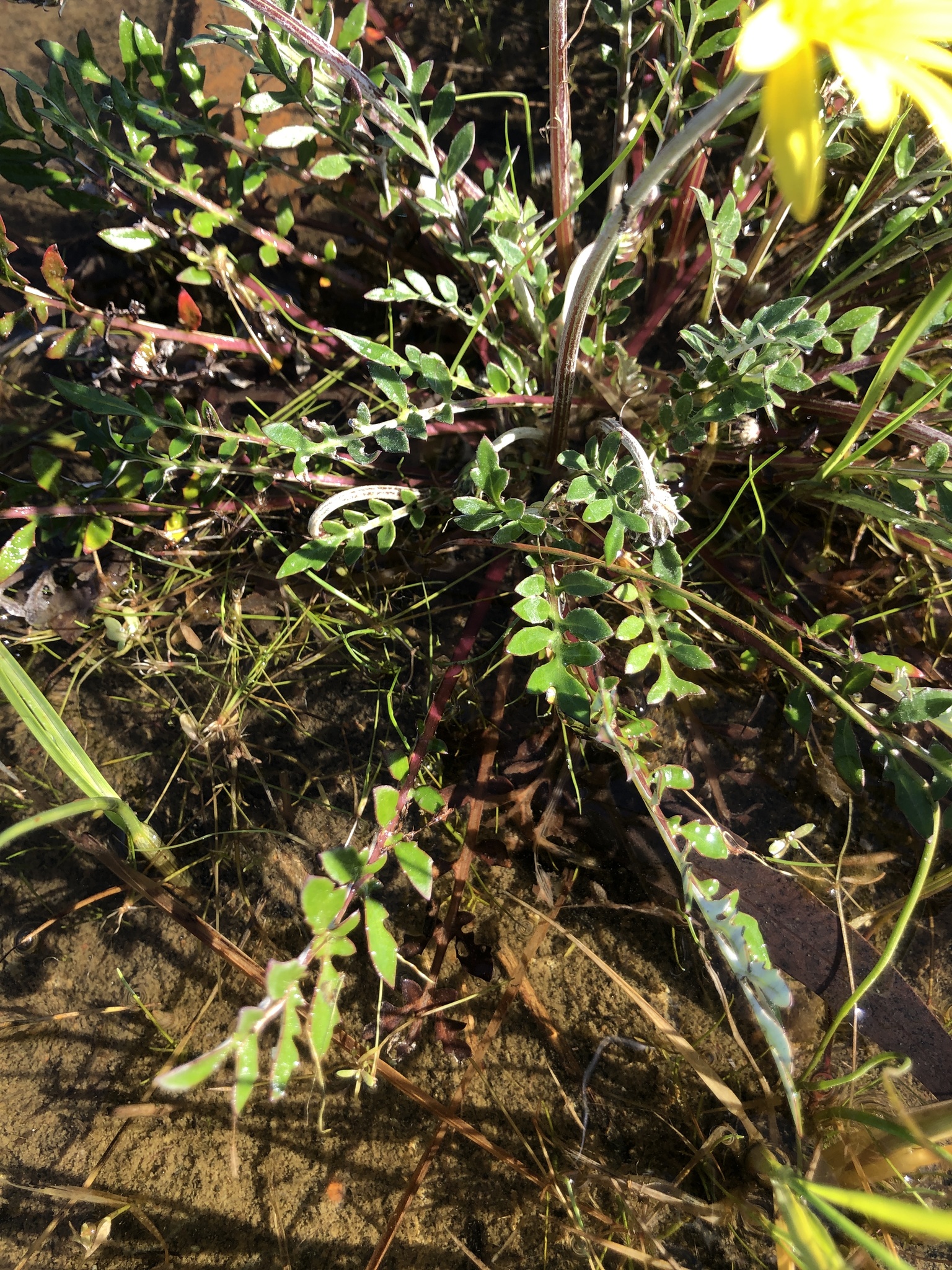
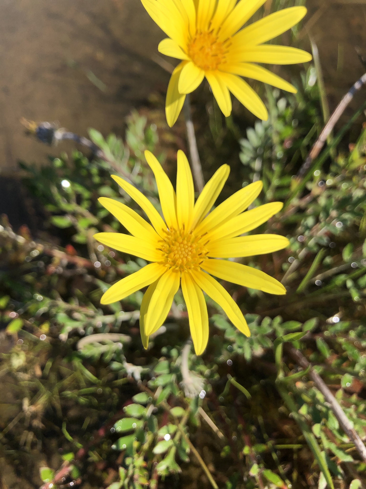
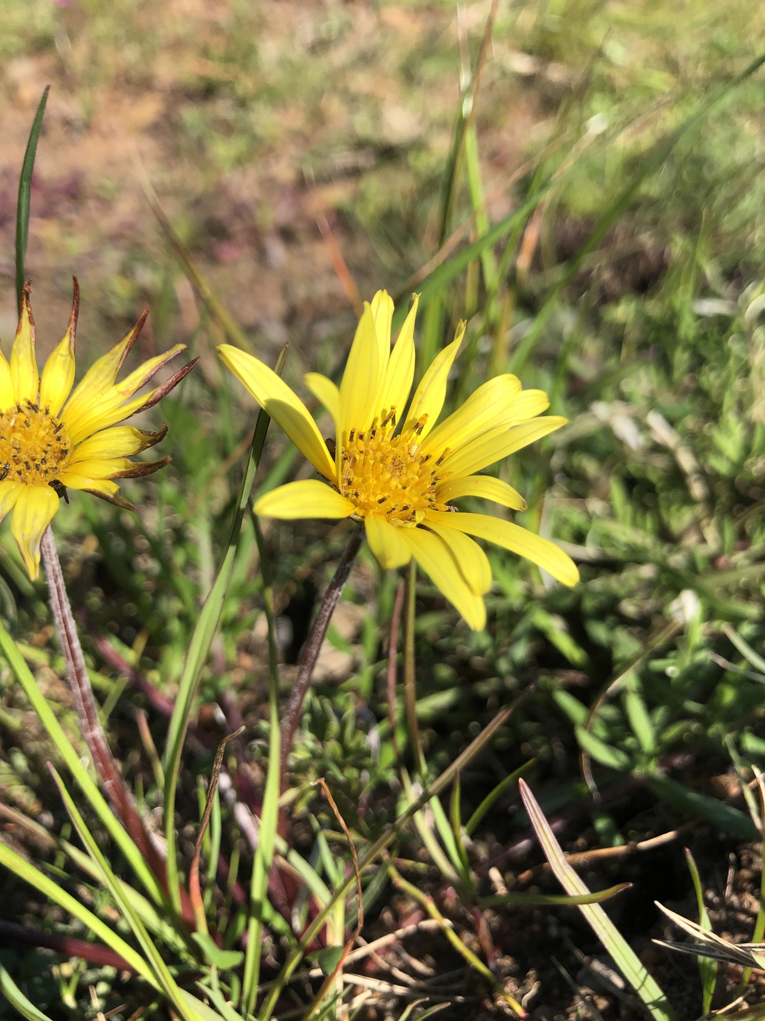
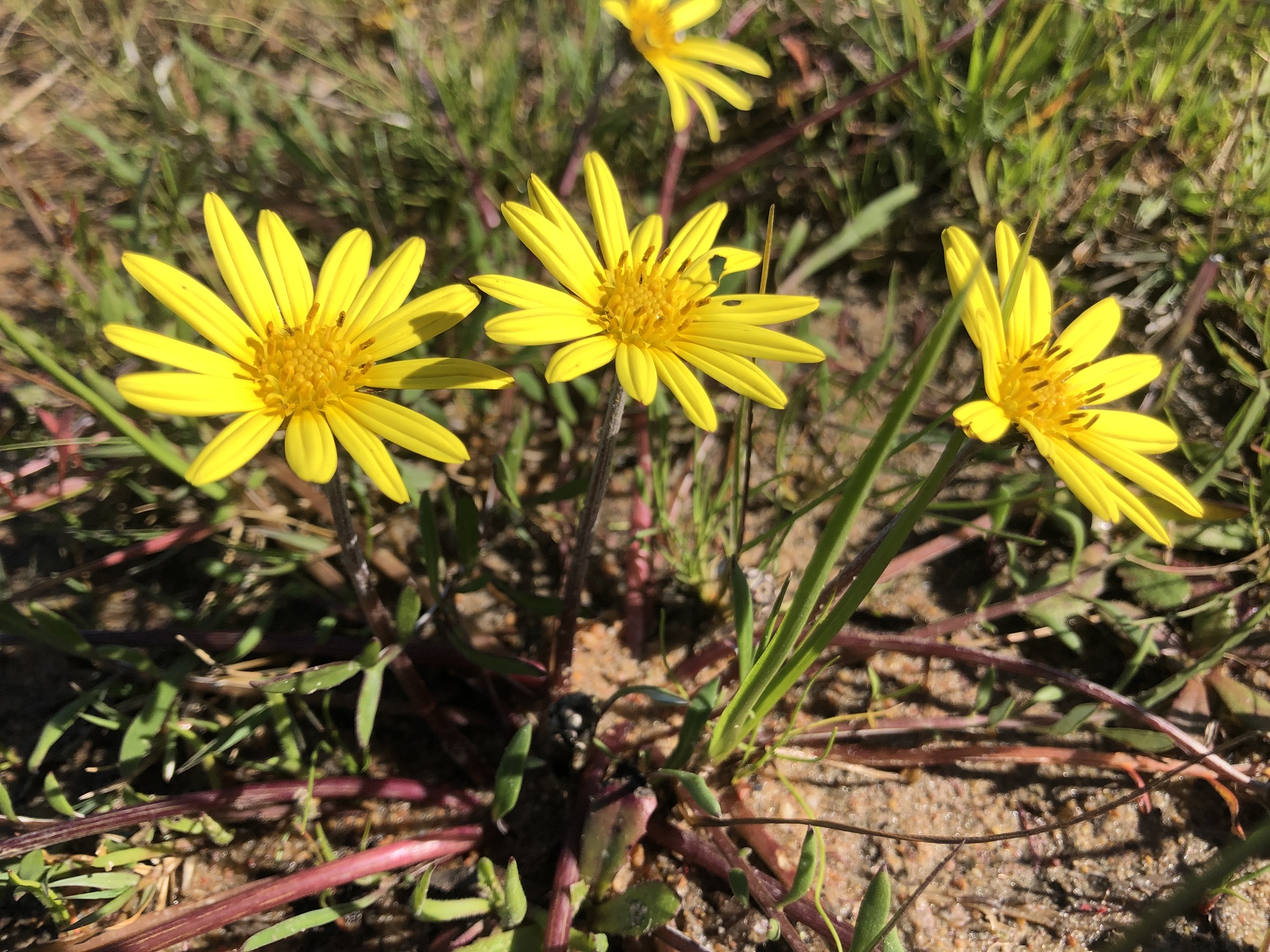
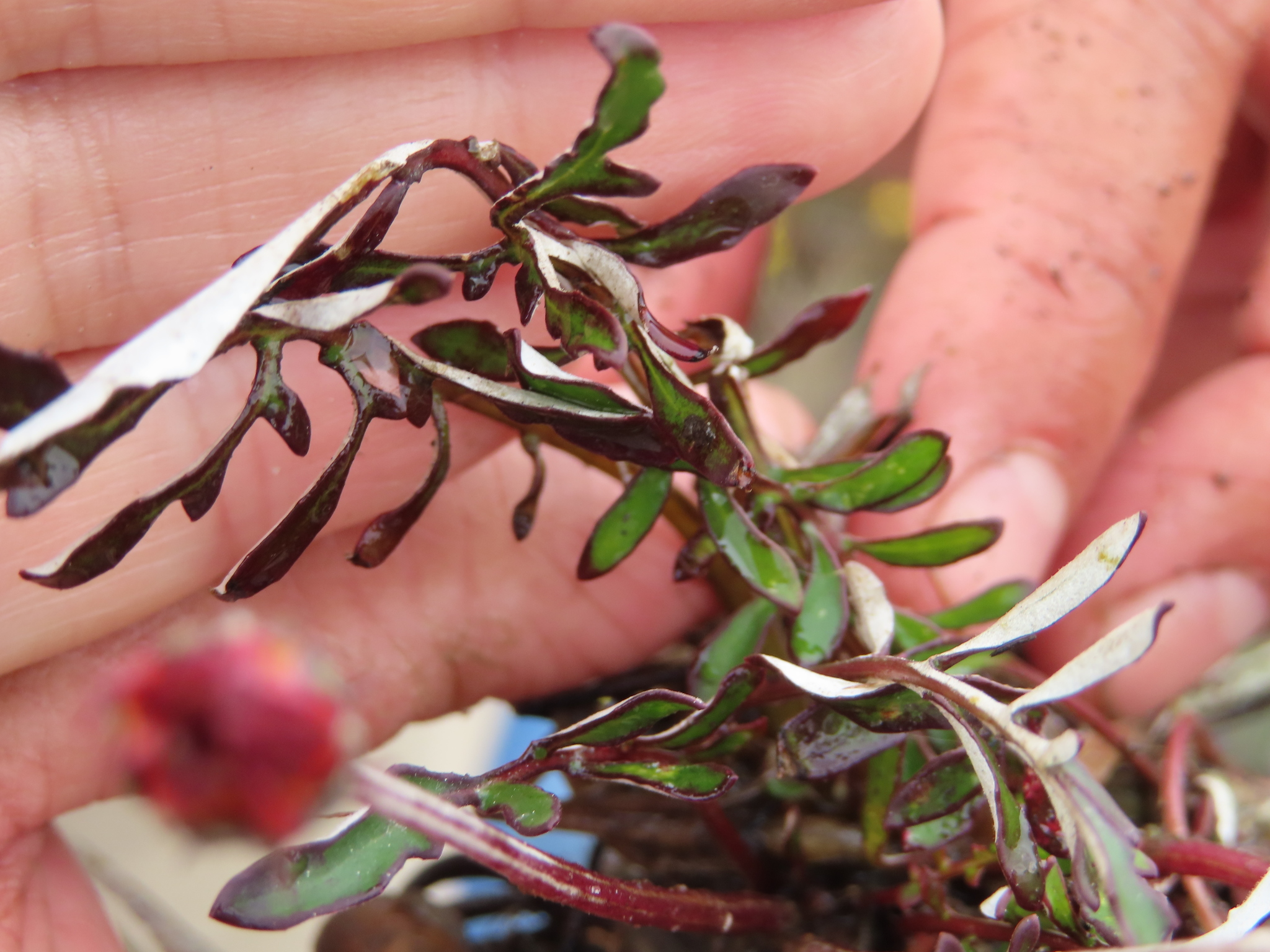
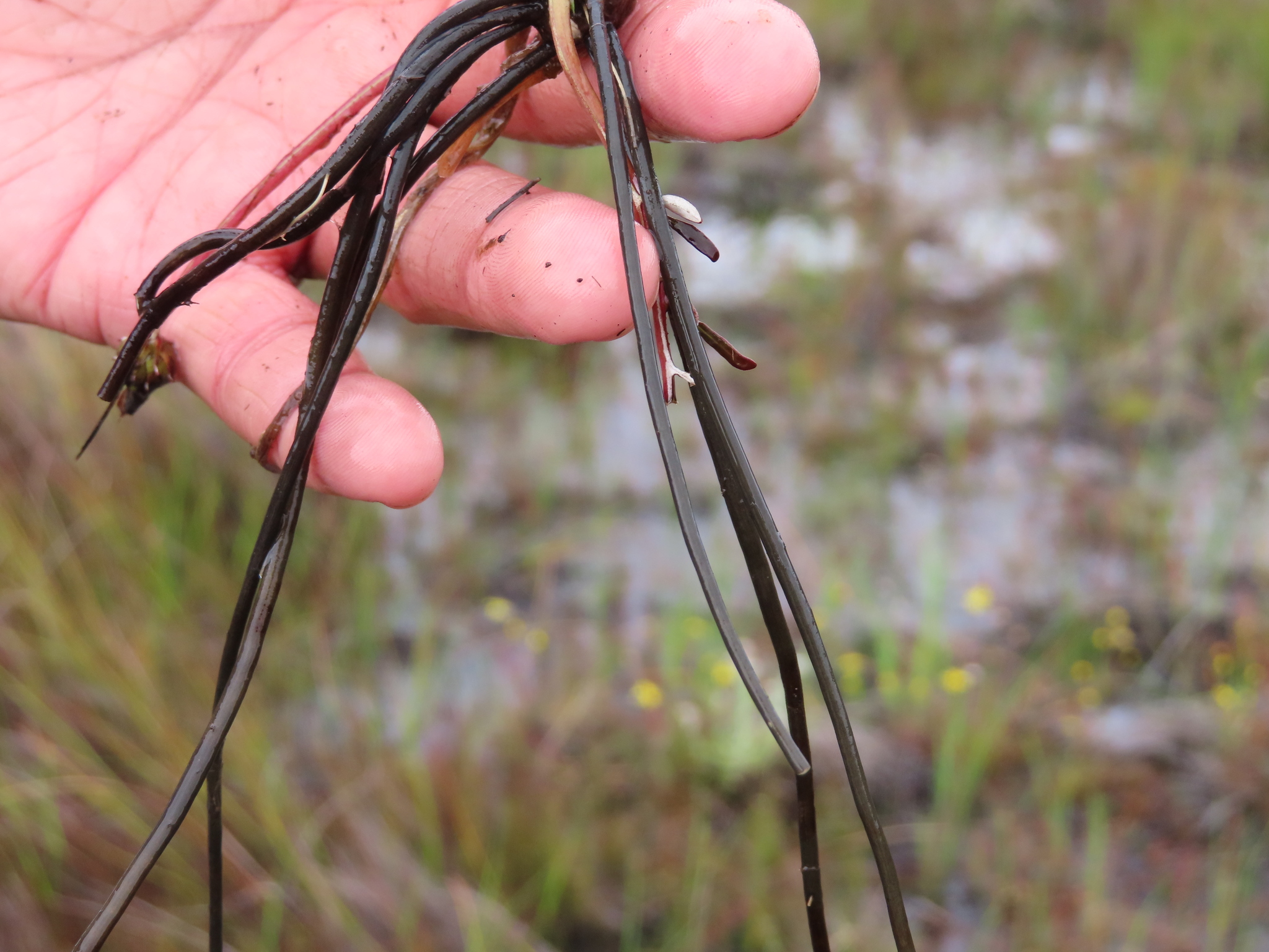
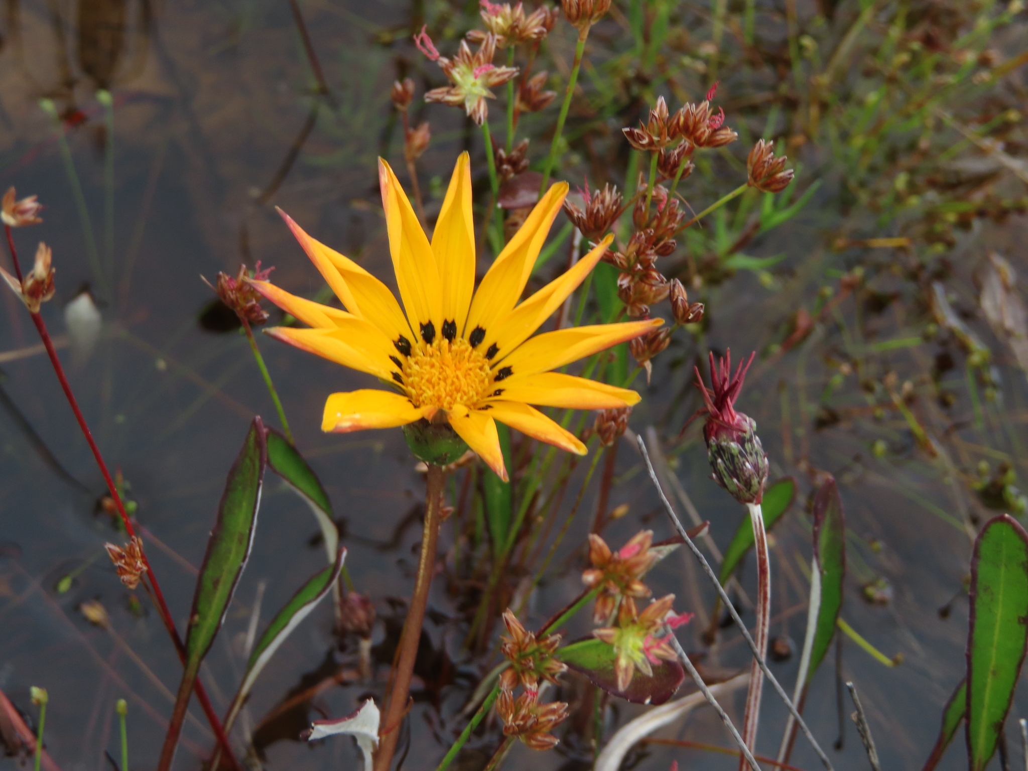
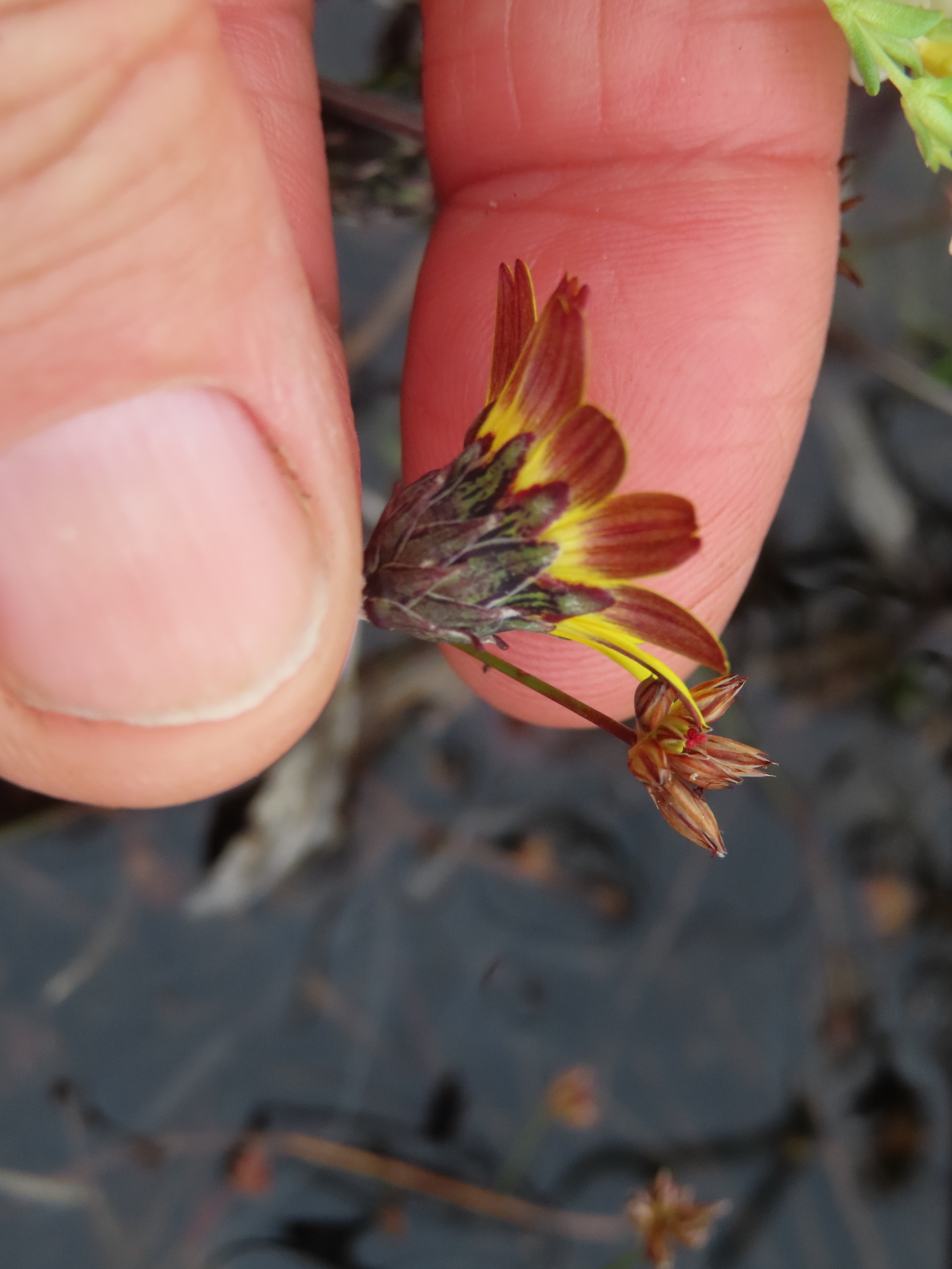
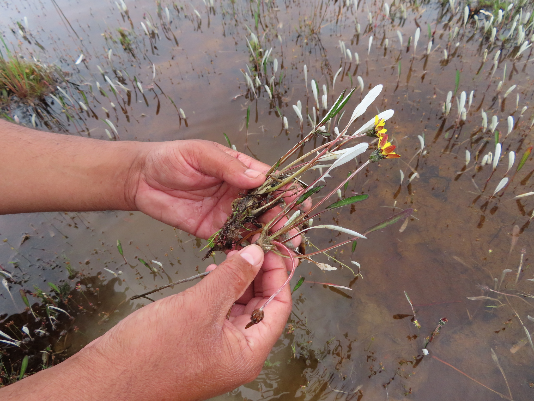
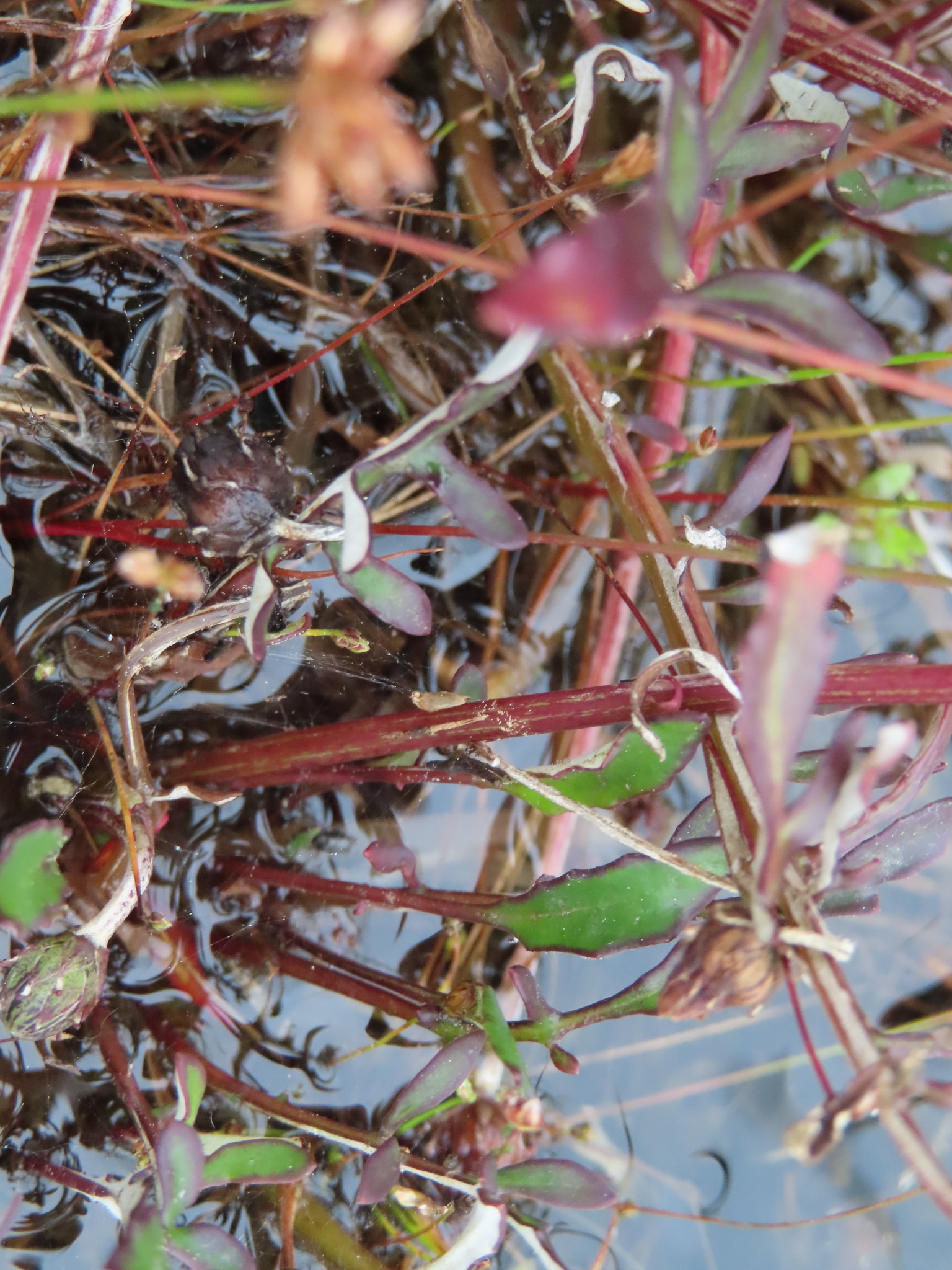
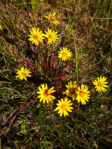
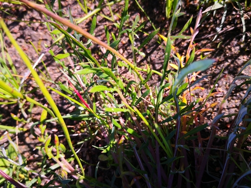
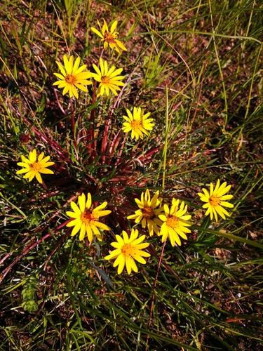
Tufted, thinly white-woolly, scapose perennial to 15 cm, roots thick, fusiform. Leaves in a basal tuft, lyrate to pinnatisect, sometimes bipinnatisect, lobes lanceolate, margins revolute, discolorous, glabrous above. Flower heads radiate, solitary on elongate peduncles, yellow; outer bracts long. Achenes woolly, pappus chaffy. From: Manning, JC; Goldblatt, P; Beyers, JBP. 2012. Asteraceae: Arctotheca J.C.Wendl. In: J Manning & P Goldblatt (eds), Plants of the Greater Cape Floristic Region 1: The Core Cape flora. Strelitzia 29: 352-353. South African National Biodiversity Institute, Pretoria. [CC BY]
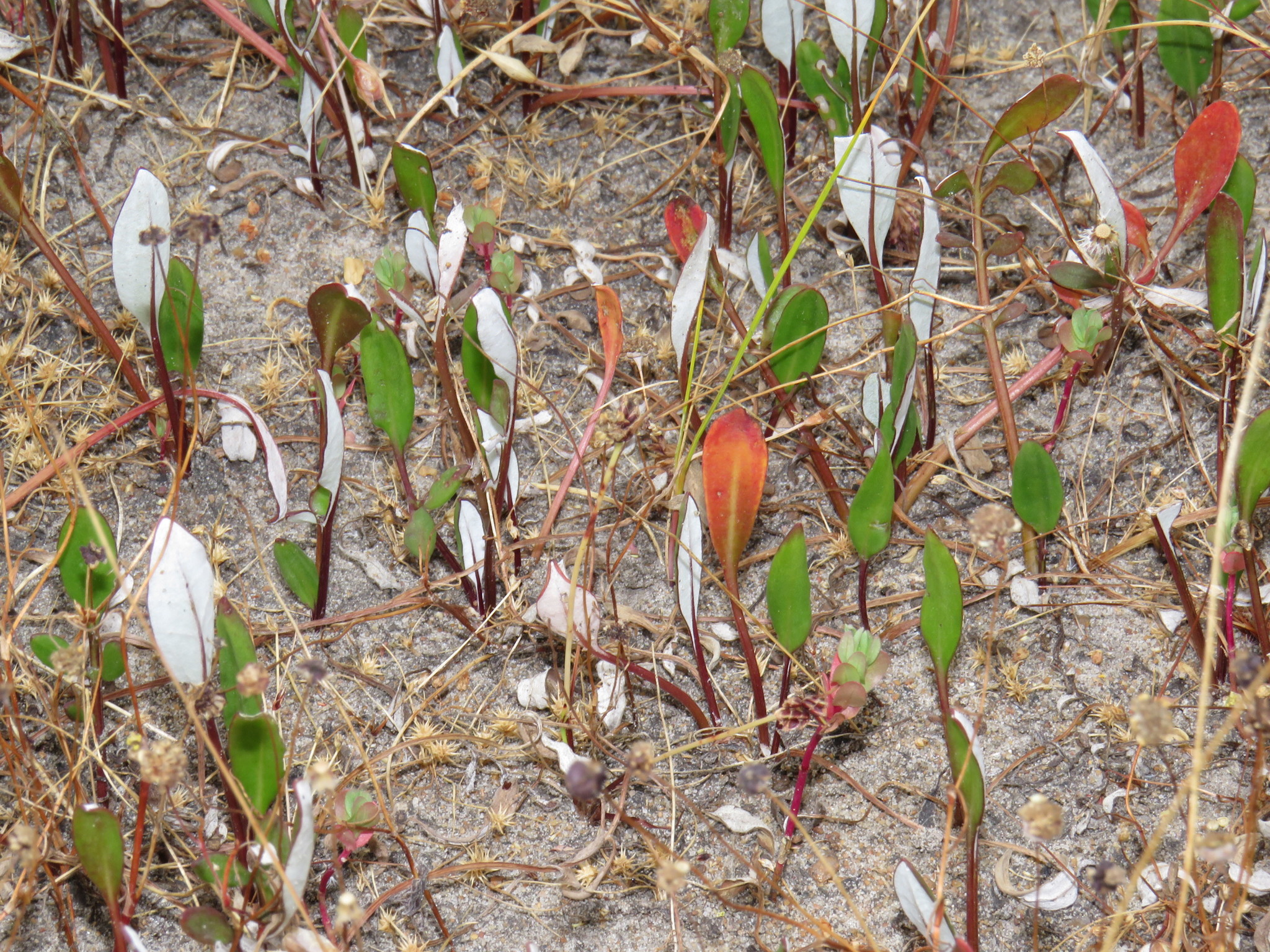
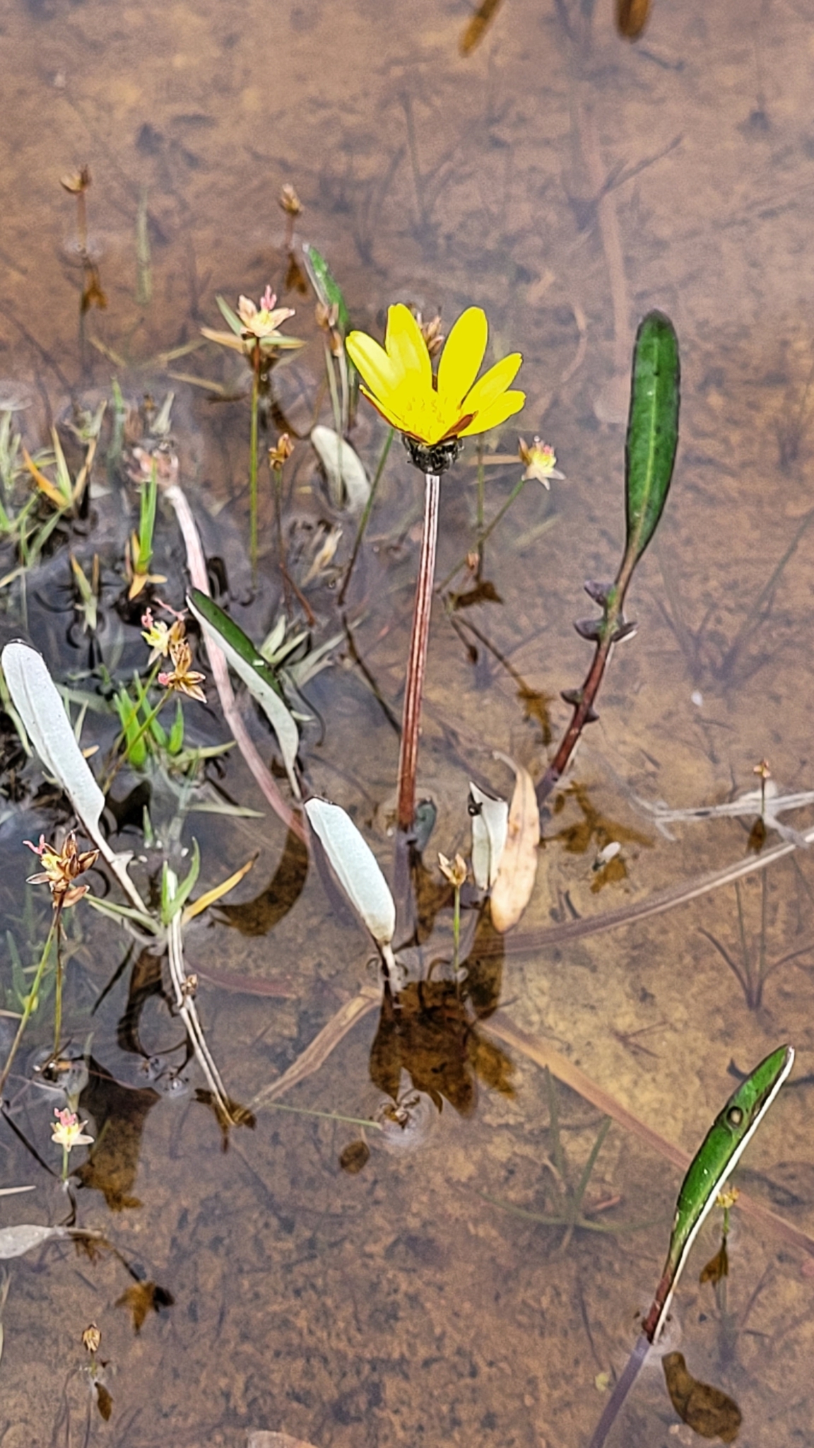
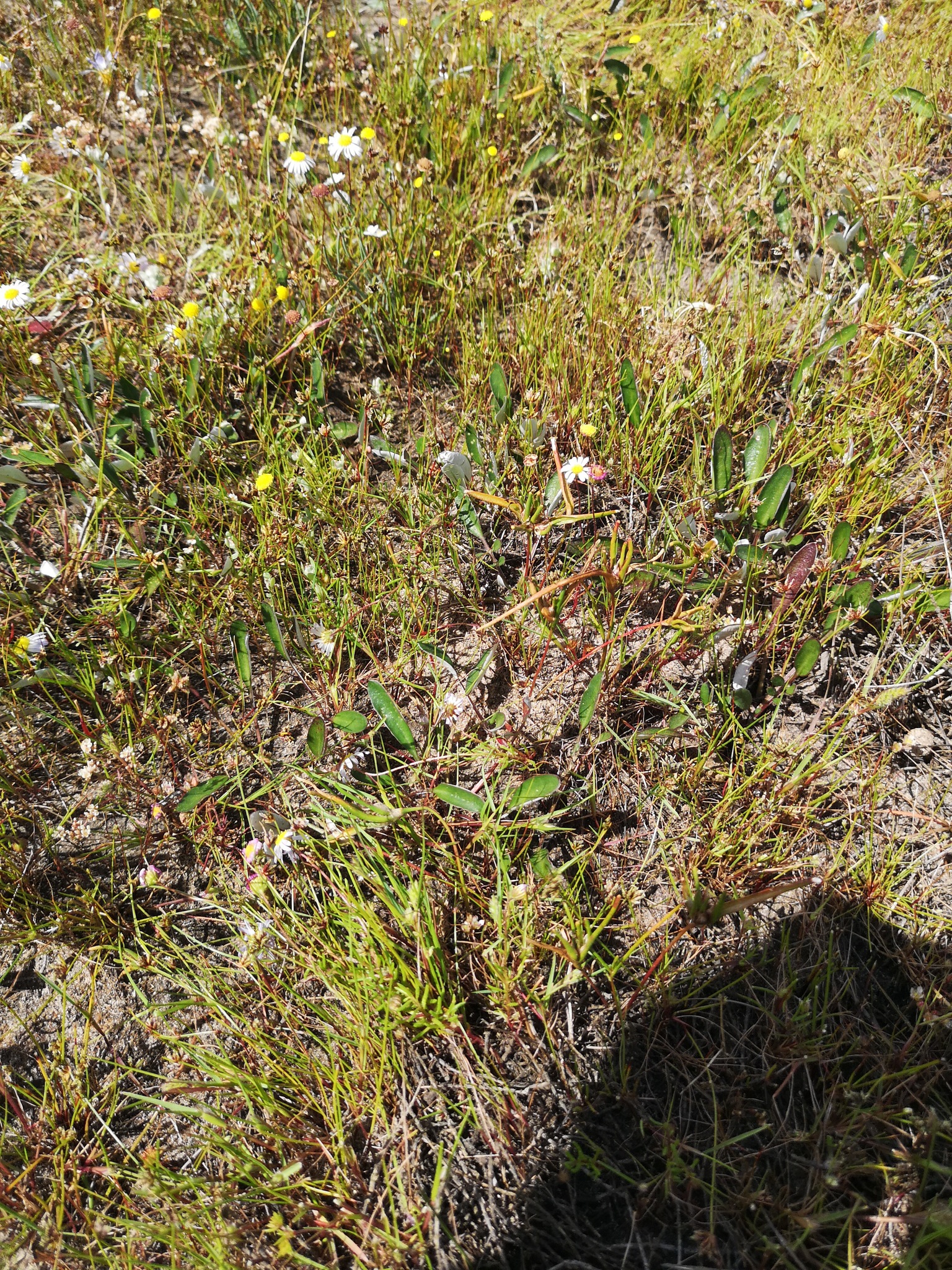
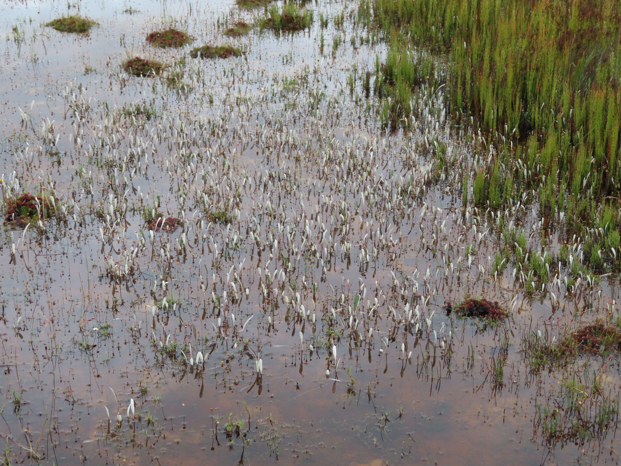
Damp sandy flats. From: Manning, JC; Goldblatt, P; Beyers, JBP. 2012. Asteraceae: Arctotheca J.C.Wendl. In: J Manning & P Goldblatt (eds), Plants of the Greater Cape Floristic Region 1: The Core Cape flora. Strelitzia 29: 352-353. South African National Biodiversity Institute, Pretoria. [CC BY]
Cape Peninsula to Elim. From: Manning, JC; Goldblatt, P; Beyers, JBP. 2012. Asteraceae: Arctotheca J.C.Wendl. In: J Manning & P Goldblatt (eds), Plants of the Greater Cape Floristic Region 1: The Core Cape flora. Strelitzia 29: 352-353. South African National Biodiversity Institute, Pretoria. [CC BY]
July
100 to 324 m
This map contains point-based occurrences at different locations
Occurrence in the Flora of Southern Africa (FSA) countries and South African provinces. Residence status indicates if a taxon is indigenous, endemic, naturalised or invasive in a specific region. This data is based on specimen records and literature
FSA
SA
BOT
NAM
ESW
LES
WC
EC
NC
FS
GA
KZN
LP
MP
NW
Absent
Indigenous
Endemic
Naturalised
Invasive
Names and Sources
Cryptostemma forbesianum (DC.) Harv.
Gazania forbesiana DC.
Classification
KINGDOM Plantae
SUBKINGDOM Phanerogamae
PHYLUM Anthophyta
ORDER Asterales
FAMILY Asteraceae
SUBFAMILY Cichorioideae
TRIBE Arctotideae
GENUS Arctotheca
SPECIES forbesiana
29 results for Arctotheca forbesiana (DC.) K.Lewin
Barcode: SAM0039929-1 Collector(s) & number: Guthrie, 1484 | 1894-8-
South Africa, Western Cape, In Cape Peninsula, near Raapenburg.
Data Resource: BODATSA View record
Barcode: NBG0247345-0 Collector(s) & number: Helme, NA, 6283 | 2009-9-13
South Africa, Western Cape, Riverlands Nature Reserve, central area, along track. 33°29'23.2''S, 18°35'31.5''E.
Data Resource: BODATSA View record
Barcode: NBG0271190-0 Collector(s) & number: Helme, NA, 6436 | 2009-9-5
South Africa, Western Cape, 3 km SW of Caledon, 1 km west of airfield, 0.8 km NE of Grootvlei. 34°15'24.1"S: 19°24'05.9"E. Altitude: 230 m.
Data Resource: BODATSA View record
Barcode: NBG0033641-0 Collector(s) & number: Parker, RN, 4348 | 1948-9-22
South Africa, Western Cape, Stellenbosch. Strand to Gordons Bay.
General notes: On wet sandy flats, often standing in water.
Data Resource: BODATSA View record
Barcode: NBG0247459-0 Collector(s) & number: Helme, NA, 4820 | 2007-8-14
South Africa, Western Cape, 3 km E of Baardskeerdersbos, just S of Elim road, on Niewe Dam 209. 34°35'25.7"S 19°36'48.6"E.
Data Resource: BODATSA View record
Barcode: NBG0191065-0 Collector(s) & number: Helme, NA, 2333 | 2001-10-13
South Africa, Western Cape, Caledon. 1km S of Caledon, just east of rifle range and cemetery. Lat. 34° 14.830' S; Long. 19° 25.406' E.
Data Resource: BODATSA View record
Barcode: NBG0198532-0 Collector(s) & number: Helme, NA, 3072 | 2004-8-16
South Africa, Western Cape, Cape Town. Faure, N of N2, W of R310, on Vergenoegd 653. Part of proposed Dreamworld Film Studio Site. Kuilsrivier floodplain, N edge.
General notes: Fynbos biome. Renosterveld vegetation. Floodplain. Seasonally waterlogged, clay soil. Shale. No slope. Recently burned. Herb. Rays yellow. Flowers present. Plant height 0.1 m. Local, but patches of 5x5 m, with hundreds of plants. Seasonally inundated. Sandy clays. In association with Cliffortia ericifolia. Threatened by Acacia saligna.
Data Resource: BODATSA View record
Barcode: NBG0197431-0 Collector(s) & number: Helme, NA, 2826 | 2003-9-12
South Africa, Western Cape, Caledon. Caledon Municipal area; south of town, in drainage line just east of old rifle range and cemetery.
General notes: Fynbos biome. Renosterveld vegetation. Floodplain. Seasonally waterlogged, clay soil. Shale. Full sun. No slope. No biotic effect seen. Herb. Rays and discs yellow. Peduncles red. Bracts edged maroon. Flowers and fruit present. Plant height 0.15 m. Common along edge of seasonal wetland, often growing in shallow water. Highly threatened by alien grasses, urbanization. In association with Chondropetalum rectum, Sarcocornia mossiana.
Data Resource: BODATSA View record
Barcode: NBG0033642-0 Collector(s) & number: Compton, RH, 20088 | 1947-10-4
South Africa, Western Cape, Stellenbosch. Kraaifontein.
Data Resource: BODATSA View record
Barcode: SAM0039929-2 Collector(s) & number: Guthrie, 1484 | 1894-8-
South Africa, Western Cape, In Cape Peninsula, near Raapenburg.
Data Resource: BODATSA View record
Barcode: SAM0039930-0 Collector(s) & number: Ecklon, CF, s.n. | --
South Africa, Western Cape, Zwartberg near Riviersonderend.
Data Resource: BODATSA View record
Barcode: NBG0266605-0 Collector(s) & number: Helme, NA, 6419 | 2009-8-31
South Africa, Western Cape, Strand, Weltevreden area, erf 14335. West of High School. 34°07'17.0"S: 18°50'55.1"E. Altitude: 15 m.
General notes: Fynbos biome. Vegetation type: Swartland Shale Renosterveld. Plain. Seasonally waterlogged, loamy and clay soil. Shale. Full sun. No slope. No biotic effect seen. Herb. Rays yellow. Stoloniferous. Flowers: present. Fruit: present. Locally common near school. Seasonally wet clays with sparse vegetation. Severely threatened by development, 100 - 200 plants. Plant height: 0.1 m.
Data Resource: BODATSA View record
Barcode: NBG0277267-0 Collector(s) & number: Helme, NA, 7083 | 2011-7-25
South Africa, Western Cape, Klipheuwel 410, 5 km SW of Caledon, entrance to Grootvlei. 34°14'46.2"S: 19°23'34.4"E. Altitude: 220 m.
General notes: Fynbos biome. Vegetation type: Shale Renosterveld. Valley, depression. No slope. Seasonally waterlogged, clay soil. Shale. Full sun. No biotic effect seen. Herb. Rays yellow. Stoloniferous. Flowers: present. Fruit: present. Locally common in well managed wetland at entrance to farm. Large population, at least 5000 plants. Plant height: 0.1 m.
Data Resource: BODATSA View record
Barcode: NBG0263388-0 Collector(s) & number: Unknown, s.n. | 2009-8-31
South Africa, Western Cape, Strand, Weltevreden area, erf 14335. West of High School. 34°07'17.0"S: 18°50'55.1"E. Altitude: 15 m.
General notes: Fynbos biome. Vegetation type: Swartland Shale Renosterveld. Plain. Seasonally waterlogged, loamy and clay soil. Shale. Full sun. No slope. No biotic effect seen. Herb. Rays yellow. Stoloniferous. Flowers: present. Fruit: present. Locally common near school. Seasonally wet clays with sparse vegetation. Severely threatened by development, 100 - 200 plants. Plant height: 0.1 m.
Data Resource: BODATSA View record
Barcode: NBG1565125-0 Collector(s) & number: Ebrahim, I, Ebr1578 | 2021-10-30
South Africa, Western Cape, Elim. Klein Blomme Fontein Farm, Agulhas.
General notes: Flower colour?
Data Resource: BODATSA View record
Barcode: NBG0198412-0 Collector(s) & number: C.R.E.W., CR200 | 2004-8-18
South Africa, Western Cape, Caledon. N2 side of road, big patch, lower down in wetland. 34°11'41" S; 19°38'02" E.
General notes: Fynbos biome. Renosterveld vegetation. Wetland. Seasonally waterlogged, moist/damp, clay soil. Shale. Full sun. No slope. Grazed. Herb. Flowers present. Fruit absent. Plant height 10 cm. Collected by Tilla Raimondo.
Data Resource: BODATSA View record
Barcode: NBG0183916-0 Collector(s) & number: Nel, GC, 1247 | 1921-8-20
South Africa, Western Cape, Damp holders on flats near Somerset Strand.
General notes: Sandy soil.
Data Resource: BODATSA View record
Barcode: PRE0215574-0 Collector(s) & number: Esterhuysen, EE, 23126 | 1954-9-15
South Africa, Western Cape, STELLENBOSCH DIV.; FLATS BETW. STRAND AND GORDONS BAY
Data Resource: BODATSA View record
Barcode: PRE0215573-0 Collector(s) & number: Nel, GC, 1247 | 1921-8-20
South Africa, Western Cape, SOMERSET STRAND
Data Resource: BODATSA View record
This map contains point-based occurrences at different locations
2012
SERIES CHAPTER
Asteraceae: Arctotheca J.C.Wendl. Manning, JC; Goldblatt, P; Beyers, JBPIn: J Manning & P Goldblatt (eds), Plants of the Greater Cape Floristic Region 1: The Core Cape flora. Strelitzia 29: 352-353
South African National Biodiversity Institute, Pretoria
1922
PERIODICAL/JOURNAL
Systematische gliederung und geographische verbreitung der Arctotideae-Arctotidinae Lewin, RARepertorium Specierum Novarum Regni Vegetabilis 11: 1-75
No results found for Arctotheca forbesiana (DC.) K.Lewin
Status and criteria
VU
Assessor(s)
Plantae Coordinator
| Part(s) of plant used | Use(s) | Reference |
|---|
Coming soon...
