PLANTAE / PHANEROGAMAE / ANTHOPHYTA / SAXIFRAGALES / CRASSULACEAE / CRASSULOIDEAE / CRASSULA / CORALLINA / MACRORRHIZA

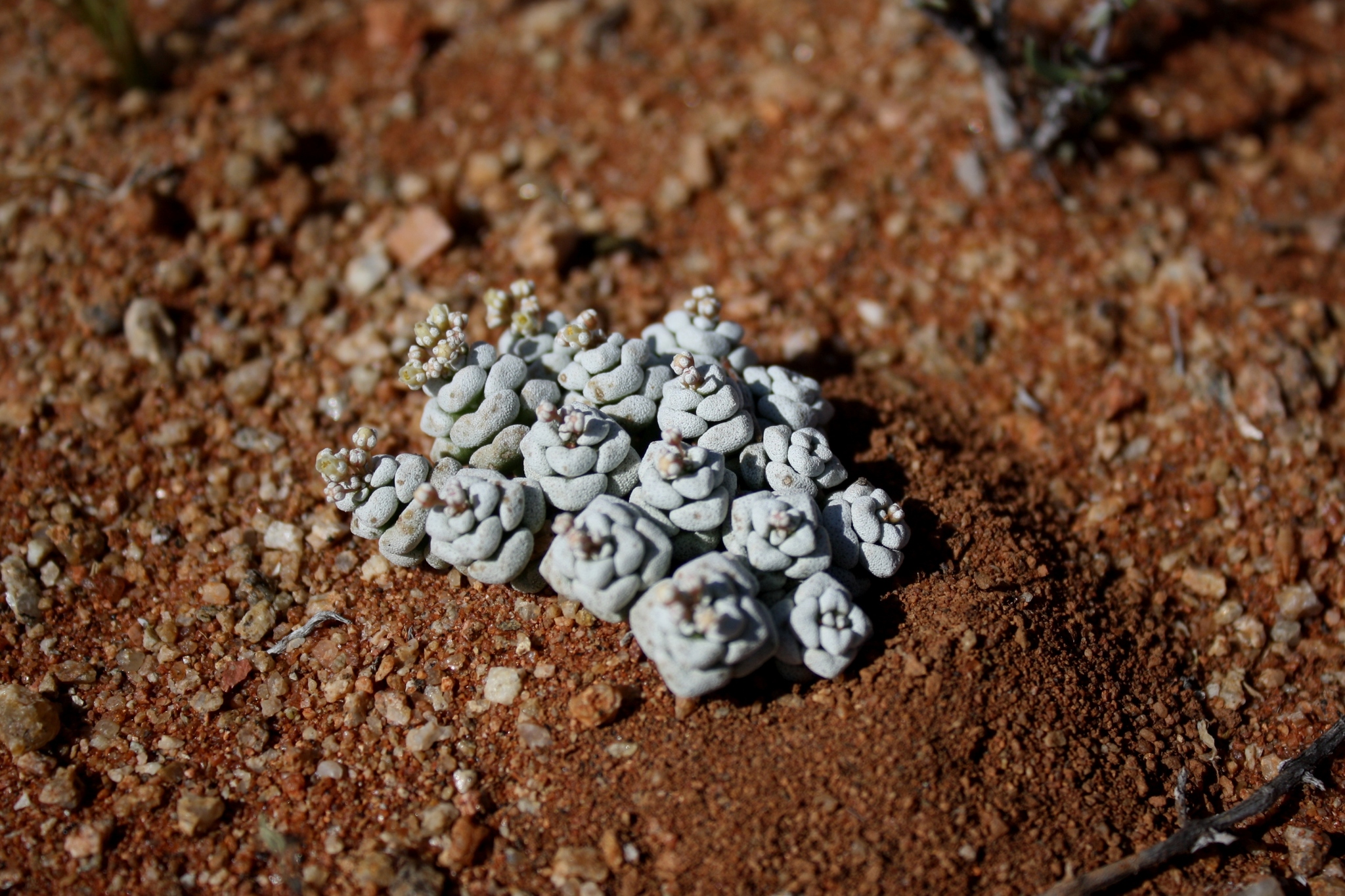
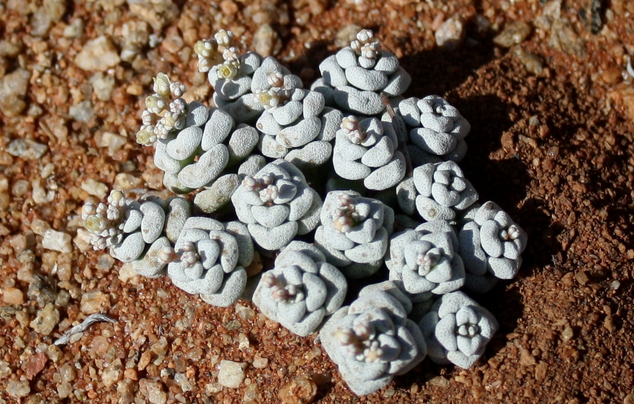
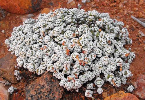
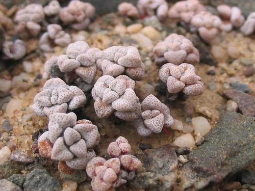
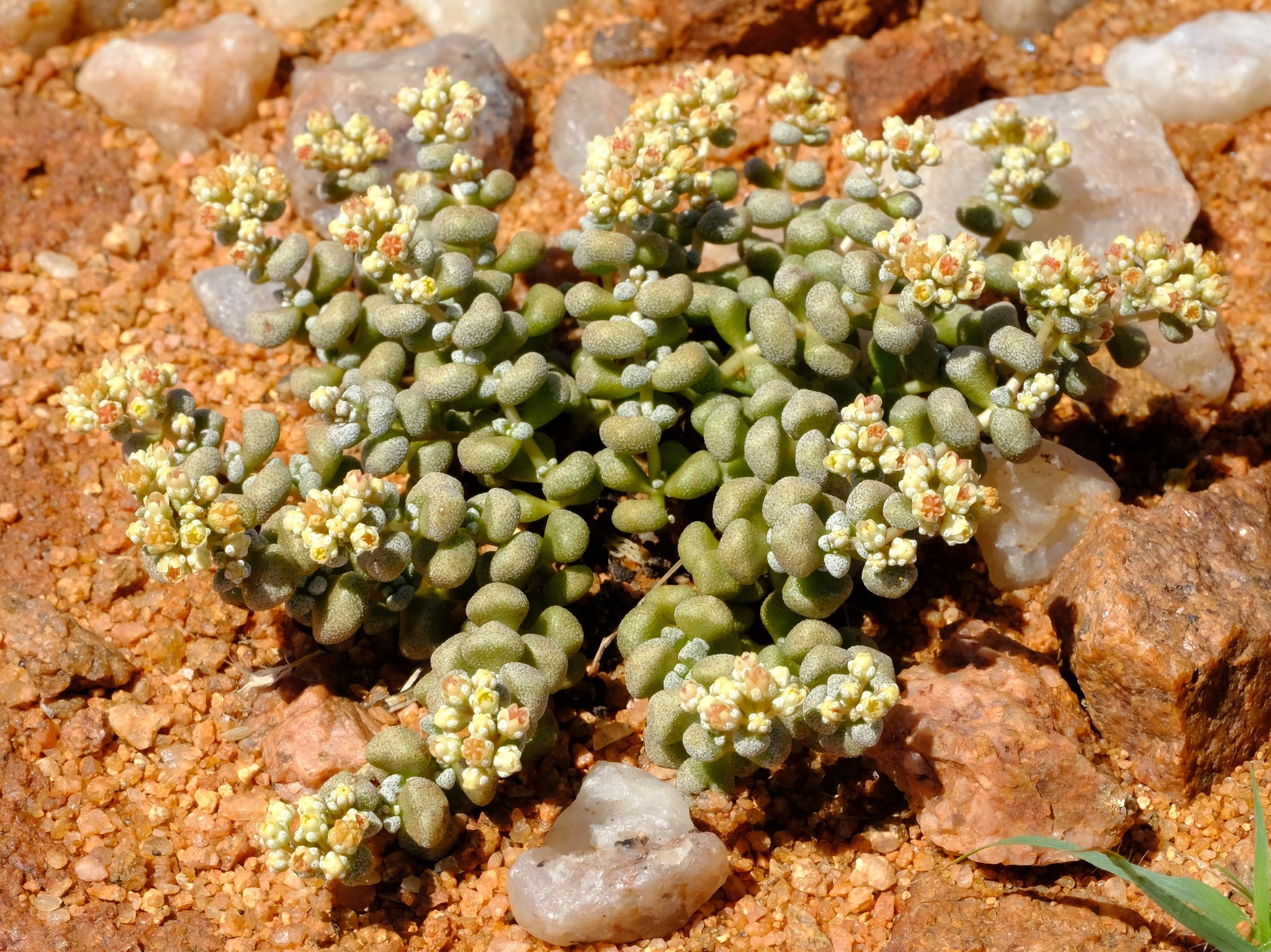
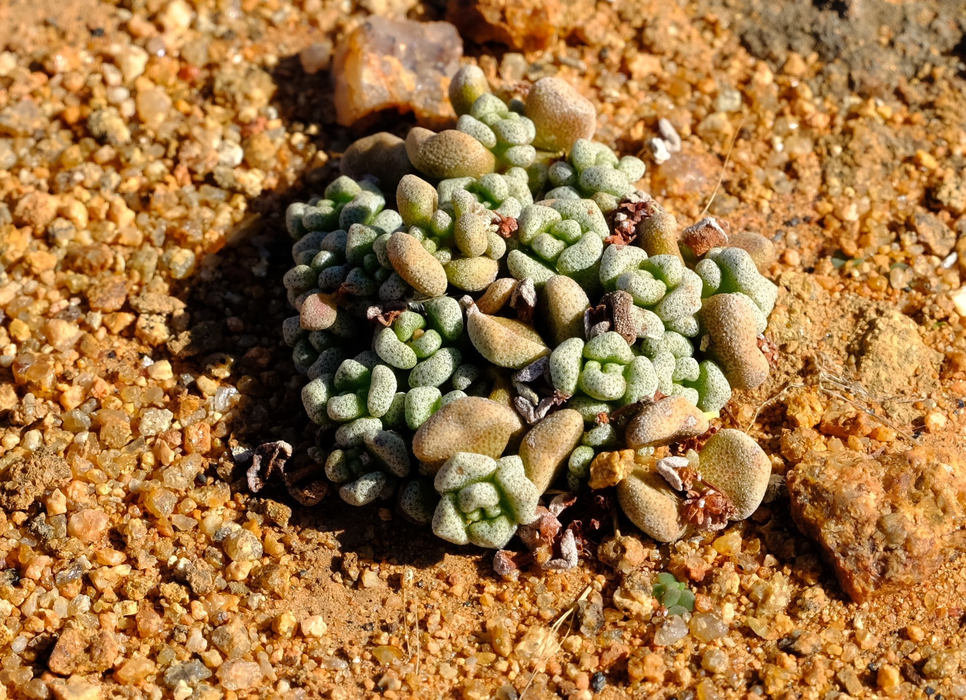
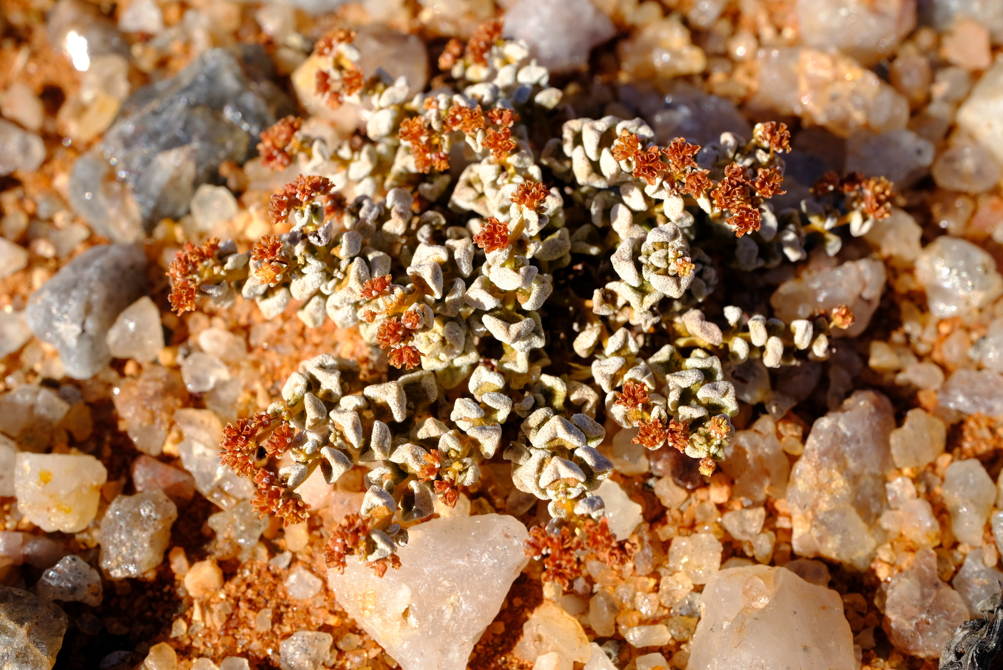
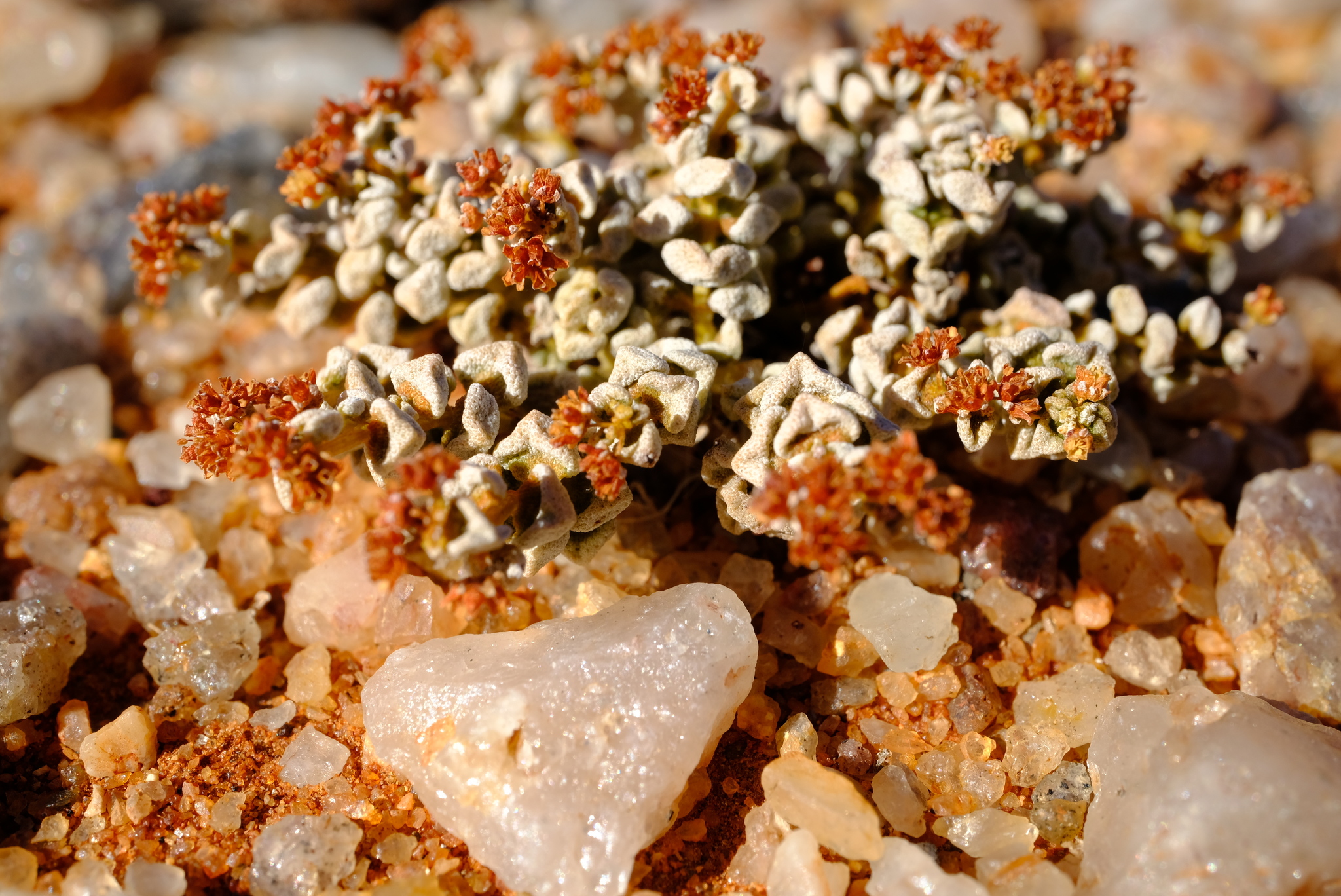
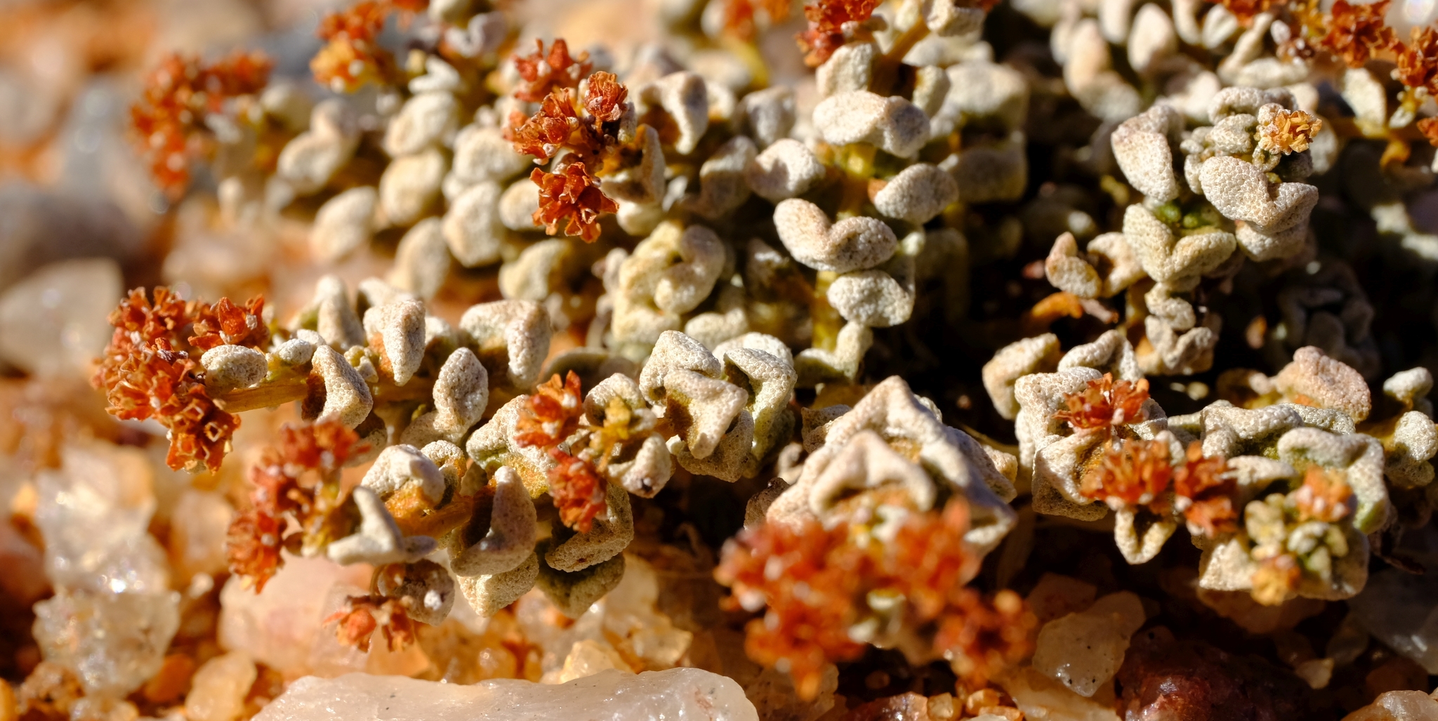
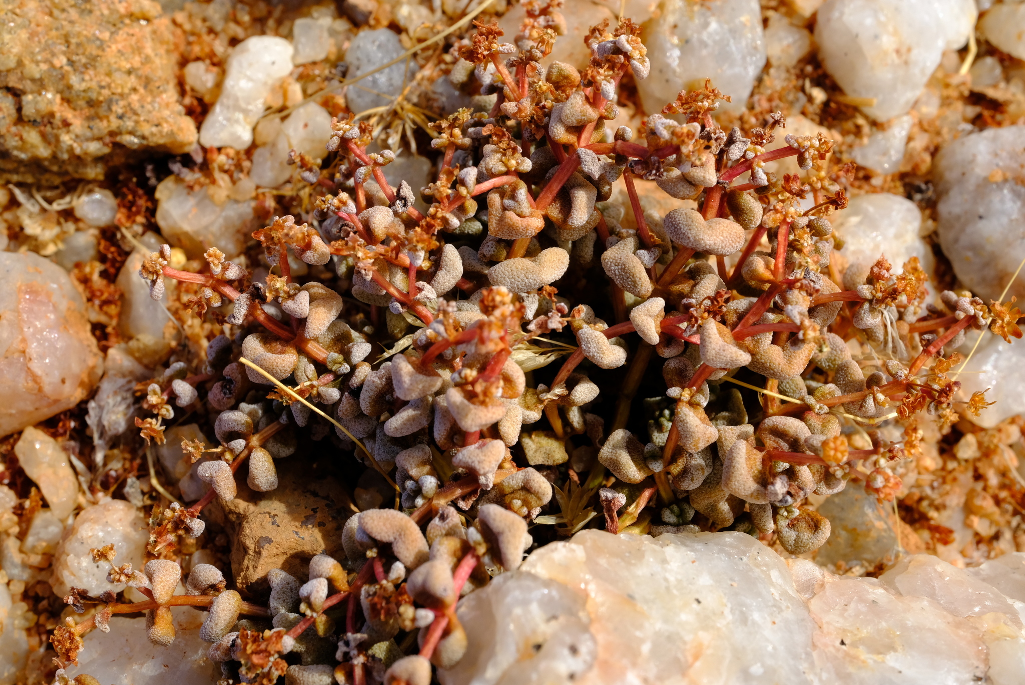
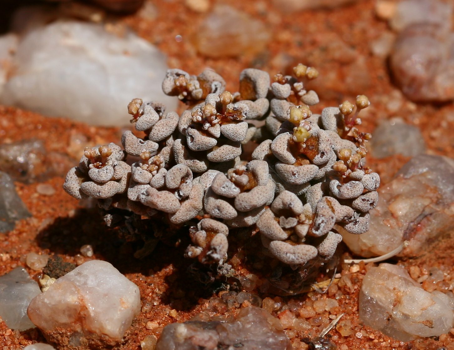
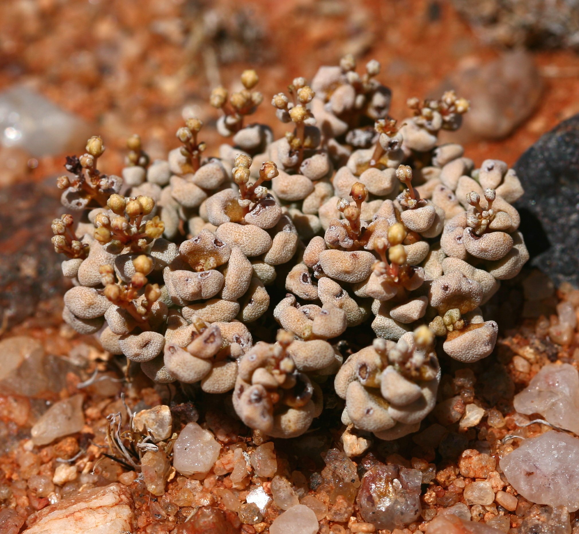
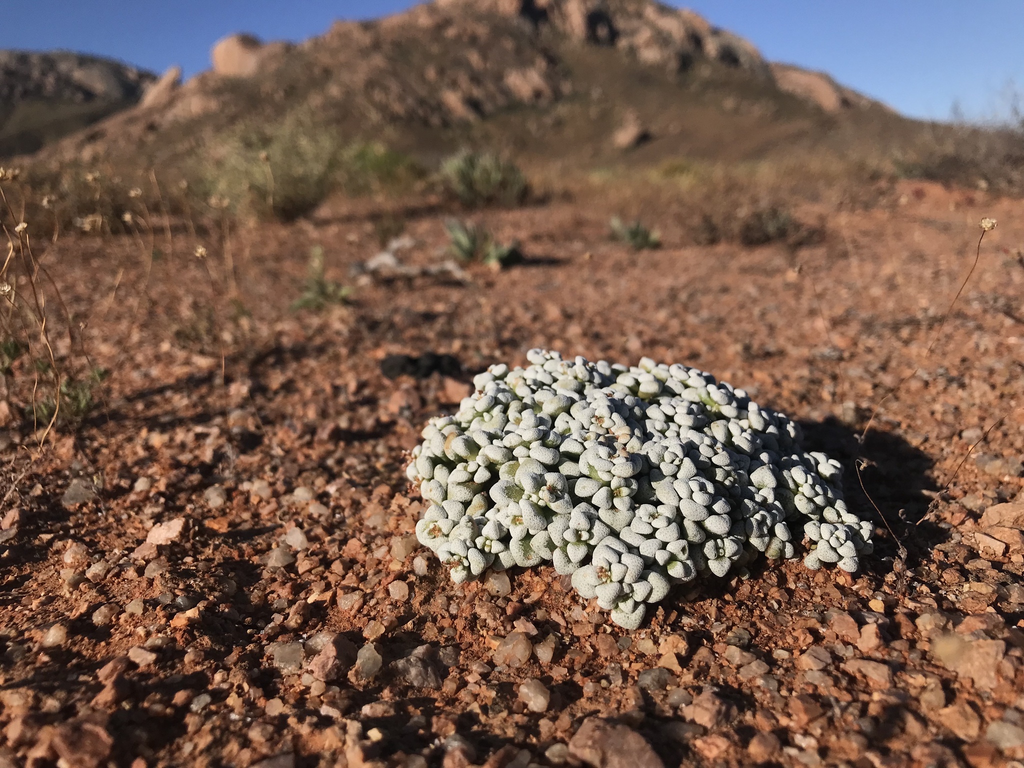
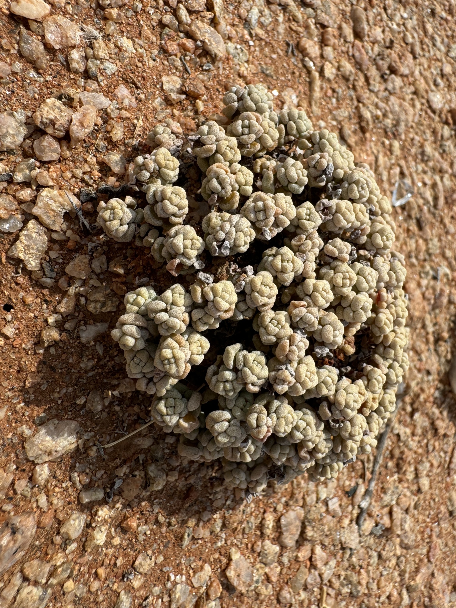
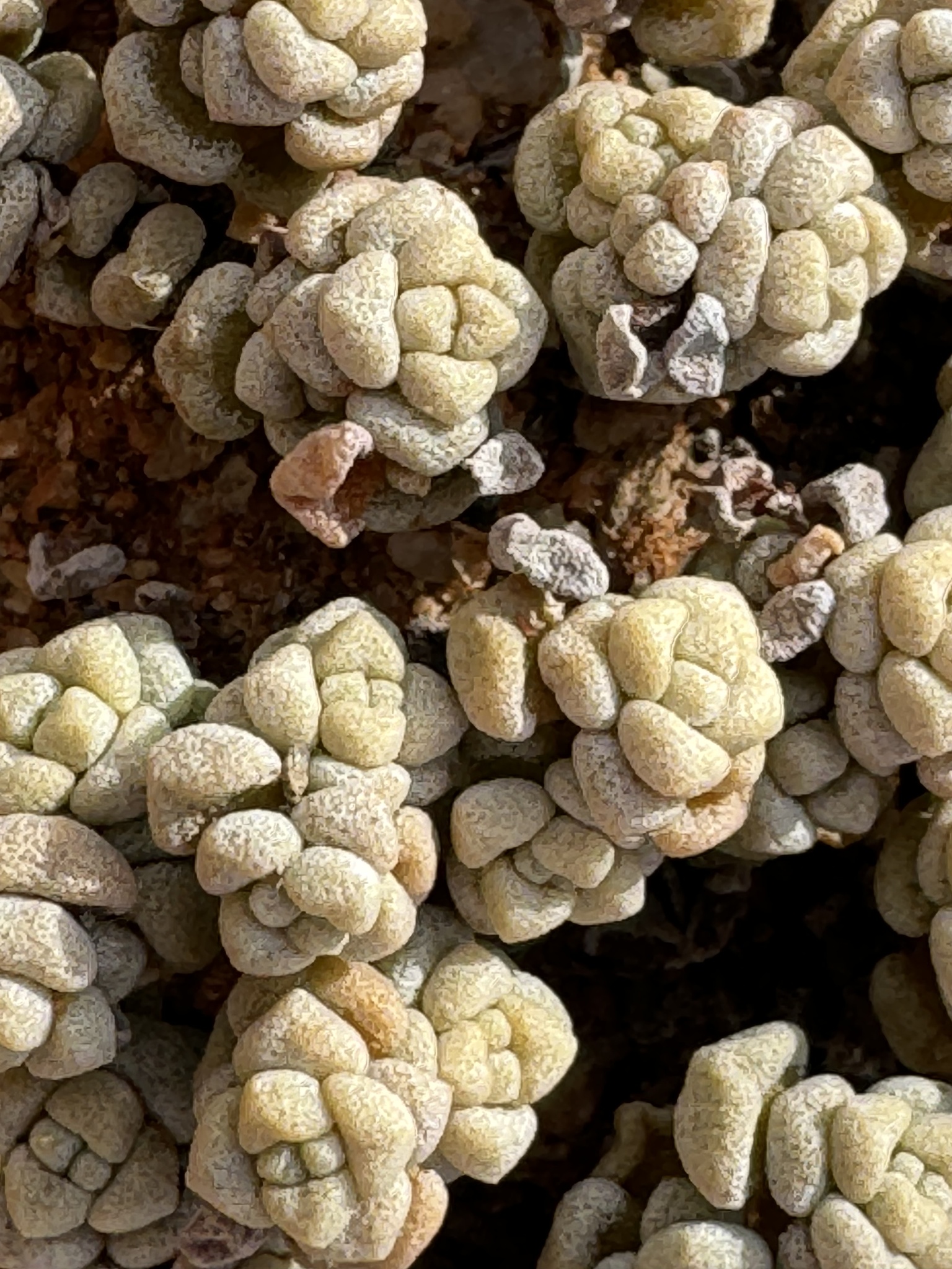
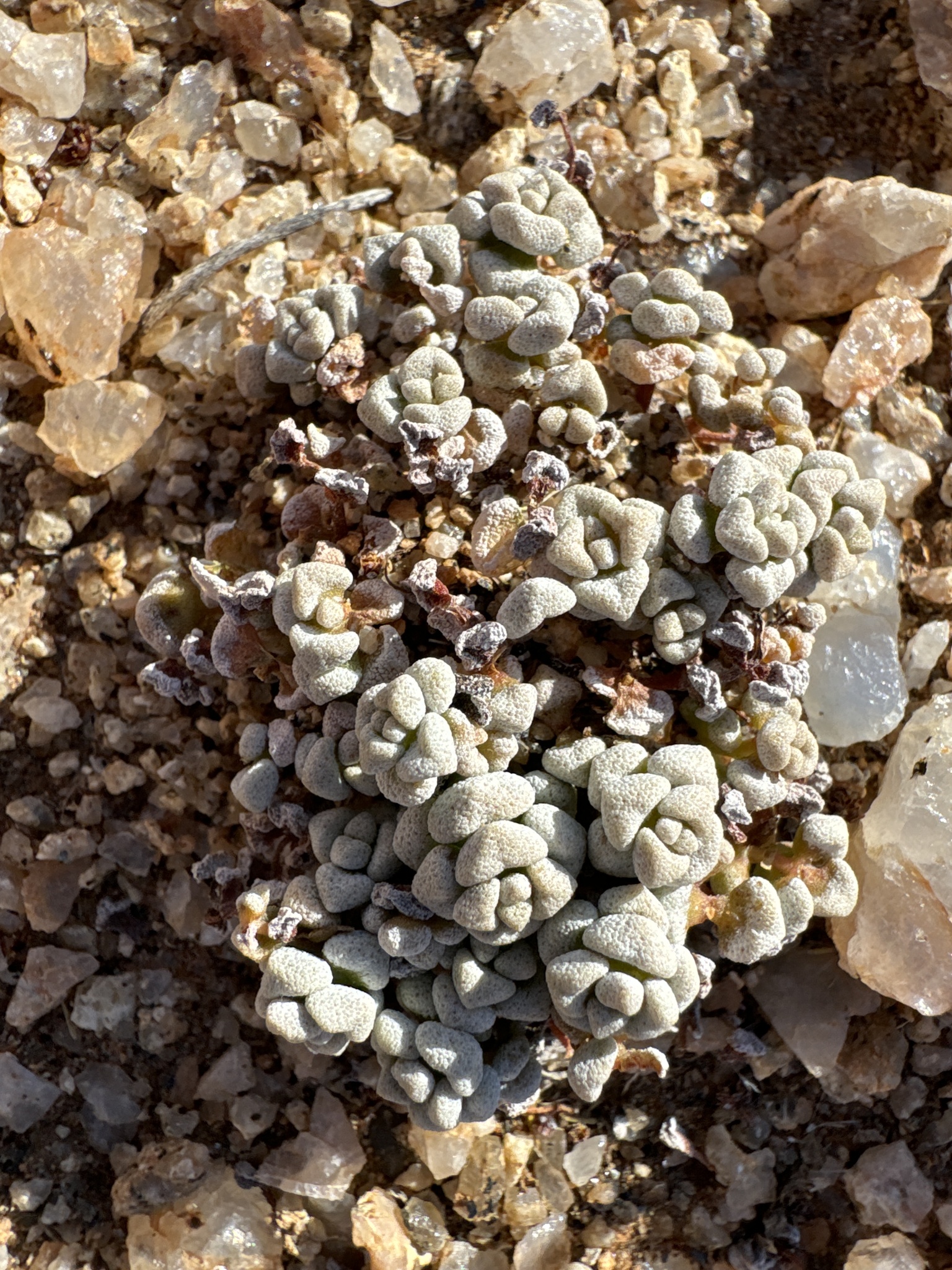
Plants with short erect, or longer decumbent or prostrate branches which are usually without adventitious roots, or if present then occurring only at a single node with tuberous main root 3-8(-12) mm in diameter. Leaves angular-obovate to almost obtriangular, 4-5 x (3.5-)4-5 mm, usually with rounded apices, covered with a white waxy layer. Carpels with indistinct styles and broad upper part of ovary recurved at apex and with sessile lateral stigmas. From: Toelken, HR. 1985. Crassulaceae. Fl. S. Africa 14: 1-229. [CC BY]
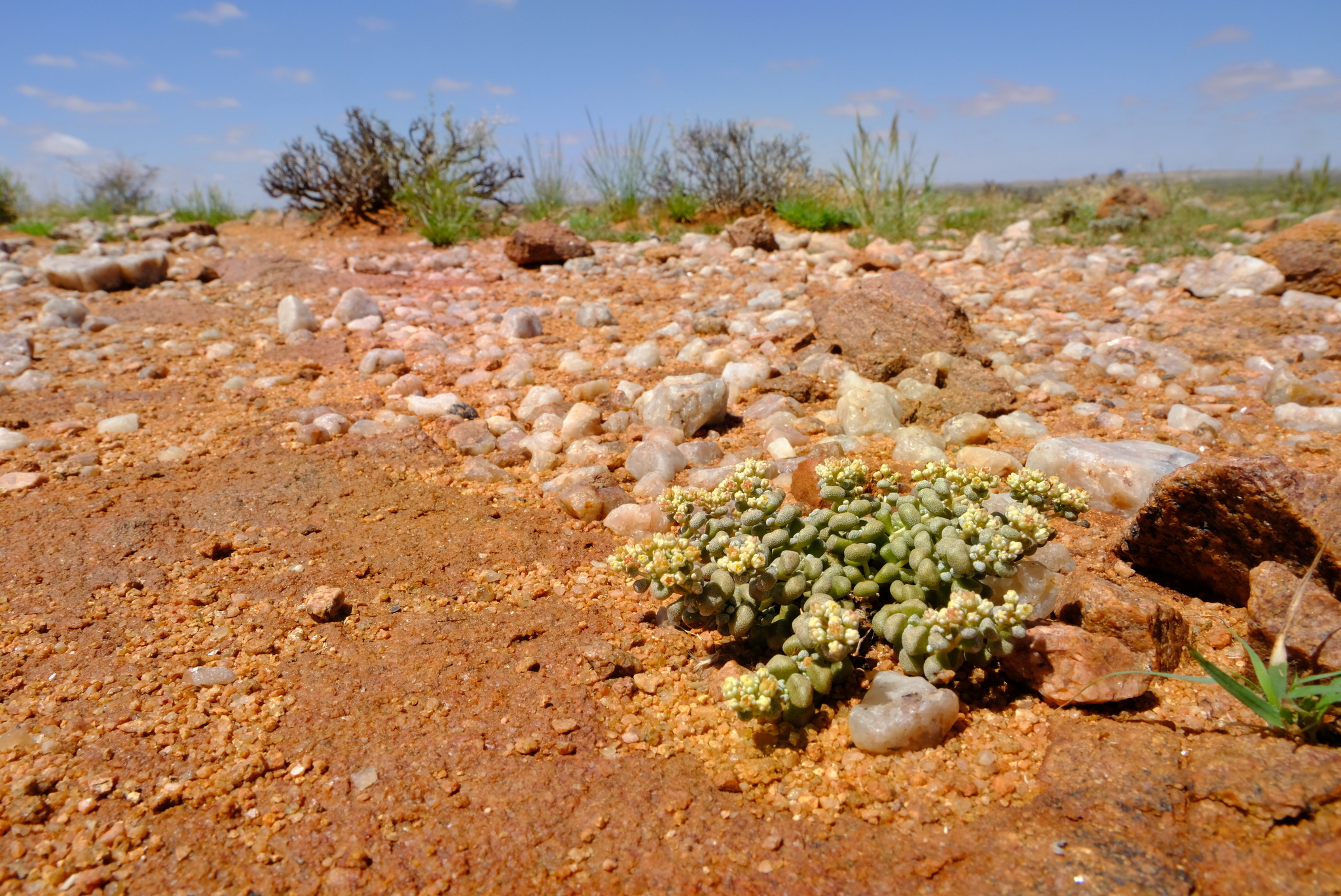
Growing usually on coarse sandy flats. From: Toelken, HR. 1985. Crassulaceae. Fl. S. Africa 14: 1-229. [CC BY]
Found in south-eastern South West Africa/Namibia mainly between Grunau and Warmbad as well as the adjoining parts of the Cape Province from Vioolsdrif to Kenhardt. From: Toelken, HR. 1985. Crassulaceae. Fl. S. Africa 14: 1-229. [CC BY]
October to January
400 to 1000 m
This map contains point-based occurrences at different locations
Occurrence in the Flora of Southern Africa (FSA) countries and South African provinces. Residence status indicates if a taxon is indigenous, endemic, naturalised or invasive in a specific region. This data is based on specimen records and literature
FSA
SA
BOT
NAM
ESW
LES
WC
EC
NC
FS
GA
KZN
LP
MP
NW
Absent
Indigenous
Endemic
Naturalised
Invasive
Names and Sources
Crassula corallina auct., sensu Higgins, H.Jacobsen, Friedrich
Classification
KINGDOM Plantae
SUBKINGDOM Phanerogamae
PHYLUM Anthophyta
ORDER Saxifragales
FAMILY Crassulaceae
SUBFAMILY Crassuloideae
GENUS Crassula
SPECIES corallina
SUBSPECIES macrorrhiza
27 results for Crassula corallina Thunb. subsp. macrorrhiza Toelken
Barcode: PRE0772452-0 Collector(s) & number: Nkoane, G, 293 | 2005-6-9
South Africa, Northern Cape, Pofadder, Boomrivier Farm.
Data Resource: BODATSA View record
Barcode: PRE0754362-0 Collector(s) & number: Burgoyne, PM, 10268 | 2005-11-27
South Africa, Northern Cape, Namaqualand District (112 km from Springbok). ± 19 km from Aggeneys on road to Pofadder.
General notes: Slope: none. Height ± 2-5 cm. Low caespitose clumps with long taproot.
Data Resource: BODATSA View record
Barcode: PRE0752142-0 Collector(s) & number: Bester, SP, 5963 | 2005-8-21
South Africa, Northern Cape, Pofadder; exiting Pofadder on the Bitterfontein road, turning of onto the Kenhardt road ca. 30 km further.
Data Resource: BODATSA View record
Barcode: PRE0767425-0 Collector(s) & number: Bester, SP, 5849 | 2005-8-13
South Africa, Northern Cape, Kakamas District. Farm: Droëgrond, ca. 35 km southwest from Kakamas.
General notes: Biome: Nama Karoo. Vegetation type: Orange River Nama Karoo. Tops of leaves white.
Data Resource: BODATSA View record
Barcode: PRE0842111-0 Collector(s) & number: Bester, SP, 6645 | 2006-3-9
South Africa, Northern Cape, Bushmanland. Farm Droëgrond, ca. 45 km southwest of Kakamas. At rocky patch close to dam near homestead.
Data Resource: BODATSA View record
Barcode: PRE0842095-0 Collector(s) & number: Bester, SP, 6628 | 2006-3-9
South Africa, Northern Cape, Bushmanland. Farm Droëgrond, ca. 45 km southwest of Kakamas.
Data Resource: BODATSA View record
Barcode: PRE0720308-0 Collector(s) & number: Perold, SM, 1589 | 1987-9-25
South Africa, Northern Cape, ON RD. BETWEEN PLATBAKKIES AND KLIPRAND. 1 KM AFTER TURN-OFF TO FRUMMELBAKKIES.
Data Resource: BODATSA View record
Barcode: PRE0756288-0 Collector(s) & number: Jordaan, M, 3994 | 2003-3-11
South Africa, Northern Cape, ± 4 km N from Pofadder to Onseepkans.
General notes: Gentle slope.
Data Resource: BODATSA View record
Barcode: PRE0392288-0 Collector(s) & number: Dinter, MK, 4773 | 1923-9-29
Namibia, KLEIN KARAS.
Data Resource: BODATSA View record
Barcode: PRE0392290-0 Collector(s) & number: Dinter, MK, PRE 53661 | 1923-10-
Namibia, KLEIN KARAS
Data Resource: BODATSA View record
Barcode: PRE0392292-0 Collector(s) & number: Acocks, JPH, 16507 | 1952-9-29
South Africa, Northern Cape, KENHARDT DIV.; 2 MI. W. OF TOWN
Data Resource: BODATSA View record
Barcode: PRE0770397-0 Collector(s) & number: Burgoyne, PM, 11092(c) | 2007-12-3
South Africa, Northern Cape, Namaqualand District. Richtersveld; ± 5 km W of Helskloof on road to Eksteenfontein.
Data Resource: BODATSA View record
Barcode: PRE0768537-0 Collector(s) & number: Burgoyne, PM, 10993 | 2007-11-30
South Africa, Northern Cape, Pofadder; ± 9.6 km E of Pofadder.
General notes: Acocks' Orange River Broken Veld. White quartzite. Slope: gentle. Common in spots. Height: ± 2-4 cm. Loose clumps with thickened rootstock leaves with white-frosted appearance.
Data Resource: BODATSA View record
Barcode: PRE0587487-0 Collector(s) & number: Burgoyne, PM, 7236 | 1999-6-23
South Africa, Northern Cape, Kenhardt District. Onseepkans ±1 km South of Onseepkans.
General notes: Rocky sparse scrubland. Gentle slope. Caespitose with blue/green leaves with crustos white margins. Common in spots. Voucher: Photo.
Data Resource: BODATSA View record
Barcode: PRE0680013-0 Collector(s) & number: Shearing, DAMB, 875 | 1985-1-3
South Africa, Western Cape, BEAUFORT WEST DIST.; KAROO NAT. PARK.; MOUNTAIN VIEW. TOP OF MOUNTAIN.
Data Resource: BODATSA View record
Barcode: PRE0856688-0 Collector(s) & number: Burgoyne, PM, 11736 | 2009-9-28
South Africa, Northern Cape, Springbok District. ± 5 km on Kaip road (E of Springbok). Farm Kongnas.
General notes: Rocky ridge. Granite boulders. Grazed by sheep. Gentle slope. Plant height: ± 2-3 cm. Low rounded clumps with leaves frosted at margins.
Data Resource: BODATSA View record
Barcode: PRE0754364-0 Collector(s) & number: Burgoyne, PM, 10277(b) | 2005-11-27
South Africa, Northern Cape, Namaqualand District. ± 12 km from Goodhouse on road to Pella.
General notes: (Acocks) Orange River Broken Veld. Big boulders. Slope: moderate. Height ± 2-3 cm. Low caespitose clumps with leaves tinged white at tips. Flowers pale yellow.
Data Resource: BODATSA View record
This map contains point-based occurrences at different locations
1985
No results found for Crassula corallina Thunb. subsp. macrorrhiza Toelken
Status and criteria
NE
Assessor(s)
Plantae Coordinator
| Part(s) of plant used | Use(s) | Reference |
|---|
Coming soon...
