PLANTAE / PHANEROGAMAE / ANTHOPHYTA / SAXIFRAGALES / CRASSULACEAE / CRASSULOIDEAE / CRASSULA / TOMENTOSA / GLABRIFOLIA

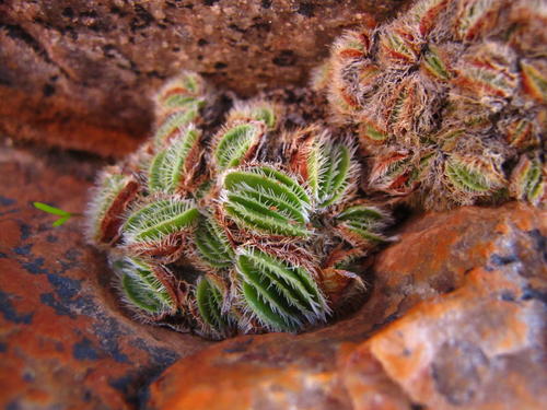
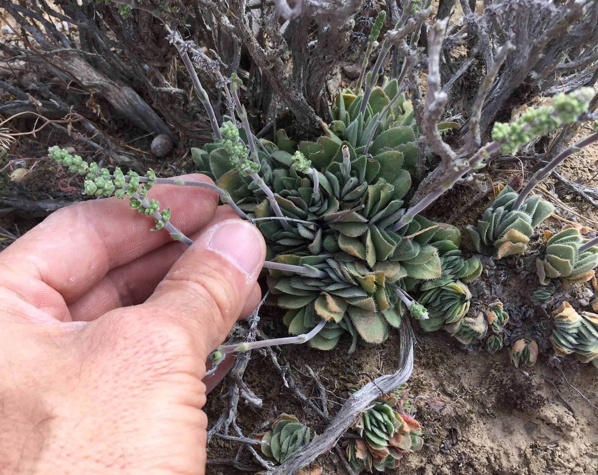
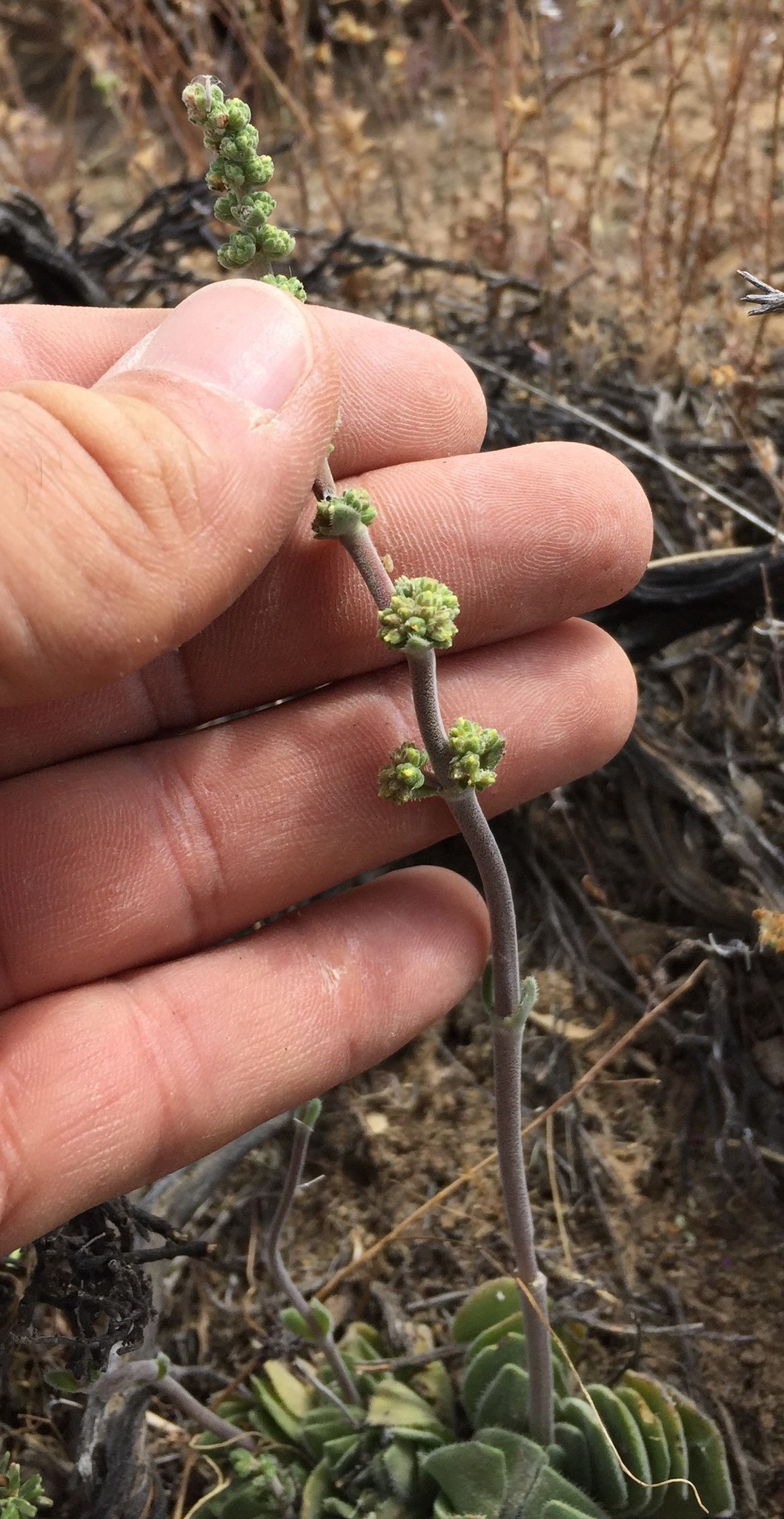
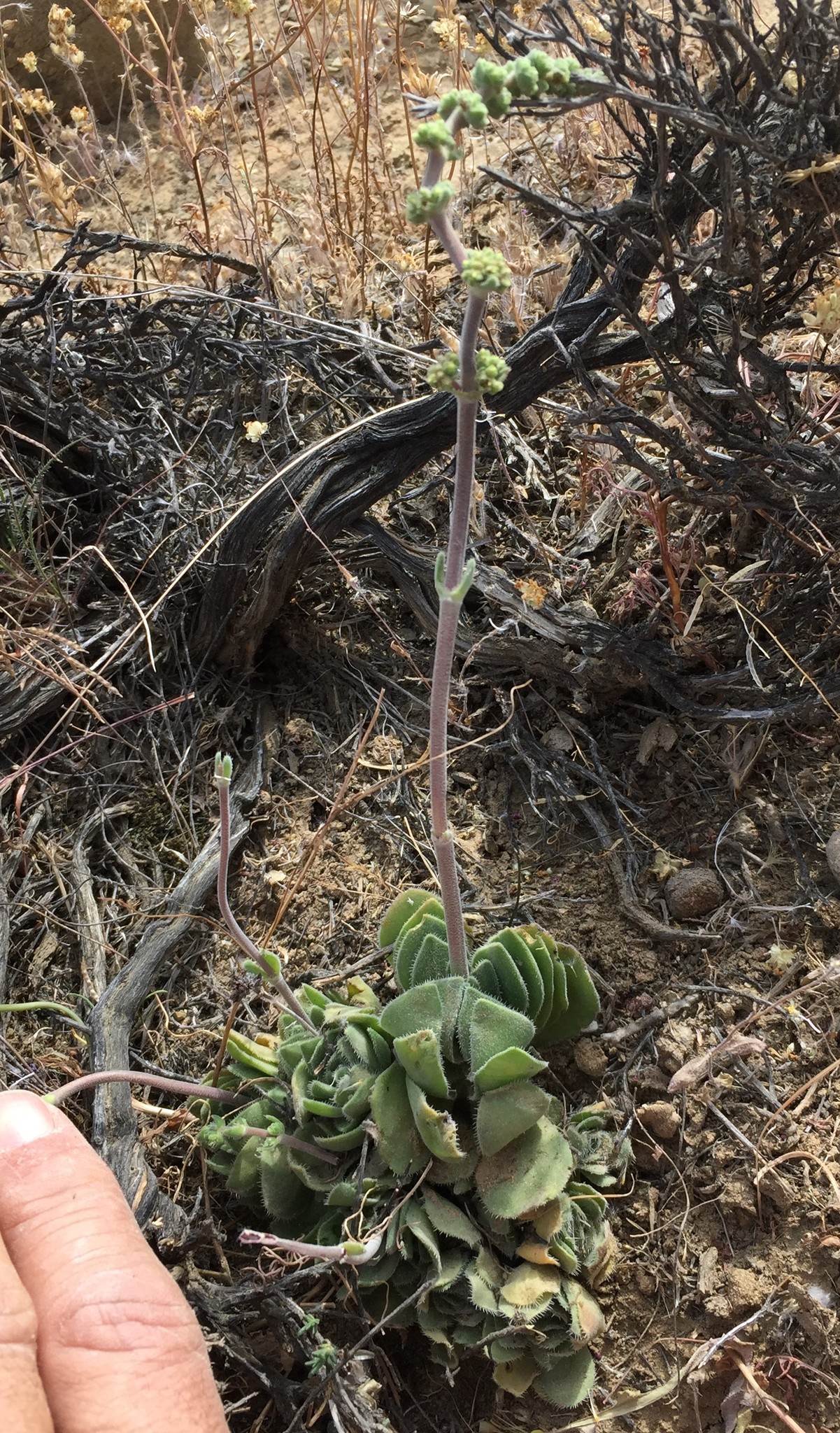
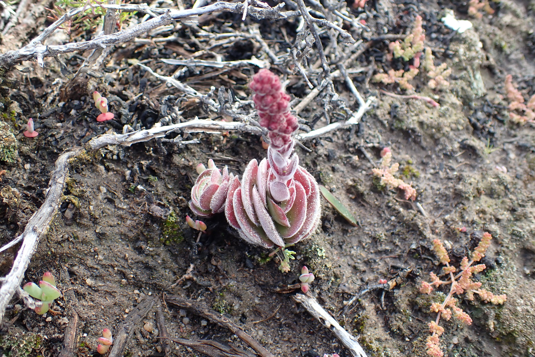
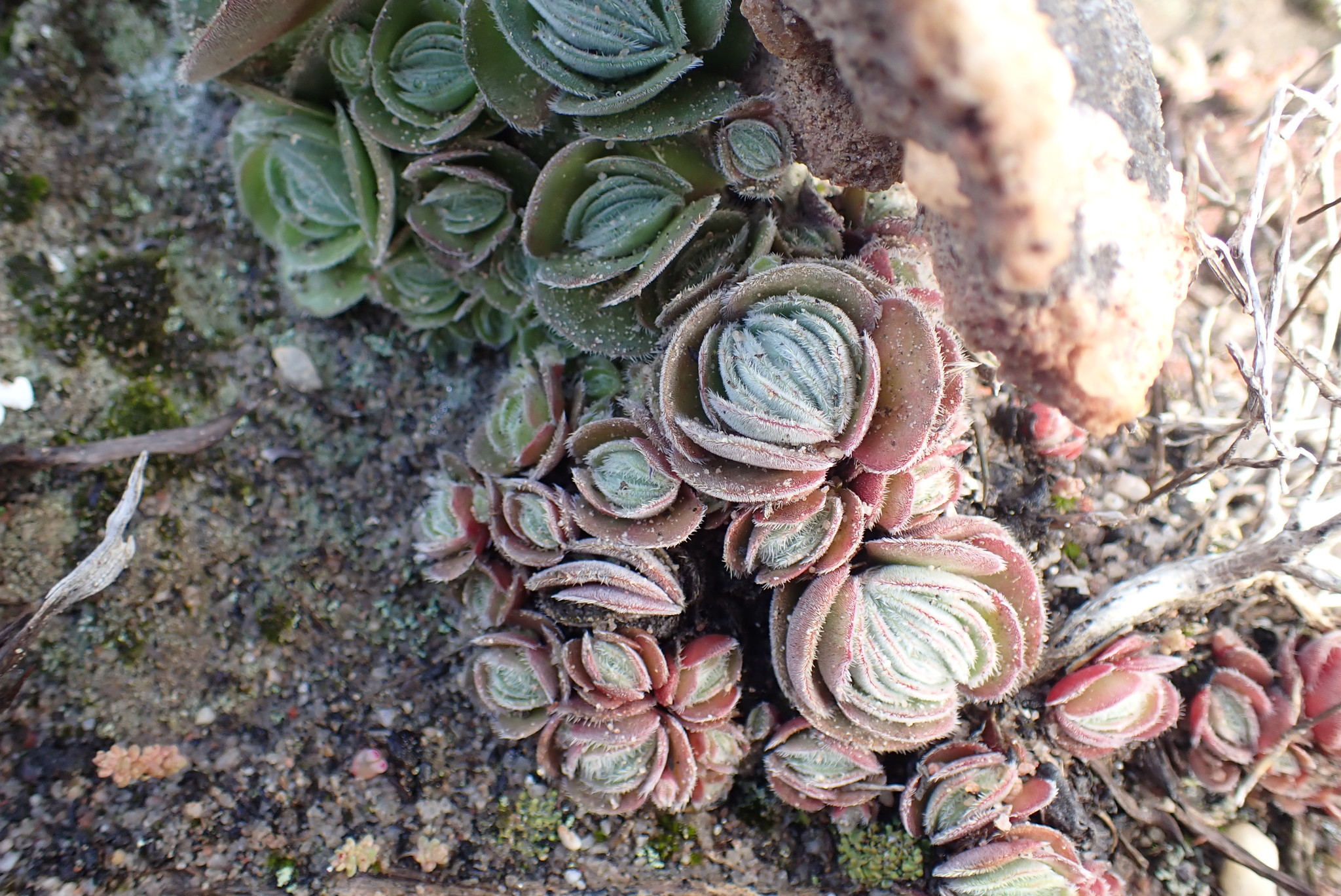
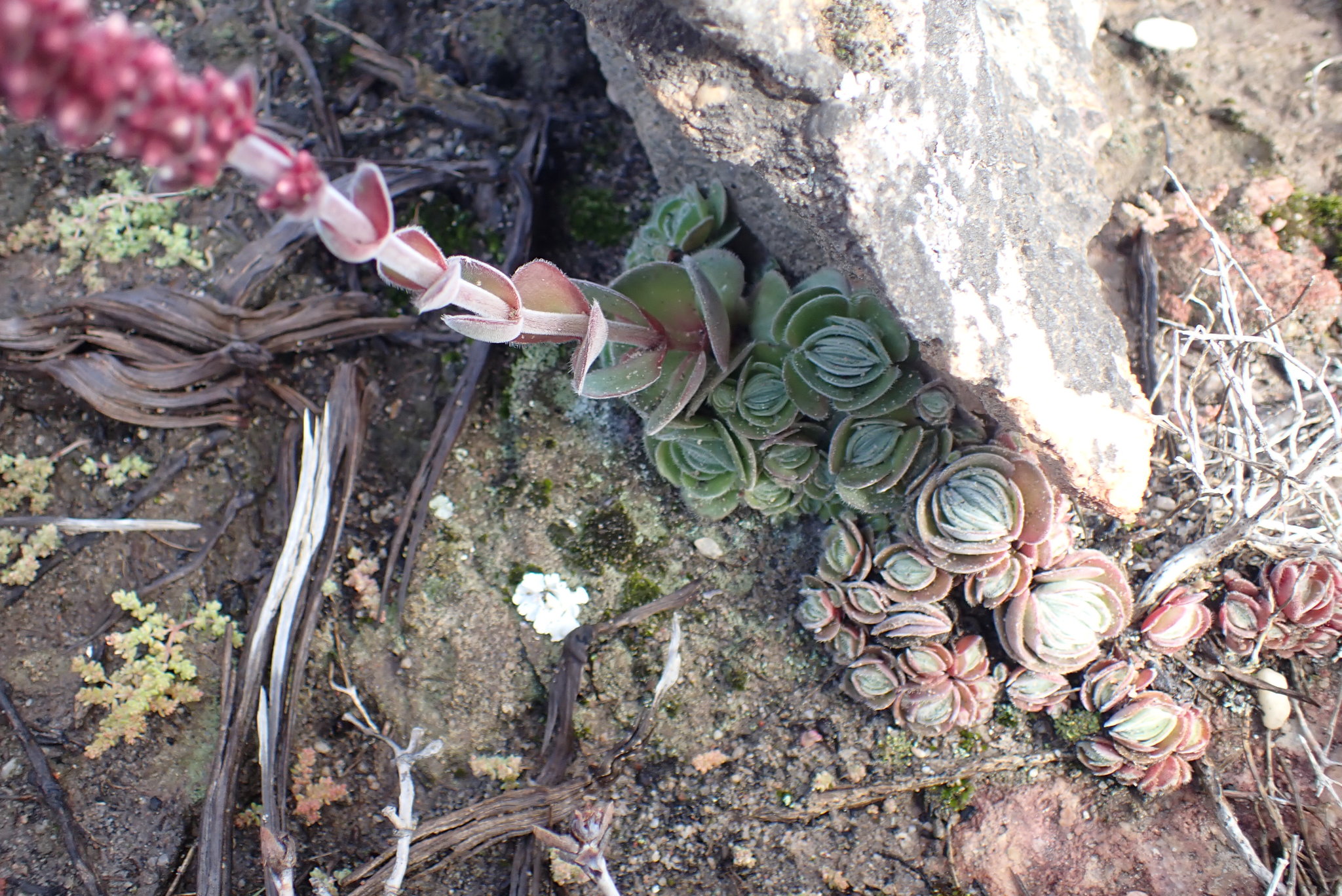
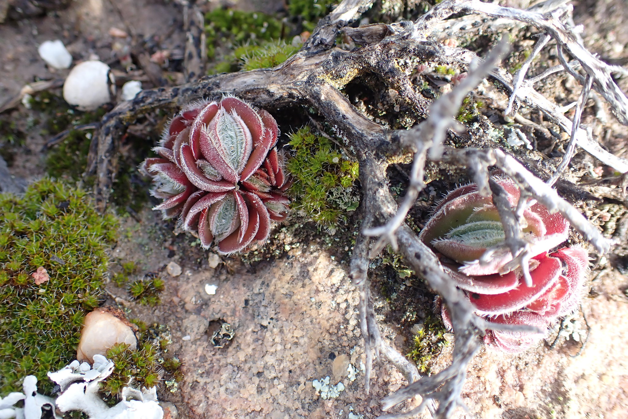
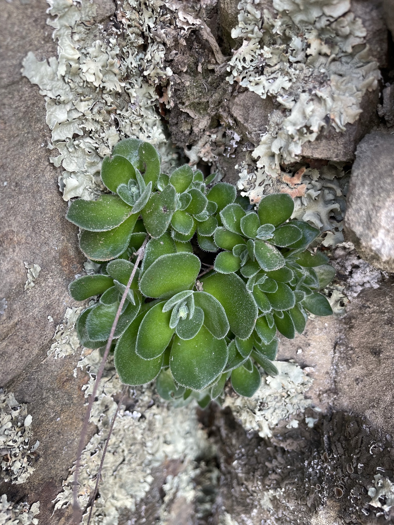
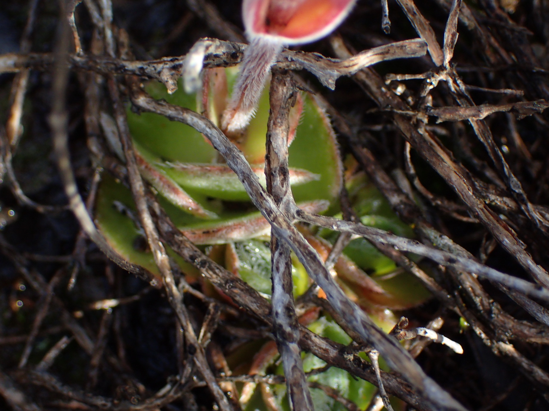
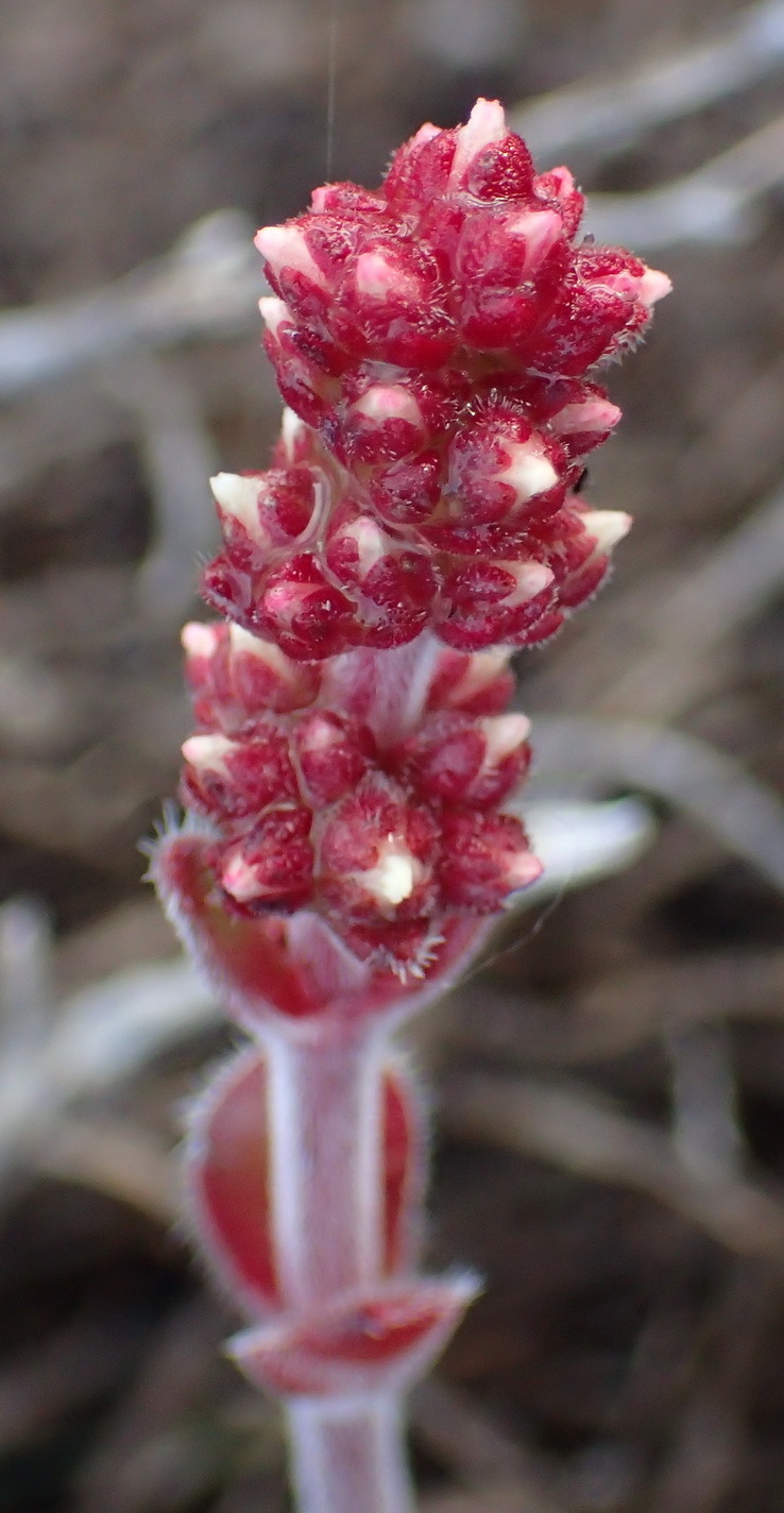
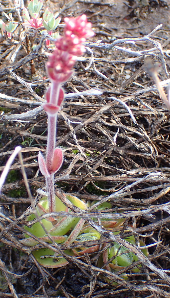
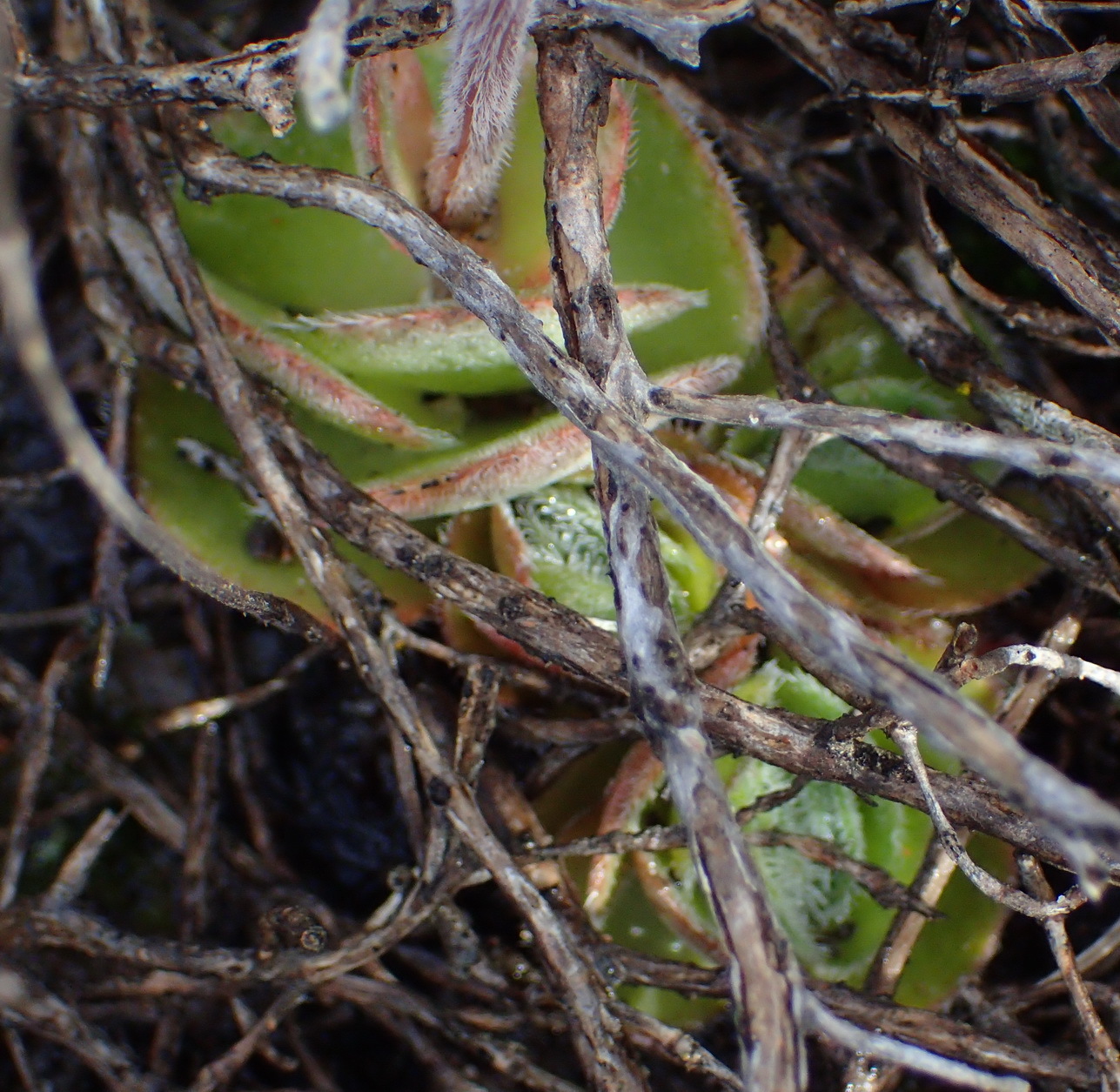
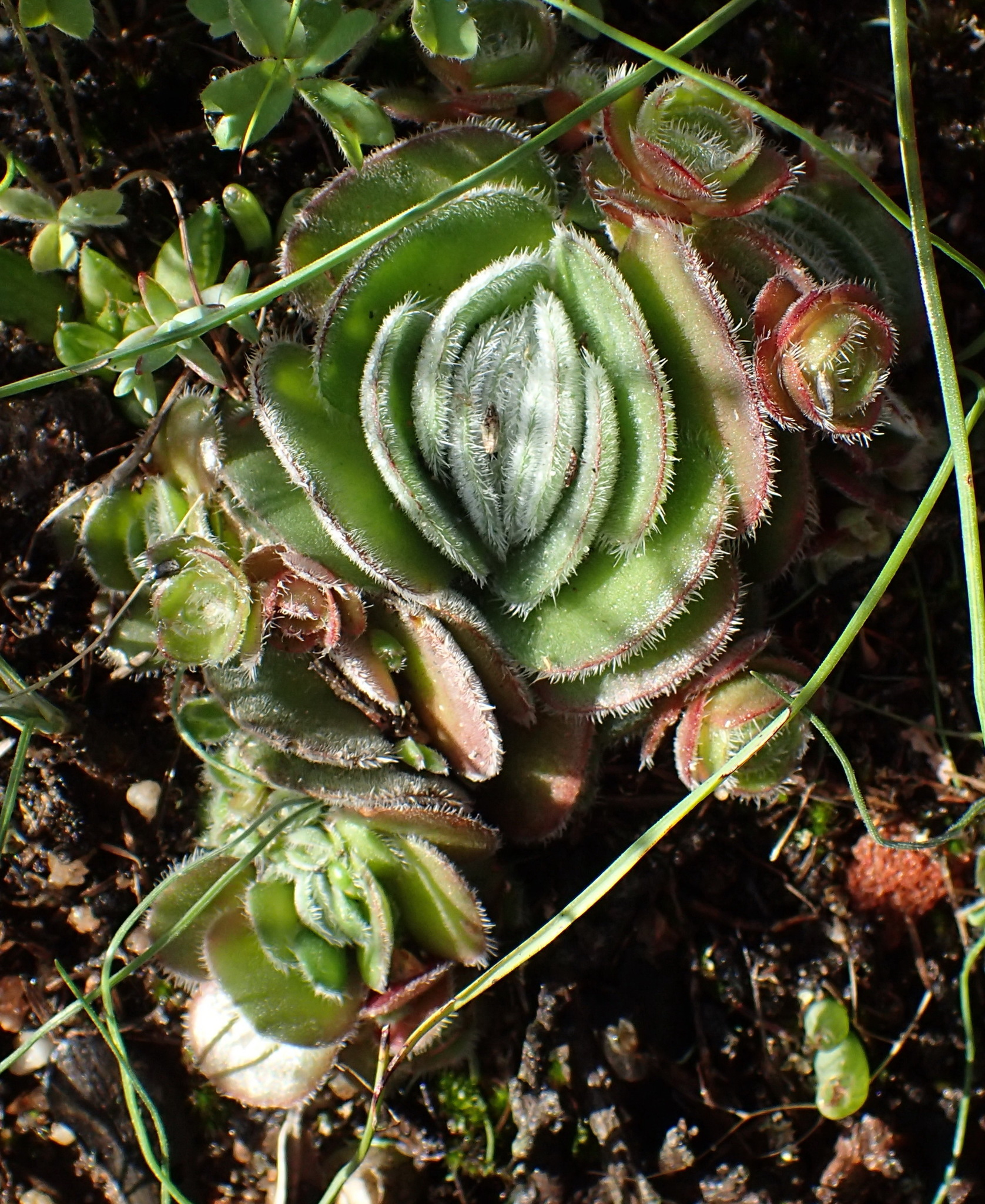
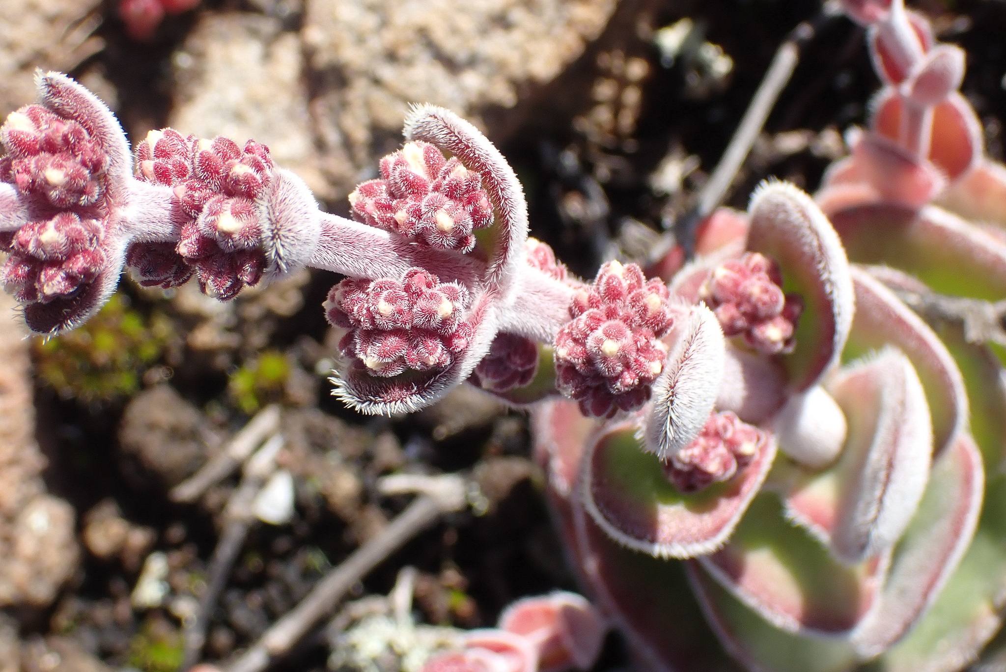
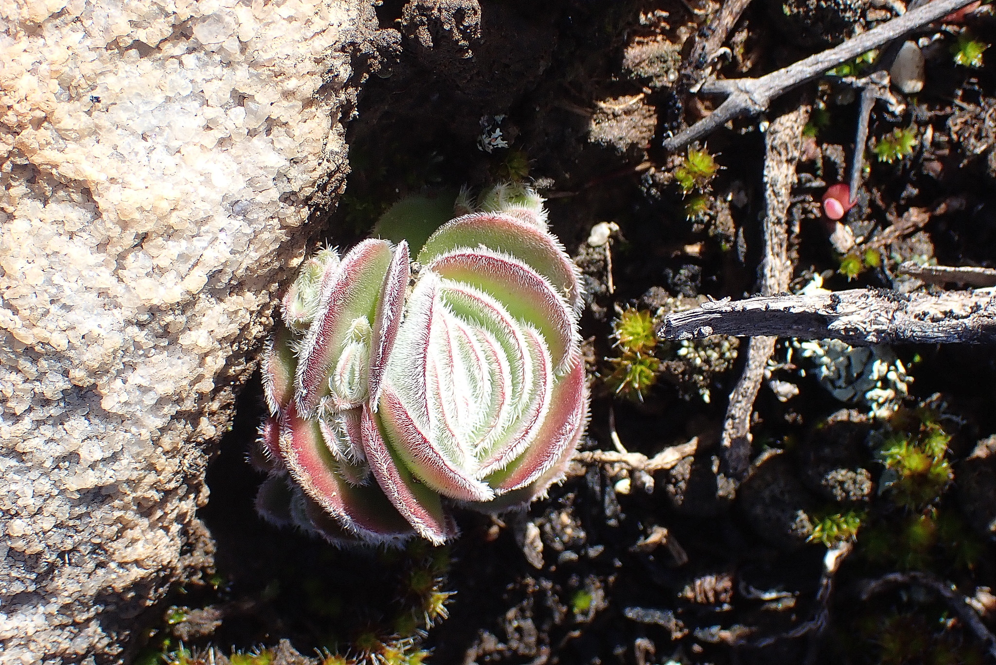
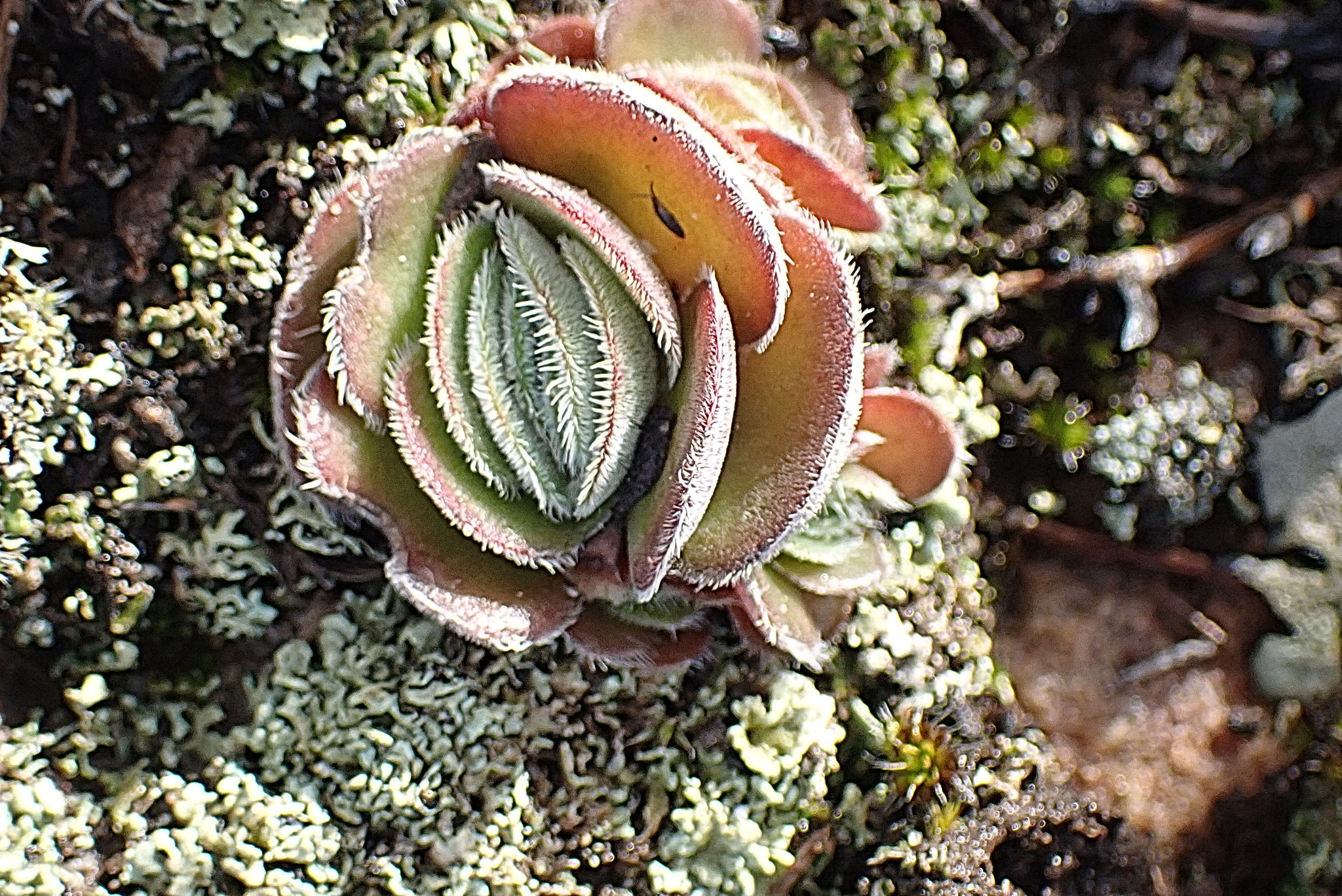
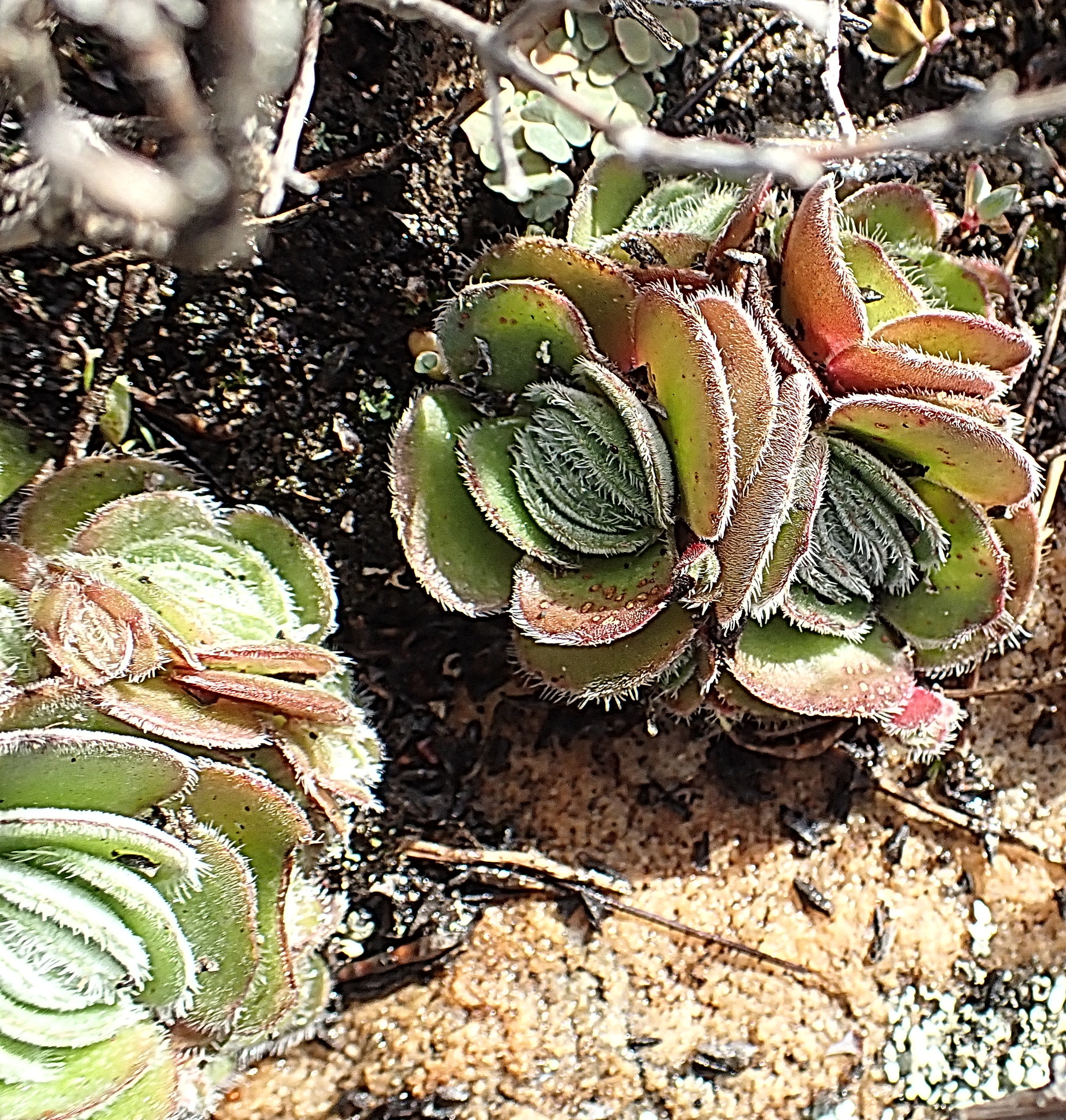
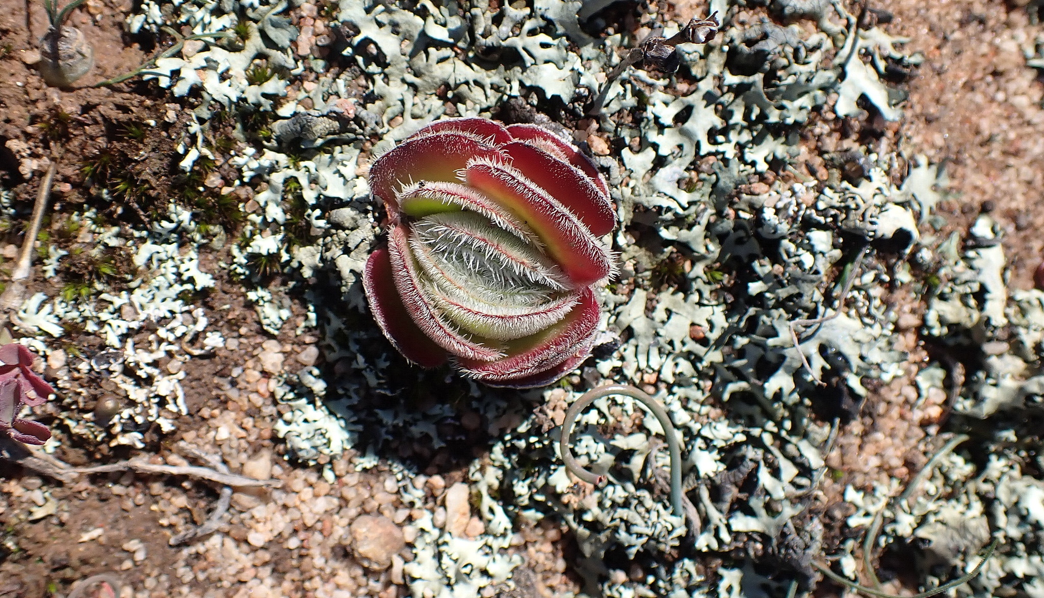
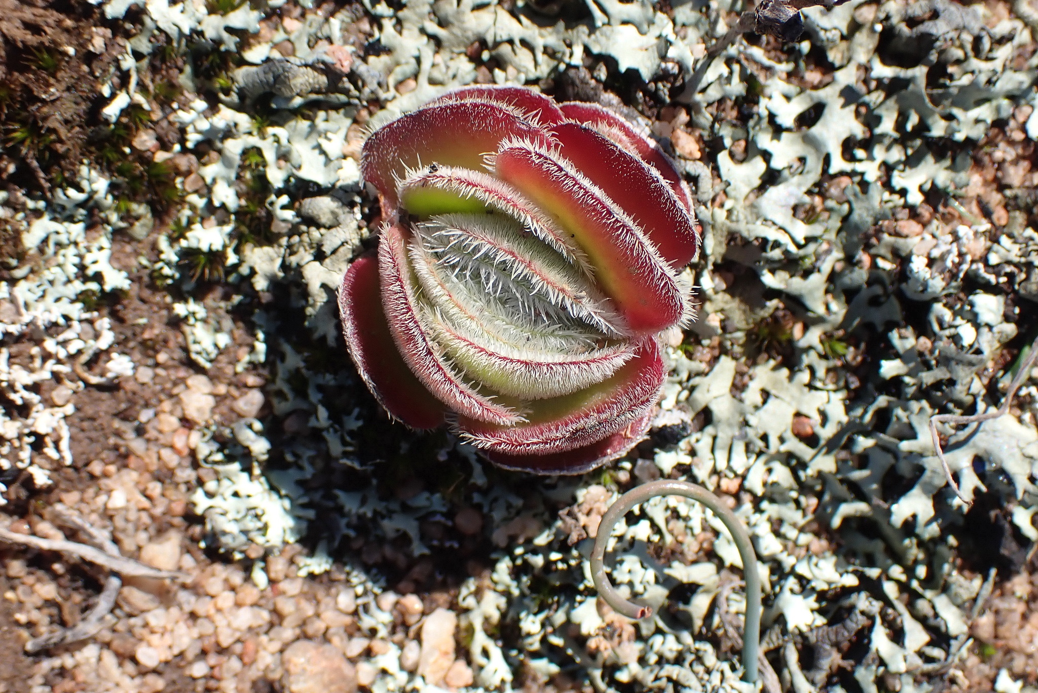
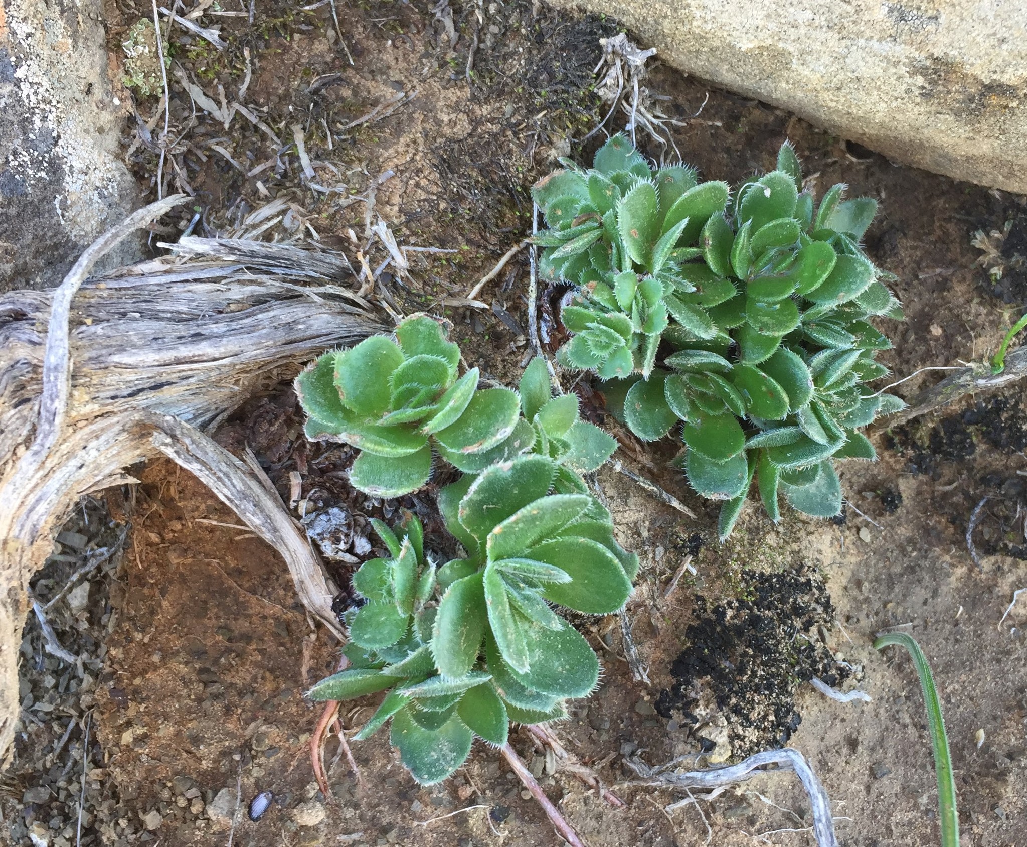
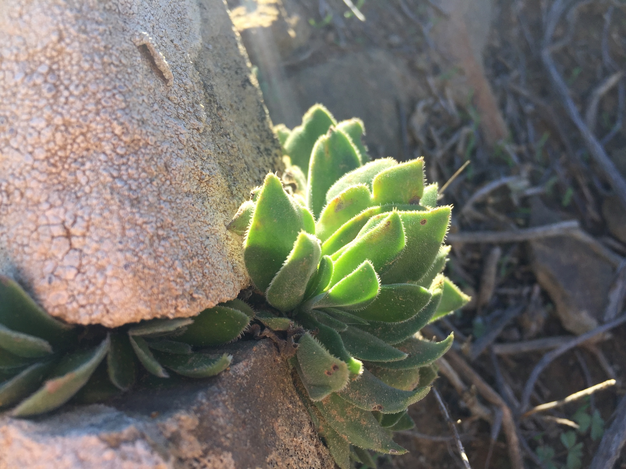
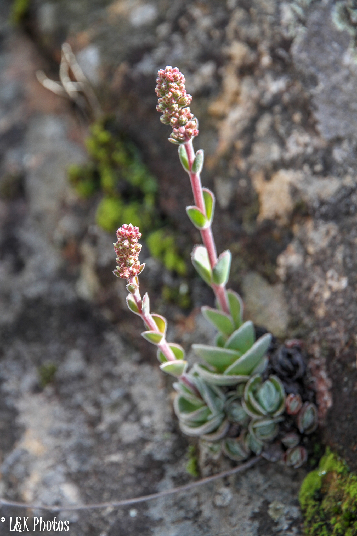
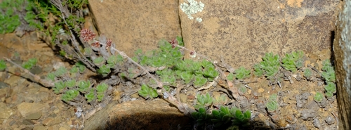
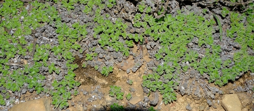
Plants 0.1-0.3 m high when flowering, usually with many rosettes with leaves apparently 2-ranked and tightly packed even when flowering, or leaves shorter than 15 mm. Leaves broadly obovate, 5-15(-25) x (5-)8-30 mm broad, usually truncate, densely hairy to glabrous and with cilia. Inflorescence not branched and lower clusters of dichasia rarely stalked, but often with several inflorescences from different rosettes of same plant. Squamae transversely oblong, square or oblong and usually somewhat constricted towards base. From: Toelken, HR. 1985. Crassulaceae. Fl. S. Africa 14: 1-229. [CC BY]
The habit and obovate leaves are very similar to those of C. barbata, but that species is distinguished by its glabrous stems and calyces. In addition, var. glabrifolia usually produces a whole cluster of rosettes which remain compact even when flowering, and the leaf-like bracts on the peduncle are abruptly shorter than the leaves below except in plants from the Ceres Karoo. In the western Richtersveld the leaves are larger and often completely glabrous, and although the plants are superficially similar to those of var. tomentosa, the transversely oblong squamae indicate that this is a form of var. glabrifolia.The squamae gradually become longer southwards so that they are about square in the vicinity of Vanrhynsdorp and become oblong further south. The leaves of the most southern representatives of this variety are rarely longer than 12 mm so that there is no difficulty in distinguishing them from the much more robust plants of var. tomentosa. From: Toelken, HR. 1985. Crassulaceae. Fl. S. Africa 14: 1-229. [CC BY]
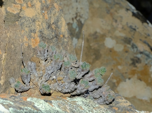
Growing usually in sheltered rock crevices or under overhanging rocks. From: Toelken, HR. 1985. Crassulaceae. Fl. S. Africa 14: 1-229. [CC BY]
Found in south-eastern South West Afri/Namibia and in the Cape Province all along the eastern slopes of the mountains bordering the Great Karoo and Tanqua Karoo from Bushmanland to near Laingsburg. From: Toelken, HR. 1985. Crassulaceae. Fl. S. Africa 14: 1-229. [CC BY]
October to December
400 to 1700 m
This map contains point-based occurrences at different locations
Occurrence in the Flora of Southern Africa (FSA) countries and South African provinces. Residence status indicates if a taxon is indigenous, endemic, naturalised or invasive in a specific region. This data is based on specimen records and literature
FSA
SA
BOT
NAM
ESW
LES
WC
EC
NC
FS
GA
KZN
LP
MP
NW
Absent
Indigenous
Endemic
Naturalised
Invasive
Names and Sources
Crassula eendoornensis Dinter
Crassula glabrifolia Harv.
Crassula interrupta Drege ex Harv.
Crassula interrupta Drege ex Harv. var. glabrifolia (Harv.) Schonland
Crassula scalaris Schonland & Baker f.
Crassula tomentosa auct., sensu Britten & Baker f.
Crassula tomentosa Thunb. var. interrupta (Drege ex Harv.) Toelken
Classification
KINGDOM Plantae
SUBKINGDOM Phanerogamae
PHYLUM Anthophyta
ORDER Saxifragales
FAMILY Crassulaceae
SUBFAMILY Crassuloideae
GENUS Crassula
SPECIES tomentosa
VARIETY glabrifolia
40 results for Crassula tomentosa Thunb. var. glabrifolia (Harv.) G.D.Rowley
Year
Barcode: PRE0862640-0 Collector(s) & number: Steyn, HM, 2035 | 2013-9-13
South Africa, Northern Cape, Sutherland District. Tankwa Karoo National Park, Gannaga Pass.
Data Resource: BODATSA View record
Barcode: NBG0212158-0 Collector(s) & number: Helme, NA, 5311 | 2006-4-10
South Africa, Western Cape, Bokkeveld Escarpment, Engel se Punt, about 12 km N of Vanrhynspas.
Data Resource: BODATSA View record
Barcode: PRE0593627-0 Collector(s) & number: Mort, ME, 05-169 | 2005-3-23
South Africa, Northern Cape, Dirt road from Springbok to Droedap, at the base of the ridge, just north of some sort quarry.
Data Resource: BODATSA View record
Barcode: PRE0424094-0 Collector(s) & number: Acocks, JPH, 17153 | 1953-9-20
South Africa, Western Cape, LAINGSBURG; MATJIESFONTEIN; 3 MI. N. OF MATJIESFONTEIN
Data Resource: BODATSA View record
Barcode: PRE0757454-0 Collector(s) & number: Bester, SP, 6961 | 2006-7-30
South Africa, Northern Cape, Namaqua National Park. Proposed westcoast section. Northwestern corner of Strandfontein farm.
Data Resource: BODATSA View record
Barcode: PRE0424095-0 Collector(s) & number: Munro, HK, PRE 55066 | 1953-10-1
South Africa, Northern Cape, RICHTERSVELD
Data Resource: BODATSA View record
Barcode: PRE0424097-0 Collector(s) & number: Marloth, HWR, 12535 | 1925-10-3
South Africa, Western Cape, CERES DIST.; PAARDEKOP; NR. SPES BONA DWYKA ROCKS
Data Resource: BODATSA View record
Barcode: PRE0752060-0 Collector(s) & number: Bester, SP, 5877 | 2005-8-16
South Africa, Northern Cape, Namaqua National Park. On road towards Soebatsfontein ca. 30 km from Offices at Main Entrance.
General notes: Biome: Succulent Karoo. Vegetation Type: Lowland Succulent Karoo. Leaves basal, reddish below and very hairy.
Data Resource: BODATSA View record
Barcode: PRE0860329-0 Collector(s) & number: Van Jaarsveld, EJ, 9502 | 1987-11-11
South Africa, Northern Cape, Boesmanland. Naip se Berg.
General notes: In rock crevices. Tufted succulent herb. 620/88 Kirstenbosch Succulent Collection. Conf. Burgoyne, P.M.
Data Resource: BODATSA View record
Barcode: PRE0587419-0 Collector(s) & number: Burgoyne, PM, 9294B | 2002-9-10
South Africa, Western Cape, Ceres District: Cederberg. Blinkberg footslopes.
General notes: Moderate slope. Upright inflorescence borne above basal rosette of leaves. Plant height: 20 - 25cm including infloresence. Fruit absent.
Data Resource: BODATSA View record
Barcode: PRE0757467-0 Collector(s) & number: Bester, SP, 7002 | 2006-7-31
South Africa, Northern Cape, Proposed Westcoast section of Namaqua National Park. Koringkorrelbaai (campsite 3).
General notes: Biome: Succulent Karoo. Vegetation type: Strandveld Succulent Karoo. Immature flowerbuds white-pinkish.
Data Resource: BODATSA View record
Barcode: PRE0848565-0 Collector(s) & number: Jaca, T, 100 | 2009-8-19
South Africa, Northern Cape, Hondeklipbaai.
General notes: Namaqualand Coastal Duneveld. No slope.
Data Resource: BODATSA View record
Barcode: PRE0515540-0 Collector(s) & number: Rosch, MW, 1472 | 1976-9-
South Africa, Northern Cape, NAMAQUALAND; SPRINGBOK; HESTER MALAN WILD FLOWER RES. PLOT 7190
Data Resource: BODATSA View record
Barcode: PRE0771490-0 Collector(s) & number: Bester, SP, 7856 | 2007-8-10
South Africa, Northern Cape, Namaqualand District. Between Koingnaas and Kleinzee.
General notes: Biome: Succulent Karoo. Vegetation type: Strandveld Succulent Karoo.
Data Resource: BODATSA View record
Barcode: PRE0736241-0 Collector(s) & number: Theron, GK, 3976 | 1988-11-16
South Africa, Northern Cape, BLAAUWKRANSPAS; TUSSEN CALVINIA EN CERES, TEEN KLIPPERIGE BERGHANG.
Data Resource: BODATSA View record
Barcode: PRE0591352-0 Collector(s) & number: Steyn, HM, 691 | 2004-9-1
South Africa, Northern Cape, Namaqualand District: Namaqua National Park. Riethuis farm
General notes: Lowland Succulent Karoo. Moderate slope. Height: including inflorescence.
Data Resource: BODATSA View record
Barcode: PRE0842168-0 Collector(s) & number: Bester, SP, 7042 | 2006-8-2
South Africa, Northern Cape, Farm: Sarisam, ca. 3 km southwest of the homestead.
General notes: Biome: Succulent Karoo. Vegetation type: Strandveld Succulent Karoo.
Data Resource: BODATSA View record
Barcode: NBG0183654-0 Collector(s) & number: Pretorius, WAJ, 648 | 2000-11-9
South Africa, Northern Cape, Nieuwoudtville. Oorlogskloof Nature Reserve. P19. Lat.: 31° 29' 32" S; Long.: 19° 6' 26" E.
General notes: Mountain. Poorly drained, brown clay. Gravel. Acocks Veld Type 28. Karoo vegetation. No disturbance. Aspect: S. Steep slope. Local common. Seasonality: unknown. Perennial, erect succulent. Flowers white. No fruit. Plant height: 0.15m.
Data Resource: BODATSA View record
Barcode: PRE0515469-0 Collector(s) & number: Rosch, MW, 1295 | 1975-10-7
South Africa, Northern Cape, NAMAQUALAND; SPRINGBOK; HESTER MALAN WILD FLOWER RES. PLOT 190
Data Resource: BODATSA View record
Barcode: PRE0586823-0 Collector(s) & number: Burgoyne, PM, 9360B | 2002-9-14
South Africa, Western Cape, Clanwilliam District: Matjiesrivier Nature Reserve. Sandleegte.
General notes: Quaternary deposits. Gentle slope. Height: including inflorescence. Basal rosette with inflorescence borne at centre.
Data Resource: BODATSA View record
Barcode: PRE0646623-0 Collector(s) & number: Oliver, EGH, 806 | 1977-9-8
South Africa, Northern Cape, RICHTERSVELD; LEKKERSING; KARUCHABPOORT 9 KM SOUTH OF LEKKERSING MAIN HILLS NORTH OF POORT
Data Resource: BODATSA View record
Barcode: PRE0563124-0 Collector(s) & number: Burgoyne, PM, 8429B | 2001-8-11
Namibia, South of Lüderitz - Diamond area No 1. Mountain slopes East of Aurus Peak.
General notes: Rare.
Data Resource: BODATSA View record
Barcode: PRE0750471-0 Collector(s) & number: Van Jaarsveld, EJ, 9442 | 1987-11-10
South Africa, Northern Cape, EENRIET; Upper S-facing slope
Data Resource: BODATSA View record
Barcode: PRE0650333-0 Collector(s) & number: Oliver, EGH, 33 | 1977-8-24
South Africa, Northern Cape, BUSHMANLAND; AGGENYS MOUNTAIN; WEST OF POFADDER. SOUTKLOOF AREA WSW OF AGGENYS FARM
Data Resource: BODATSA View record
Barcode: PRE0779122-0 Collector(s) & number: Van Jaarsveld, EJ, 10394 | 1989-5-18
South Africa, Western Cape, Kleinspreeufontein on Quartz flats
Data Resource: BODATSA View record
Barcode: PRE0458301-0 Collector(s) & number: Thompson, MF, 398 | 1967-8-26
South Africa, Cape Province, BITTERFONTEIN; 5.6 MI. FROM BITTERFONTEIN TO POFADDER- 1 MI. OFF ROAD IN KLOOF IN WHEATLANDS
Data Resource: BODATSA View record
Barcode: PRE0588175-0 Collector(s) & number: Burgoyne, PM, 9699 | 2003-9-2
South Africa, Western Cape, Ceres District: ± 24km on R356 from Sutherland to Ceres.
General notes: Gentle slope. Plant height; including inflorescence. Forming clumps with leaves tightly adpressed, cilia on margins.
Data Resource: BODATSA View record
Barcode: PRE0716701-0 Collector(s) & number: Hardy, DS, 5023 | 1978-10-
Namibia, LUDERITZ DIST.; AURUS MTS.; ROOIBERG ON GRANITE PNBG 24348
Data Resource: BODATSA View record
Barcode: PRE0563113-0 Collector(s) & number: Burgoyne, PM, 8365 | 2001-8-7
Namibia, South of Lüderitz - Diamond area No 1. SW of Auguchab River twixt Aurus and Klinghardt Mountains.
Data Resource: BODATSA View record
Barcode: NBG0120193-0 Collector(s) & number: Rossouw, GJ, 375 | 1979--
South Africa, Western Cape, CAPE. Worcester. Theronsberg Pass.
Data Resource: BODATSA View record
This map contains point-based occurrences at different locations
1985
No results found for Crassula tomentosa Thunb. var. glabrifolia (Harv.) G.D.Rowley
Status and criteria
NE
Assessor(s)
Plantae Coordinator
| Part(s) of plant used | Use(s) | Reference |
|---|
Coming soon...
