
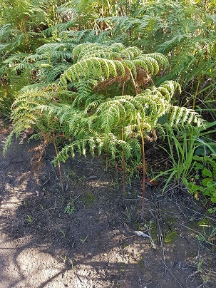
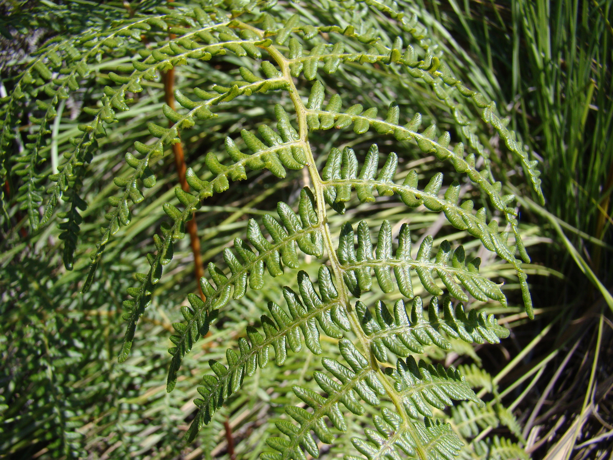
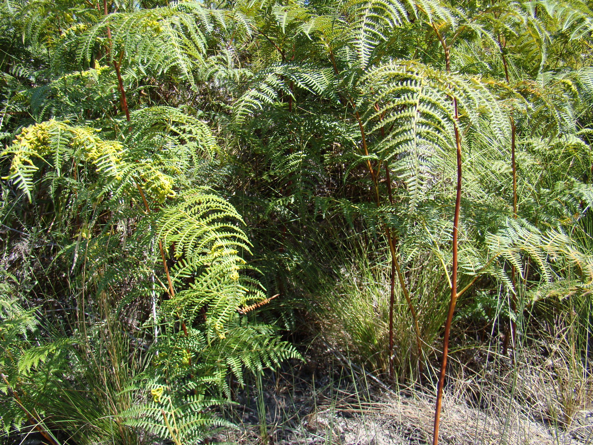
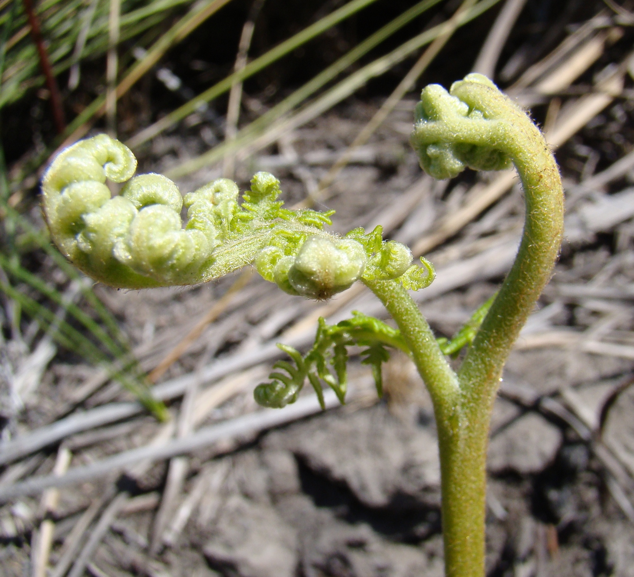
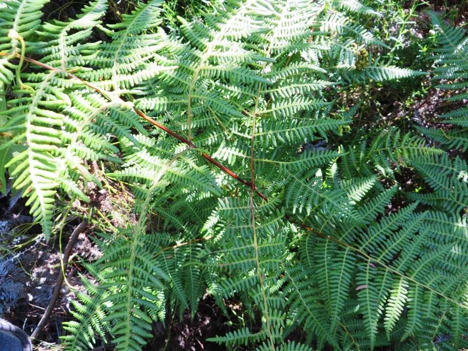
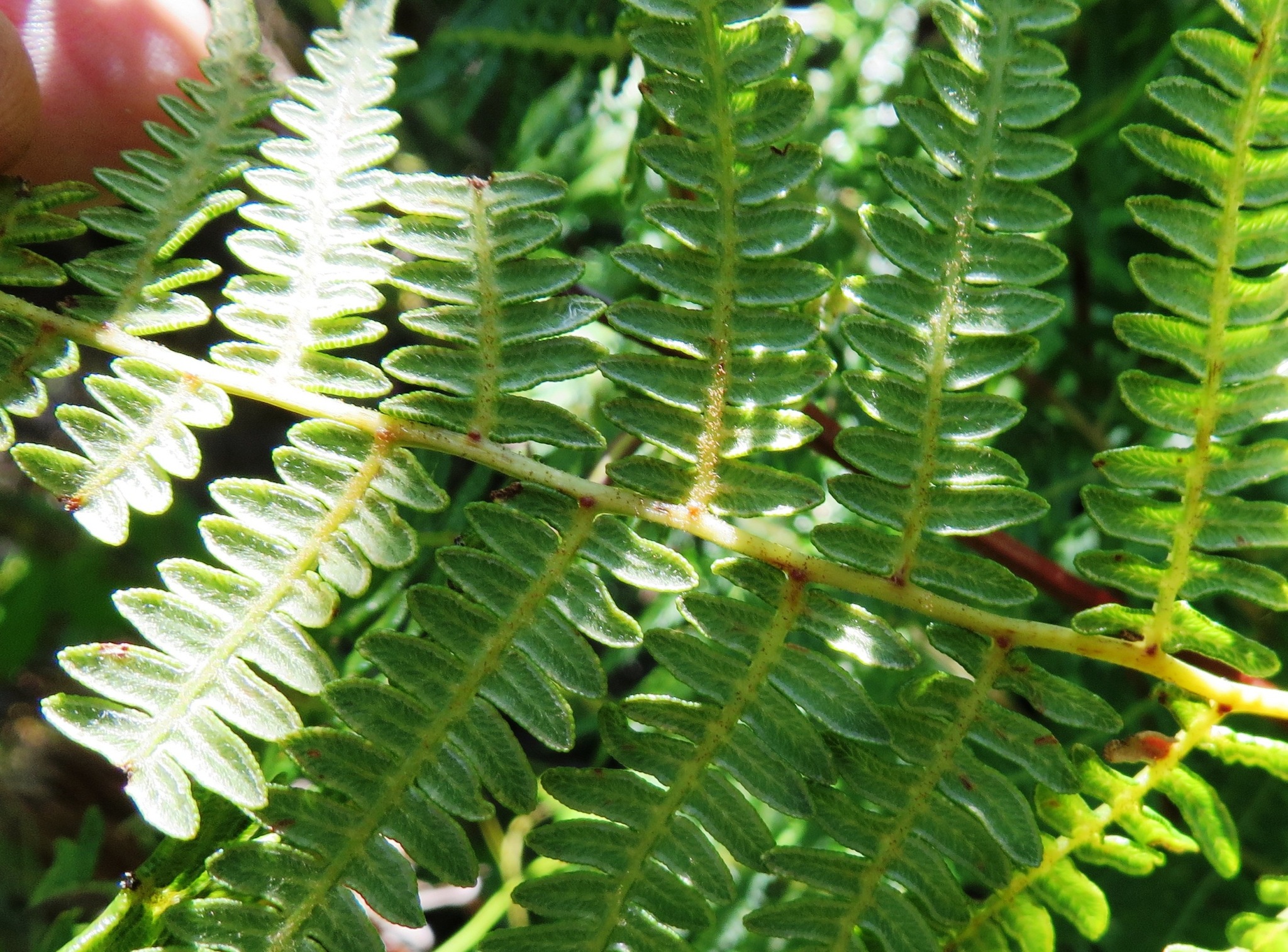
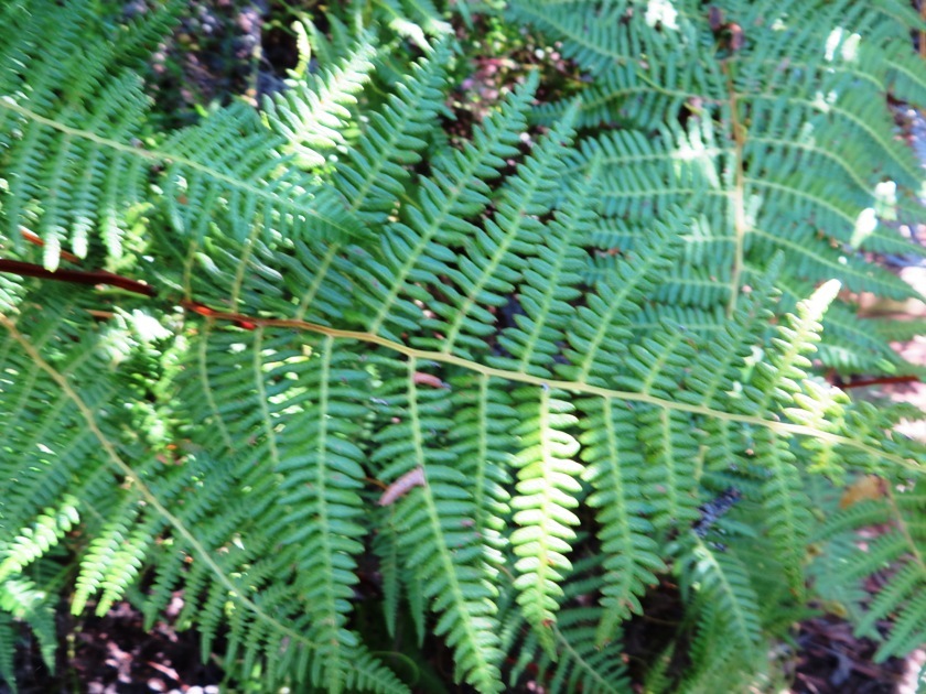
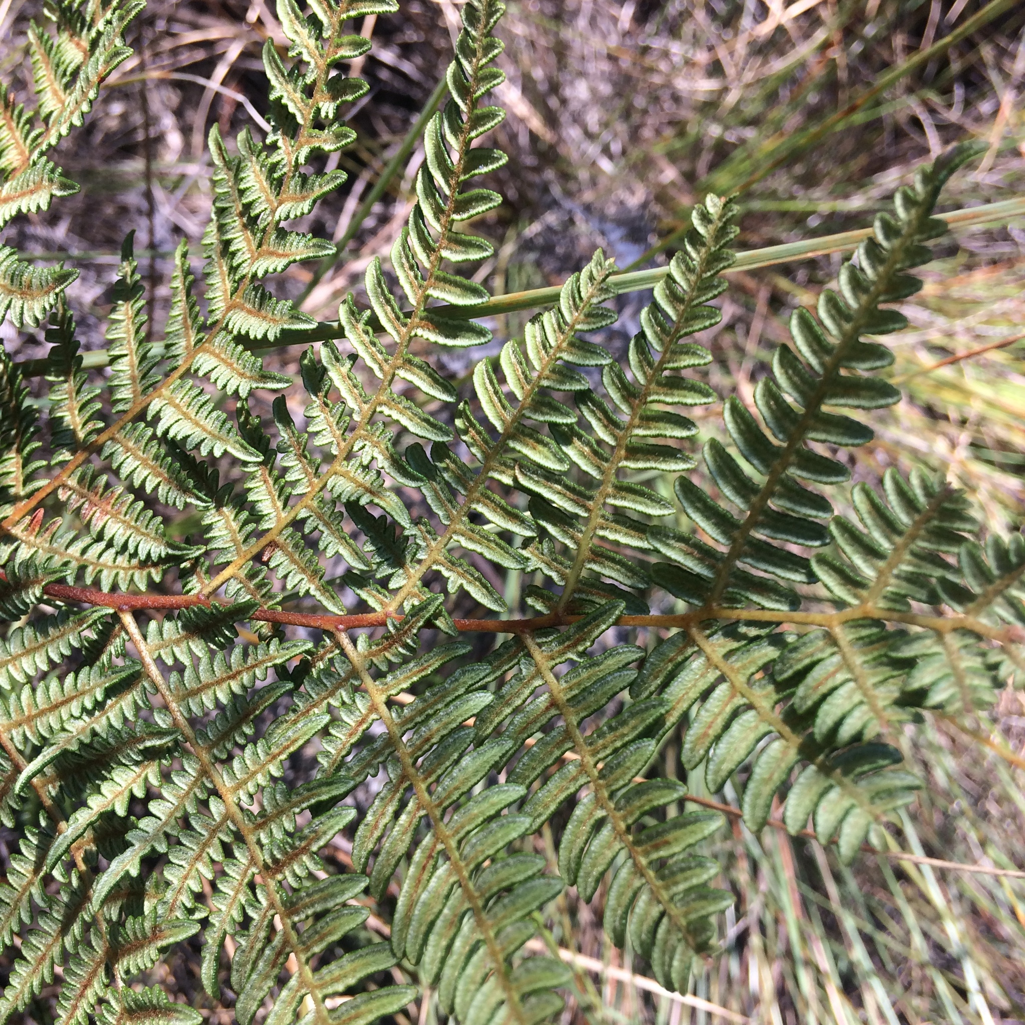
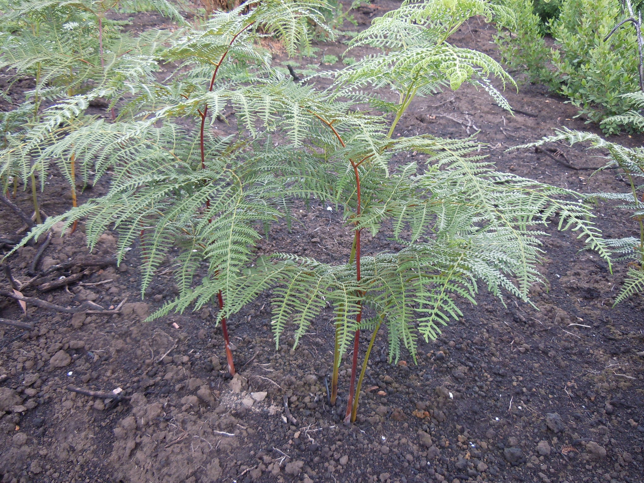
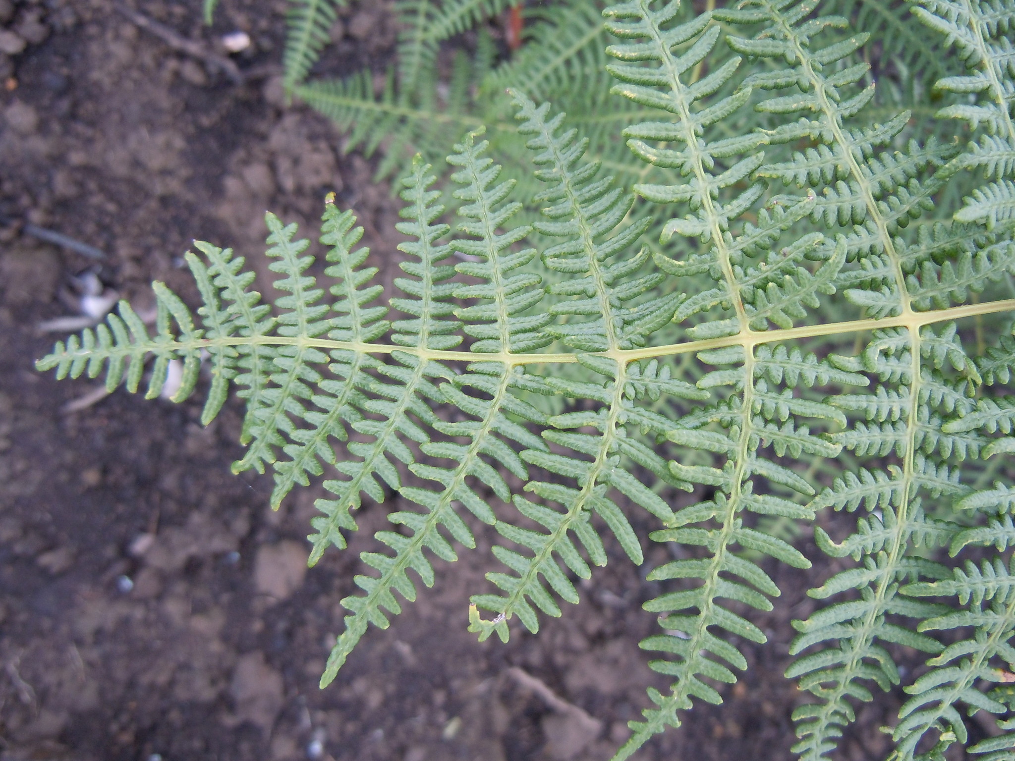
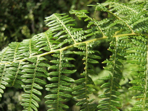
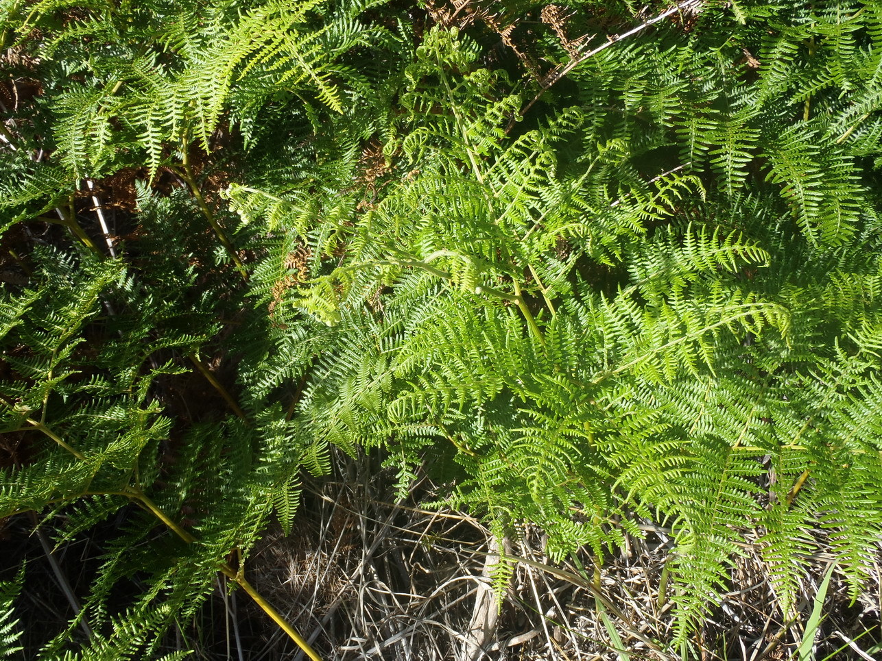
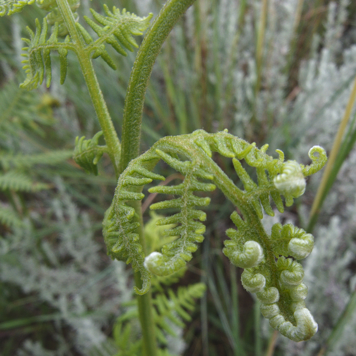
Terrestrial perennial. Rhizome creeping subterranean. Fronds erect, up to 1.75 m long, lamina ovate to deltate, 3-pinnatifid to 4-pinnate, with sparse, fine, pale hairs, denser abaxially and along costae and costules; pinnules deeply incised, basal pinnae basiscopically developed, ± half as long as frond. Sporangia in linear, continuous sori borne submarginally inside inrolled margins, pseudo-indusium ciliate. From: Klopper, RR. 2017. Pteridophyta. In: E Retief & NL Meyer (eds), Plants of the Free State: Inventory and identification guide. Strelitzia 38: 114-143. South African National Biodiversity Institute, Pretoria. [CC BY]
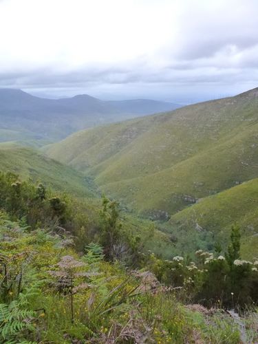
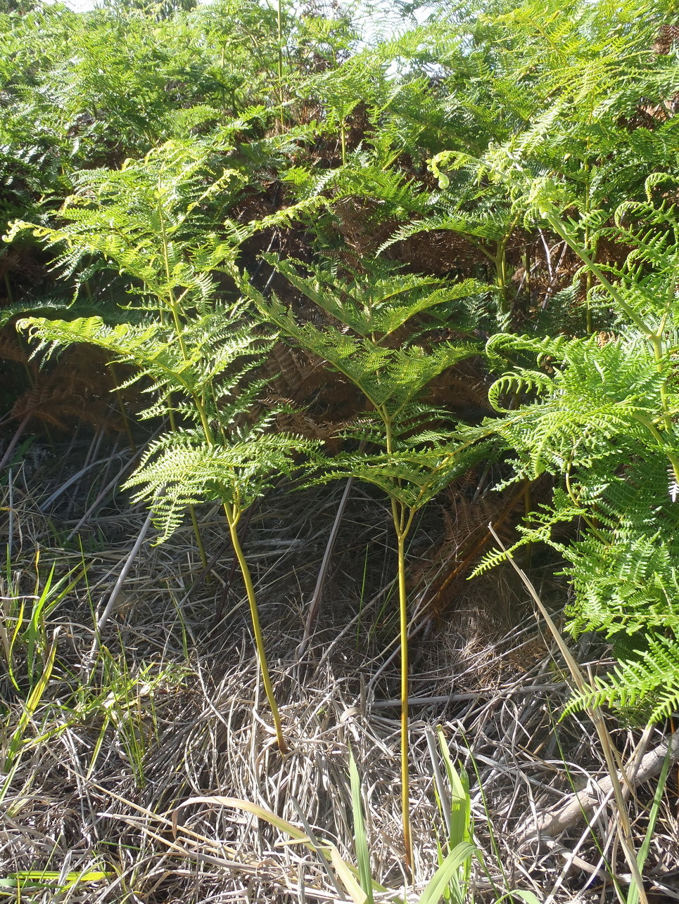
Mesic Grassland. Exposed grassland and forest margins. From: Klopper, RR. 2017. Pteridophyta. In: E Retief & NL Meyer (eds), Plants of the Free State: Inventory and identification guide. Strelitzia 38: 114-143. South African National Biodiversity Institute, Pretoria. [CC BY]
This map contains point-based occurrences at different locations
Occurrence in the Flora of Southern Africa (FSA) countries and South African provinces. Residence status indicates if a taxon is indigenous, endemic, naturalised or invasive in a specific region. This data is based on specimen records and literature
FSA
SA
BOT
NAM
ESW
LES
WC
EC
NC
FS
GA
KZN
LP
MP
NW
Absent
Indigenous
Endemic
Naturalised
Invasive


Names and Sources
Published in: Index Filic.: 591 (1906)
Allosorus capensis (Thunb.) Pappe & Rawson
Allosorus coriifolius (Kunze) Pappe & Rawson
Pteridium aquilinum (L.) Kuhn var. lanuginosum (Willd.) Kuhn
Pteridium capense (Thunb.) Krasser
Pteris aquilina L. var. lanuginosa (Bory ex Willd.) Hook.
Pteris capensis Thunb.
Pteris coriifolia Kunze
Pteris lanuginosa Bory ex Willd.
Classification
KINGDOM Plantae
SUBKINGDOM Cryptogamae
PHYLUM Pteridophyta
CLASS Polypodiopsida
ORDER Polypodiales
FAMILY Dennstaedtiaceae
GENUS Pteridium
SPECIES aquilinum
SUBSPECIES capense
30 results for Pteridium aquilinum (L.) Kuhn subsp. capense (Thunb.) C.Chr.
Barcode: NBG0244805-2 Collector(s) & number: Roux, JP, 4581 | 2010-2-4
South Africa, KwaZulu-Natal, Injisuthi Nature Reserve, Yellowwood forest. 29°01'7.21" S; 29°25'59.75" E.
Data Resource: BODATSA View record
Barcode: NBG0244805-0 Collector(s) & number: Roux, JP, 4581 | 2010-2-4
South Africa, KwaZulu-Natal, Injisuthi Nature Reserve, Yellowwood forest. 29°01'7.21" S; 29°25'59.75" E.
General notes: Grassland biome. Gentle, hill slope. Moist/damp, loam soil. Sandstone. Full sun. No biotic effect seen. Herb. Common fern in grassland, after forming extensive stands.
Data Resource: BODATSA View record
Barcode: NBG0244287-0 Collector(s) & number: Roux, JP, 4676 | 2010-2-10
South Africa, KwaZulu-Natal, Cobham Nature Reserve, Gxalingenwa Cave route. 29°40'18.48" S; 29°23'2.70" E.
General notes: Grassland biome. Montane grassland vegetation. Gentle, hill slope. Moist/damp, loam soil. Sandstone. Full sun. S aspect. No biotic effect seen. Herb. Frequent in grassland, below 2000 m.
Data Resource: BODATSA View record
Barcode: NBG0263661-0 Collector(s) & number: Roux, JP, 5135 | 2010-12-10
Réunion, Reunion, Le Demitile. 21°12'00" E; 55°29'00.2" E. Altitude: 1368 m.
General notes: Forest biome. Montane forest margin. Steep, mountain slope. Well-drained, loam soil. Partial shade. S aspect. No biotic effect seen. Herb. Plants tall and frequent along exposed ridges.
Data Resource: BODATSA View record
Barcode: NBG0265396-0 Collector(s) & number: Roux, JP, 5380 | 2011-3-30
South Africa, Limpopo, Louis Trichardt, Buysdorp, kloof behind settlement. 23°02'53.3" S; 29°24'04.3" E.
General notes: Forest biome. Montane forest vegetation. Ravine/kloof/gorge. Moist/damp, loam soil. Quartzite. Shade. Gentle slope. S aspect. No biotic effect seen. Herb. Plants infrequent among rocks in forest along stream.
Data Resource: BODATSA View record
Barcode: PRE0897061-0 Collector(s) & number: Jaca, T, 376 | 2012-3-1
South Africa, Gauteng, Groenkloof Nature Reserve.
Data Resource: BODATSA View record
Barcode: NBG0244857-0 Collector(s) & number: Roux, JP, 4630 | 2010-2-7
South Africa, KwaZulu-Natal, Underberg, Bamboo Mountain, gorge above Restmount. 29°44'52.96" S; 29°20'29.87" E.
General notes: Grassland biome. Montane grassland vegetation. Moderate, mountain slope. Moist/damp, loam soil. Sandstone. Full sun. No biotic effect seen. Herb. Frequent along forest margin.
Data Resource: BODATSA View record
Barcode: PRE0897062-0 Collector(s) & number: Jaca, T, 402 | 2012-3-6
South Africa, Eastern Cape, Hogsback Forest Reserve. Pine plantation.
Data Resource: BODATSA View record
Barcode: NBG0263616-0 Collector(s) & number: Roux, JP, 4967 | 2010-12-4
Réunion, Reunion. Hellbourgh. Path to Piton des Neiges on plateau. 21°04'23.1" S; 55°30'52.8" E. Alt.: 2084 m.
General notes: Ericaceous scrub. Plateau. Well-drained, loam soil. Partial shade. Gentle slope. No biotic effect seen. Herb. Frequent in light shade in ericaceous scrub on upper plateau.
Data Resource: BODATSA View record
Barcode: NBG0206339-1 Collector(s) & number: Roux, JP, 3900 | 2006-2-21
Lesotho, Ha Ntsi Village. 29°24.053' S; 27°46.061' E.
General notes: Rare on bank at W facing stream. River/stream bank. Well-drained, loam soil. Sandstone. Full sun. SW aspect. Gentle slope. Herb.
Data Resource: BODATSA View record
Barcode: NBG0244877-0 Collector(s) & number: Roux, JP, 4655 | 2010-2-8
South Africa, KwaZulu-Natal, Drakensberg, Lotheni Nature Reserve, Ka-Malungana Ridge, S slopes below McKenzie's Caves. 29°30'43.74" S; 29°40'4.14" E.
General notes: Grassland biome. Montane grassland vegetation. Gentle, mountain slope. Well-drained, loam soil. Sandstone. Full sun. S aspect. No biotic effect seen. Herb. Frequent in open grassland with Protea.
Data Resource: BODATSA View record
Barcode: NBG0244805-1 Collector(s) & number: Roux, JP, 4581 | 2010-2-4
South Africa, KwaZulu-Natal, Injisuthi Nature Reserve, Yellowwood forest. 29°01'7.21" S; 29°25'59.75" E.
General notes: Grassland biome. Gentle, hill slope. Moist/damp, loam soil. Sandstone. Full sun. No biotic effect seen. Herb. Common fern in grassland, after forming extensive stands.
Data Resource: BODATSA View record
Barcode: NBG0268125-0 Collector(s) & number: Roux, JP, 4967 | 2010-12-4
Réunion, Réunion. Hell Bourgh, path to Piton des Neiges, on upper plateau. 21°04'23.1"S 55°30'52.8"E.
Data Resource: BODATSA View record
Barcode: NBG0208484-0 Collector(s) & number: Roux, JP, 4245 | 2007-1-18
South Africa, KwaZulu-Natal, Royal Natal National Park. Along path to Gudu Forest. Form large stands. 28°41'16.5" S; 28°55'51.5" E.
General notes: Grassland biome. Gentle, hill slope. Well-drained, loam soil. Sandstone. Full sun. E aspect. No biotic effect seen. Herb.
Data Resource: BODATSA View record
Barcode: NBG0206339-2 Collector(s) & number: Roux, JP, 3900 | 2006-2-21
Lesotho, Ha Ntsi Village. 29°24.053' S; 27°46.061' E.
General notes: Rare on bank at W facing stream. River/stream bank. Well-drained, loam soil. Sandstone. Full sun. SW aspect. Gentle slope. Herb.
Data Resource: BODATSA View record
Barcode: NBG0276570-0 Collector(s) & number: Nicolson, G, 900 | 2011-6-11
South Africa, Western Cape, Paardeberg, between Wellington and Malmesbury, Botterkloof. ± 3 km SW of dam. 33.58662 S: 18.82698 E. Altitude: 441 m.
General notes: Fynbos biome. Vegetation type: Boland Granite Fynbos. River/streambank. Well-drained, loamy soil. Granite. Full sun. No slope. E aspect. Recently burned. Plant height: ± 40 cm.
Data Resource: BODATSA View record
Barcode: PRE0893883-0 Collector(s) & number: Zietsman, PC, 5265 | 2012-4-4
South Africa, Free State, Harrismith. Sterkfonteindam Nature Reserve. Near picnic spot on SW side of the dam.
General notes: Habitat: rocky slope. Occurrence: localised. Growth form: fern.
Data Resource: BODATSA View record
Barcode: PRE0574200-0 Collector(s) & number: Burgoyne, PM, 3711 | 1995-5-10
South Africa, Mpumalanga, Belfast area: ± 12 km NW of Belfast on Bospoort Farm.
General notes: Grassland. Rocky grassland interspersed with woodland. Valley. Soil. Well drained. Sand. Quartzite. Partial shade. Gentle slope. NW aspect. Biotic effect: none seen. Fern. ± 1 m tall. Erect stems. Fronds bi-coloured. Common in pure stands.
Data Resource: BODATSA View record
Barcode: NBG0272805-0 Collector(s) & number: Mboya, E, 159 | 2001-2-9
Tanzania, Morogoro: Morogoro Rural District. Lukwangule Plateau. 07°06'49" S; 37°36'37" E.
General notes: Rocky plateau with black soil, vegetation dominated by Hypoxis, Lobelia sp., Helichysum spp., a fern and a grass, with scattered Melastomataceae shrubs and Warburgia ugandensis. Single-stemmed, abundant.
Data Resource: BODATSA View record
Barcode: NBG0211109-0 Collector(s) & number: Roux, JP, 4439 | 2008-1-20
South Africa, KwaZulu-Natal, Cathkin Peak area, Dragon Peaks. 'V'- forest . 29°01'14.7" S; 29°25'30" E.
General notes: Common in seasonally moist grassland near forest. Grassland biome. Montane grassland vegetation. Gentle, hill slope. Well-drained, loam soil. Sandstone. Full sun. E aspect. No biotic effect seen. Herb.
Data Resource: BODATSA View record
This map contains point-based occurrences at different locations
2017
SERIES CHAPTER
Pteridophyta Klopper, RRIn: E Retief & NL Meyer (eds), Plants of the Free State: Inventory and identification guide. Strelitzia 38: 114-143
South African National Biodiversity Institute, Pretoria
2011
BOOK
Ferns of southern Africa: A Comprehensive Guide Crouch, NR; Klopper, RR; Burrows, JE; Burrows, SMPenguin Random House South Africa
2009
SERIES
Synopsis of the Lycopodiophyta and Pteridophyta of Africa, Madagascar and neighbouring islands Roux, JPStrelitzia 23: 1-296
SANBI, Pretoria
BOOK
Index Filicum, Supplementum sextum pro annis 1906-1933 Christensen, CFANo results found for Pteridium aquilinum (L.) Kuhn subsp. capense (Thunb.) C.Chr.
| Part(s) of plant used | Use(s) | Reference |
|---|
Coming soon...
